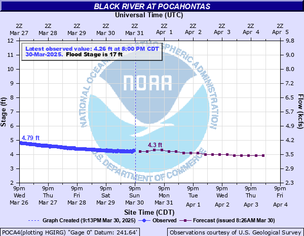
Black River at Pocahontas
Critical Stages
16' - Action
17' - Flood
22' - Moderate
25' - Major
Latest Observation
Updated: 10:00 PM CST 12/12/25
Status: No Flooding
Stage: 2.29 ft
Flow: 2.47 kcfs
Forecast
| Time | Stage (ft) | Flow (kcfs) |
|---|---|---|
| 12 AM 12/13 | 2.3 | 2.48 |
| 6 AM 12/13 | 2.3 | 2.48 |
| 12 PM 12/13 | 2.2 | 2.41 |
| 6 PM 12/13 | 2.2 | 2.41 |
| 12 AM 12/14 | 2.2 | 2.41 |
| 6 AM 12/14 | 2.2 | 2.41 |
| 12 PM 12/14 | 2.2 | 2.41 |
| 6 PM 12/14 | 2.2 | 2.41 |
| 12 AM 12/15 | 2.2 | 2.41 |
| 6 AM 12/15 | 2.2 | 2.41 |
| 12 PM 12/15 | 2.1 | 2.35 |
| 6 PM 12/15 | 2.1 | 2.35 |
| 12 AM 12/16 | 2.1 | 2.35 |
| 6 AM 12/16 | 2.1 | 2.35 |
| 12 PM 12/16 | 2.1 | 2.35 |
| 6 PM 12/16 | 2.1 | 2.35 |
| 12 AM 12/17 | 2.1 | 2.35 |
| 6 AM 12/17 | 2.1 | 2.35 |
| Time | Stage (ft) | Flow (kcfs) |
|---|---|---|
| 10:00 PM 12/12 | 2.29 | 2.47 |
| 9:45 PM 12/12 | 2.29 | 2.47 |
| 9:30 PM 12/12 | 2.29 | 2.47 |
| 9:15 PM 12/12 | 2.29 | 2.47 |
| 9:00 PM 12/12 | 2.29 | 2.47 |
| 8:45 PM 12/12 | 2.3 | 2.48 |
| 8:30 PM 12/12 | 2.29 | 2.47 |
| 8:15 PM 12/12 | 2.29 | 2.47 |
| 8:00 PM 12/12 | 2.3 | 2.48 |
| 7:45 PM 12/12 | 2.27 | 2.46 |
| 7:30 PM 12/12 | 2.29 | 2.47 |
| 7:15 PM 12/12 | 2.28 | 2.46 |
| 7:00 PM 12/12 | 2.29 | 2.47 |
| 6:45 PM 12/12 | 2.29 | 2.47 |
| 6:30 PM 12/12 | 2.29 | 2.47 |
| 6:15 PM 12/12 | 2.3 | 2.48 |
| 6:00 PM 12/12 | 2.3 | 2.48 |
| 5:45 PM 12/12 | 2.3 | 2.48 |
| 5:30 PM 12/12 | 2.3 | 2.48 |
| 5:15 PM 12/12 | 2.3 | 2.48 |
| 5:00 PM 12/12 | 2.3 | 2.48 |
| 4:45 PM 12/12 | 2.27 | 2.46 |
| 4:30 PM 12/12 | 2.27 | 2.46 |
| 4:15 PM 12/12 | 2.29 | 2.47 |
| 4:00 PM 12/12 | 2.29 | 2.47 |
| 3:45 PM 12/12 | 2.3 | 2.48 |
| 3:30 PM 12/12 | 2.27 | 2.46 |
| 3:15 PM 12/12 | 2.29 | 2.47 |
| 3:00 PM 12/12 | 2.29 | 2.47 |
| 2:45 PM 12/12 | 2.3 | 2.48 |
28' -
Similar conditions to record flood event in April 2011 when river crested at 28.47 feet. Patrolling of levees become necessary.
26' -
River crested March 2008 at 26.5 feet. Much of the area around Pocahontas was flooded. U. S. Highway 67 floods between Pocahontas and Walnut Ridge. Running water levee overtopped. Numerous homes impacted by flooding or flooded access.
25' -
Major flooding begins, residential flooding in Eastern Pocahontas, evacuations may be needed. April 2025 crest was 25.68 ft. Residential and business property along the Fourche, Black, and Current rivers will flood. Jansen Trail Road will become flooded and some homes may become impacted.
24' -
Without temporary levee, water could be rising near homes along Pace Street. State Highway 166 and 328 flooded. Riverfront Park is flooded and water will be rising near businesses on West bank of river at U. S. Highway 67 Bridge. Homes along State Highway 166 flooded. Lower portions of Jansen Trail Road will become impacted. Property on Current River at U. S. Highway 67 bridge also flooded.
23' -
Water around homes on State Highway 166. State Highway 166 and 328 may be flooded. Riverfront Park flooded. Several homes, cabins, and business at the State Highway 67 Bridge over the Current River are surrounded by water. Water getting near Pace Street at the north end of airport.
22' -
Moderate flood level, flooding on Fourche River, Pettit Creek, and Mill Creek. North fringe of airport may be flooding. High water on the Fourche River may be affecting State Highways 328 and 166. Houses along State Highway 166 may have water near foundations. Riverfront Park is partially flooded.
20' -
Flooding of backwater up tributaries is spreading into lands along the Current, Fourche, and Black rivers. Water is spreading towards the northern edge of the airport.
17' -
Agricultural lands along the river east and south of Pocahontas will be impacted by high water. Equipment and livestock should be moved to higher ground.
| Date | Stage (ft) |
|---|---|
| May 3, 2017 | 28.95 |
| Apr 28, 2011 | 28.47 |
| Aug 4, 1915 | 27.9 |
| Mar 22, 2008 | 26.56 |
| Apr 17, 1927 | 25.9 |
| Apr 9, 2025 | 25.68 |
| Dec 7, 1982 | 25.22 |
| Jan 1, 2016 | 25.08 |
| Apr 25, 1973 | 25 |
| Jun 17, 1945 | 24.32 |
| Apr 1, 1977 | 24.21 |
| May 12, 1961 | 24.18 |
| Feb 3, 1969 | 24.18 |
| Jan 29, 1949 | 24.07 |
| Jan 21, 1937 | 24 |
| Apr 1, 1975 | 23.65 |
| May 29, 1957 | 23.34 |
| Mar 14, 1964 | 23.32 |
| Apr 14, 2008 | 23.31 |
| May 21, 2002 | 23.24 |
Data provided by the National Weather Service.