Nueces River near Asherton
Critical Stages
18' - Action
20' - Flood
24' - Moderate
27' - Major
Latest Observation
Updated: 8:30 AM CST 12/16/25
Status: No Flooding
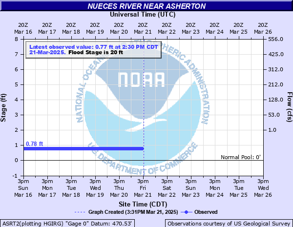
Stage: 0.81 ft
Flow: -999 kcfs
Forecast
Forecast not available for this location.
| Time | Stage (ft) | Flow (kcfs) |
|---|---|---|
| 8:30 AM 12/16 | 0.81 | -999 |
| 8:15 AM 12/16 | 0.81 | -999 |
| 8:00 AM 12/16 | 0.81 | -999 |
| 7:45 AM 12/16 | 0.81 | -999 |
| 7:30 AM 12/16 | 0.81 | -999 |
| 7:15 AM 12/16 | 0.81 | -999 |
| 7:00 AM 12/16 | 0.81 | -999 |
| 6:45 AM 12/16 | 0.81 | -999 |
| 6:30 AM 12/16 | 0.81 | -999 |
| 6:15 AM 12/16 | 0.81 | -999 |
| 6:00 AM 12/16 | 0.81 | -999 |
| 5:45 AM 12/16 | 0.81 | -999 |
| 5:30 AM 12/16 | 0.81 | -999 |
| 5:15 AM 12/16 | 0.81 | -999 |
| 5:00 AM 12/16 | 0.81 | -999 |
| 4:45 AM 12/16 | 0.81 | -999 |
| 4:30 AM 12/16 | 0.81 | -999 |
| 4:15 AM 12/16 | 0.81 | -999 |
| 4:00 AM 12/16 | 0.81 | -999 |
| 3:45 AM 12/16 | 0.81 | -999 |
| 3:30 AM 12/16 | 0.81 | -999 |
| 3:15 AM 12/16 | 0.81 | -999 |
| 3:00 AM 12/16 | 0.81 | -999 |
| 2:45 AM 12/16 | 0.81 | -999 |
| 2:30 AM 12/16 | 0.81 | -999 |
| 2:15 AM 12/16 | 0.81 | -999 |
| 2:00 AM 12/16 | 0.81 | -999 |
| 1:45 AM 12/16 | 0.81 | -999 |
| 1:30 AM 12/16 | 0.81 | -999 |
| 1:15 AM 12/16 | 0.81 | -999 |
31' -
The Nueces River and Turkey Creek are a mile and a half wide south and west of Crystal City. Farm to Market 190 is flooded over a mile near the Nueces River and the bridge floor is flooded. Livestock should be moved from the flood plain. Upstream, Highway 85 becomes impassable as routed water spills into Soldier Slough and over the highway.
29' -
Widespread major flooding threatens livestock over a large area of the flood plain. A mile of Farm to Market 190 near the river is flooded and flow is within a foot of the Farm to Market 190 bridge floor over the Nueces River. The Nueces River and Turkey Creek are a mile and a half wide south and west of Carrizo Springs.
27' -
Major widespread lowland flooding cuts off and potentially drowns livestock above Uvalde to below Tilden. Most secondary roads and low bridges near the river flood. Flow is within a foot of the bottom of the Farm to Market 190 bridge and the approaches are flooded.
26' -
Widespread moderate lowland flooding threatens livestock and equipment in low areas of the flood plain. Secondary roads and bridges flood and Farm to Market 190 is threatened.
24' -
Moderate lowland flooding reaches into low lying areas of the flood plain. Livestock should be moved from vulnerable areas.
22' -
Minor lowland flooding reaches into low lying areas of the flood plain. Livestock and equipment should be moved from vulnerable areas.
20' -
Flow reaches into low areas of the flood plain with no damage.
18' -
Flow reaches into low sections of the flood plain.
| Date | Stage (ft) |
|---|---|
| Jun 17, 1935 | 33 |
| Jun 30, 1913 | 33 |
| Oct 6, 1959 | 30.88 |
| Jul 4, 2002 | 30.21 |
| Oct 19, 2018 | 29.97 |
| Oct 14, 2013 | 29.7 |
| Oct 13, 2018 | 29.59 |
| Jun 26, 1997 | 29.28 |
| May 20, 2015 | 29.25 |
| Jul 17, 1990 | 28.58 |
| Nov 20, 2004 | 28.19 |
| Jun 19, 2013 | 28.14 |
| Jan 3, 1985 | 27 |
| Aug 1, 2007 | 26.11 |
| Sep 18, 1991 | 25.74 |
| Jun 8, 2019 | 25.21 |
| Jul 27, 1992 | 23.46 |
| Sep 13, 2018 | 23.35 |
| Dec 23, 1991 | 21.21 |
Data provided by the National Weather Service.