San Saba River near Brady
Critical Stages
16' - Action
18' - Flood
23' - Moderate
28' - Major
Latest Observation
Updated: 1:00 AM CST 12/10/25
Status: No Flooding
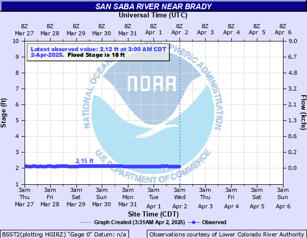
Stage: 2.45 ft
Flow: 0.0517 kcfs
Forecast
Forecast not available for this location.
| Time | Stage (ft) | Flow (kcfs) |
|---|---|---|
| 1:00 AM 12/10 | 2.45 | 0.0517 |
| 12:00 AM 12/10 | 2.44 | 0.0499 |
| 11:00 PM 12/9 | 2.45 | 0.0517 |
| 10:00 PM 12/9 | 2.43 | 0.0481 |
| 9:00 PM 12/9 | 2.45 | 0.0517 |
| 8:00 PM 12/9 | 2.45 | 0.0517 |
| 7:00 PM 12/9 | 2.45 | 0.0517 |
| 6:00 PM 12/9 | 2.45 | 0.0517 |
| 5:00 PM 12/9 | 2.44 | 0.0499 |
| 4:00 PM 12/9 | 2.44 | 0.0499 |
| 3:00 PM 12/9 | 2.43 | 0.0481 |
| 2:00 PM 12/9 | 2.44 | 0.0499 |
| 1:00 PM 12/9 | 2.43 | 0.0481 |
| 12:00 PM 12/9 | 2.44 | 0.0499 |
| 11:00 AM 12/9 | 2.44 | 0.0499 |
| 10:00 AM 12/9 | 2.44 | 0.0499 |
| 9:00 AM 12/9 | 2.45 | 0.0517 |
| 8:00 AM 12/9 | 2.45 | 0.0517 |
| 7:00 AM 12/9 | 2.45 | 0.0517 |
| 6:00 AM 12/9 | 2.45 | 0.0517 |
| 5:00 AM 12/9 | 2.45 | 0.0517 |
| 4:00 AM 12/9 | 2.45 | 0.0517 |
| 3:00 AM 12/9 | 2.45 | 0.0517 |
| 2:00 AM 12/9 | 2.45 | 0.0517 |
| 1:00 AM 12/9 | 2.45 | 0.0517 |
| 12:00 AM 12/9 | 2.45 | 0.0517 |
| 11:00 PM 12/8 | 2.45 | 0.0517 |
| 10:00 PM 12/8 | 2.45 | 0.0517 |
| 9:00 PM 12/8 | 2.45 | 0.0517 |
| 8:00 PM 12/8 | 2.45 | 0.0517 |
28' -
Major lowland flooding will occur. No access to the picnic area at rest stop on US HWY 87. Utility pole at the rest area are partially inundated and possibly damaged.
23' -
Moderate lowland flooding will occur. Picnic area at rest stop on US HWY 87 will be inundated.
18' -
Minor lowland flooding will occur. Picnic area at rest stop off of US HWY 87 will begin flooding.
| Date | Stage (ft) |
|---|---|
| Jul 4, 2025 | 30.53 |
| Jul 23, 1938 | 29.1 |
| Oct 6, 1930 | 25.9 |
| Sep 8, 1980 | 25.5 |
| Sep 10, 1952 | 24.8 |
| May 18, 1955 | 22.4 |
| Jul 16, 1990 | 21.64 |
| Sep 18, 1990 | 20.99 |
| Nov 3, 2000 | 20.1 |
| Jul 26, 1981 | 19.8 |
| Dec 31, 1984 | 18.13 |
| Apr 27, 1941 | 16.81 |
Data provided by the National Weather Service.