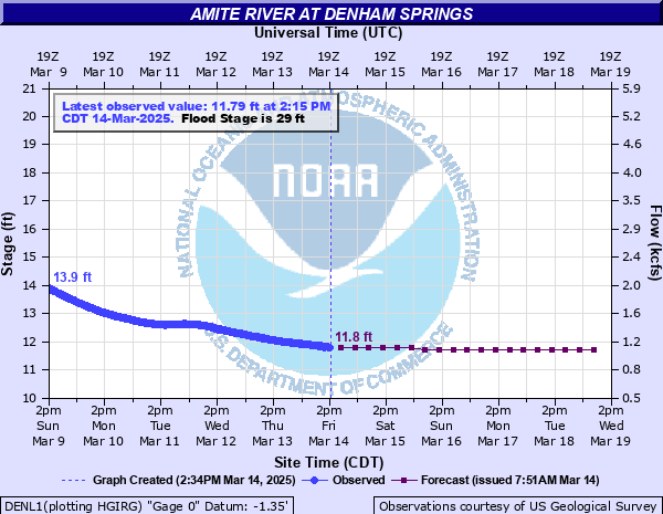
Amite River at Denham Springs
Critical Stages
26' - Action
29' - Flood
35' - Moderate
39' - Major
Latest Observation
Updated: 1:15 PM CST 12/5/25
Status: No Flooding
Stage: 25.3 ft
Flow: 11 kcfs
Forecast
| Time | Stage (ft) | Flow (kcfs) |
|---|---|---|
| 6 PM 12/5 | 25.9 | 12.6 |
| 12 AM 12/6 | 25.5 | 11.5 |
| 6 AM 12/6 | 24.9 | 10.2 |
| 12 PM 12/6 | 23.8 | 8.57 |
| 6 PM 12/6 | 22.5 | 7.13 |
| 12 AM 12/7 | 20.9 | 5.8 |
| 6 AM 12/7 | 19.2 | 4.72 |
| 12 PM 12/7 | 17.6 | 3.78 |
| 6 PM 12/7 | 16.2 | 3.03 |
| 12 AM 12/8 | 14.9 | 2.39 |
| 6 AM 12/8 | 13.8 | 1.9 |
| 12 PM 12/8 | 12.9 | 1.54 |
| 6 PM 12/8 | 12.3 | 1.32 |
| 12 AM 12/9 | 11.9 | 1.15 |
| 6 AM 12/9 | 11.7 | 1.07 |
| 12 PM 12/9 | 11.6 | 1.03 |
| 6 PM 12/9 | 11.5 | 0.986 |
| 12 AM 12/10 | 11.5 | 0.986 |
| 6 AM 12/10 | 11.5 | 0.986 |
| Time | Stage (ft) | Flow (kcfs) |
|---|---|---|
| 1:15 PM 12/5 | 25.3 | 11 |
| 1:00 PM 12/5 | 25.29 | 11 |
| 12:45 PM 12/5 | 25.28 | 11 |
| 12:30 PM 12/5 | 25.28 | 11 |
| 12:15 PM 12/5 | 25.27 | 11 |
| 12:00 PM 12/5 | 25.26 | 11 |
| 11:45 AM 12/5 | 25.25 | 10.9 |
| 11:30 AM 12/5 | 25.22 | 10.9 |
| 11:15 AM 12/5 | 25.22 | 10.9 |
| 11:00 AM 12/5 | 25.19 | 10.8 |
| 10:45 AM 12/5 | 25.16 | 10.7 |
| 10:30 AM 12/5 | 25.16 | 10.7 |
| 10:15 AM 12/5 | 25.14 | 10.7 |
| 10:00 AM 12/5 | 25.12 | 10.6 |
| 9:45 AM 12/5 | 25.11 | 10.6 |
| 9:30 AM 12/5 | 25.09 | 10.6 |
| 9:15 AM 12/5 | 25.06 | 10.5 |
| 9:00 AM 12/5 | 25.05 | 10.5 |
| 8:45 AM 12/5 | 25.03 | 10.4 |
| 8:30 AM 12/5 | 25.01 | 10.4 |
| 8:15 AM 12/5 | 24.99 | 10.4 |
| 8:00 AM 12/5 | 24.97 | 10.3 |
| 7:45 AM 12/5 | 24.95 | 10.3 |
| 7:30 AM 12/5 | 24.92 | 10.2 |
| 7:15 AM 12/5 | 24.89 | 10.2 |
| 7:00 AM 12/5 | 24.88 | 10.2 |
| 6:45 AM 12/5 | 24.87 | 10.1 |
| 6:30 AM 12/5 | 24.83 | 10.1 |
| 6:15 AM 12/5 | 24.81 | 10 |
| 6:00 AM 12/5 | 24.78 | 9.99 |
46.2' -
Flood of Record on August 14, 2016. At this level, widespread flooding will occur with most roads, including Interstate 12 and LA Hwy 190, inundated. Approximately 90 percent of the homes will be flooded, along with businesses and other buildings.
41.5' -
Widespread flooding of the area between Range Avenue in Denham Springs, west to Airline Highway in Baton Rouge, is expected. Significant flood reached this level in April 1983.
39' -
Widespread major flooding can be expected in subdivisions along Tiger Bend Road, Antioch Road, Eliot Road, and in Woodcrest and Stevendale Estates in Old Jefferson.
38.2' -
Tropical Storm Allison - June 2001
35' -
There will be moderate flooding of areas around Clay Cut Bayou, Jones Creek, and Honey Cut Bayou. In Denham Springs the area west of Florida Avenue will be subject to flooding.
30' -
Flooding will begin in the westernmost parts of Denham Springs. River Road at the foot of Benton Lane will flood.
29' -
Flooding will begin in the westernmost parts of Denham Springs.
| Date | Stage (ft) |
|---|---|
| Aug 14, 2016 | 46.2 |
| Apr 8, 1983 | 41.5 |
| Apr 23, 1977 | 41.08 |
| Jan 27, 1990 | 39.88 |
| Mar 15, 1921 | 39.27 |
| Jun 9, 2001 | 38.34 |
| Jan 22, 1993 | 38.15 |
| Apr 24, 1979 | 36.7 |
| Mar 27, 1973 | 36.5 |
| May 20, 1953 | 36.33 |
| Sep 5, 2008 | 36.23 |
| Jan 30, 1994 | 36.1 |
| Mar 13, 2016 | 36.09 |
| Mar 30, 1980 | 35.96 |
| Apr 15, 1955 | 35.95 |
| Apr 12, 1995 | 35.93 |
| Apr 17, 1967 | 35.26 |
| Apr 29, 1997 | 35.05 |
| Dec 8, 1971 | 35.01 |
| Apr 29, 1962 | 34.55 |
Data provided by the National Weather Service.