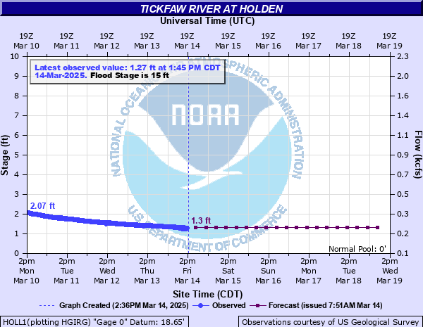
Tickfaw River at Holden
Critical Stages
14' - Action
15' - Flood
19' - Moderate
21' - Major
Latest Observation
Updated: 12:45 PM CST 12/5/25
Status: No Flooding
Stage: 8.14 ft
Flow: 1.67 kcfs
Forecast
| Time | Stage (ft) | Flow (kcfs) |
|---|---|---|
| 6 PM 12/5 | 10.1 | 2.32 |
| 12 AM 12/6 | 10.3 | 2.39 |
| 6 AM 12/6 | 10.2 | 2.35 |
| 12 PM 12/6 | 10.1 | 2.32 |
| 6 PM 12/6 | 10.2 | 2.35 |
| 12 AM 12/7 | 10.7 | 2.53 |
| 6 AM 12/7 | 11.1 | 2.68 |
| 12 PM 12/7 | 11.2 | 2.72 |
| 6 PM 12/7 | 10.9 | 2.61 |
| 12 AM 12/8 | 10.1 | 2.32 |
| 6 AM 12/8 | 9.3 | 2.05 |
| 12 PM 12/8 | 8.8 | 1.88 |
| 6 PM 12/8 | 8.6 | 1.81 |
| 12 AM 12/9 | 8.4 | 1.75 |
| 6 AM 12/9 | 8.1 | 1.66 |
| 12 PM 12/9 | 7.5 | 1.49 |
| 6 PM 12/9 | 6.7 | 1.28 |
| 12 AM 12/10 | 5.8 | 1.08 |
| 6 AM 12/10 | 5 | 0.915 |
| Time | Stage (ft) | Flow (kcfs) |
|---|---|---|
| 12:45 PM 12/5 | 8.14 | 1.67 |
| 12:30 PM 12/5 | 8.12 | 1.67 |
| 12:15 PM 12/5 | 8.09 | 1.66 |
| 12:00 PM 12/5 | 8.06 | 1.65 |
| 11:45 AM 12/5 | 8.02 | 1.64 |
| 11:30 AM 12/5 | 8 | 1.63 |
| 11:15 AM 12/5 | 7.96 | 1.62 |
| 11:00 AM 12/5 | 7.93 | 1.61 |
| 10:45 AM 12/5 | 7.89 | 1.6 |
| 10:30 AM 12/5 | 7.88 | 1.6 |
| 10:15 AM 12/5 | 7.84 | 1.59 |
| 10:00 AM 12/5 | 7.8 | 1.58 |
| 9:45 AM 12/5 | 7.76 | 1.56 |
| 9:30 AM 12/5 | 7.74 | 1.56 |
| 9:15 AM 12/5 | 7.69 | 1.54 |
| 9:00 AM 12/5 | 7.64 | 1.53 |
| 8:45 AM 12/5 | 7.61 | 1.52 |
| 8:30 AM 12/5 | 7.58 | 1.51 |
| 8:15 AM 12/5 | 7.52 | 1.5 |
| 8:00 AM 12/5 | 7.48 | 1.49 |
| 7:45 AM 12/5 | 7.43 | 1.47 |
| 7:30 AM 12/5 | 7.41 | 1.47 |
| 7:15 AM 12/5 | 7.35 | 1.45 |
| 7:00 AM 12/5 | 7.32 | 1.44 |
| 6:45 AM 12/5 | 7.26 | 1.43 |
| 6:30 AM 12/5 | 7.2 | 1.41 |
| 6:15 AM 12/5 | 7.16 | 1.4 |
| 6:00 AM 12/5 | 7.09 | 1.38 |
| 5:45 AM 12/5 | 7.03 | 1.37 |
| 5:30 AM 12/5 | 6.98 | 1.35 |
22.16' -
Flood of Record occurred on August 13, 2016. Water will inundate Highway 190 bridge. The bridge will be in danger of structural damage as debris is carried downstream in strong, swift current. Access roads will be impassable. Evacuations will be necessary. Interstate 12 will be flooded.
21' -
Many secondary roads will be under water and closed due to high water.
20' -
Property in low areas along the river from Interstate 12 north to Parish Road 1036 will flood.
15' -
Wooded areas in the vicinity of the Highway 190 bridge will be inundated.
12' -
Tickfaw State Park, located downstream of the Holden gage, will close.
11' -
Flooding will expand downstream in the Tickfaw State Park. All campgrounds will close.
9' -
Areas downstream in the Tickfaw State Park will begin to flood, primarily in the Tent Area.
| Date | Stage (ft) |
|---|---|
| Aug 13, 2016 | 22.16 |
| Apr 7, 1983 | 21.04 |
| May 23, 1974 | 20.37 |
| Mar 13, 2016 | 20.23 |
| Apr 22, 1977 | 20.18 |
| Apr 23, 1979 | 20.08 |
| Jan 22, 1993 | 20.08 |
| Apr 17, 1993 | 20.08 |
| Mar 22, 1943 | 19.75 |
| Apr 29, 1961 | 19.41 |
| Jan 27, 1990 | 19.13 |
| Mar 31, 1980 | 19.04 |
| Feb 14, 1966 | 19 |
| May 20, 1953 | 18.97 |
| Jan 30, 1994 | 18.93 |
| Sep 2, 2021 | 18.82 |
| Apr 15, 1967 | 18.78 |
| Apr 13, 1995 | 18.63 |
| Feb 23, 1961 | 18.55 |
| Mar 26, 1973 | 18.5 |
Data provided by the National Weather Service.