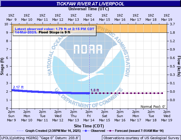
Tickfaw River at Liverpool
Critical Stages
9' - Action
9' - Flood
11' - Moderate
12' - Major
Latest Observation
Updated: 12:15 PM CST 12/5/25
Status: No Flooding
Stage: -5 ft
Flow: -999 kcfs
Forecast
| Time | Stage (ft) | Flow (kcfs) |
|---|---|---|
| 6 PM 12/5 | 5.2 | 0.482 |
| 12 AM 12/6 | 5.3 | 0.5 |
| 6 AM 12/6 | 5.2 | 0.482 |
| 12 PM 12/6 | 4.9 | 0.429 |
| 6 PM 12/6 | 4.5 | 0.364 |
| 12 AM 12/7 | 3.9 | 0.271 |
| 6 AM 12/7 | 3.3 | 0.185 |
| 12 PM 12/7 | 2.9 | 0.133 |
| 6 PM 12/7 | 2.6 | 0.0973 |
| 12 AM 12/8 | 2.4 | 0.0767 |
| 6 AM 12/8 | 2.2 | 0.0592 |
| 12 PM 12/8 | 2 | 0.0454 |
| 6 PM 12/8 | 1.9 | 0.0396 |
| 12 AM 12/9 | 1.8 | 0.0343 |
| 6 AM 12/9 | 1.8 | 0.0343 |
| 12 PM 12/9 | 1.7 | 0.0295 |
| 6 PM 12/9 | 1.7 | 0.0295 |
| 12 AM 12/10 | 1.7 | 0.0295 |
| 6 AM 12/10 | 1.6 | 0.0251 |
| Time | Stage (ft) | Flow (kcfs) |
|---|---|---|
| 12:15 PM 12/5 | -5 | -999 |
| 12:00 PM 12/5 | -5 | -999 |
| 11:45 AM 12/5 | -5 | -999 |
| 11:30 AM 12/5 | -5 | -999 |
| 11:15 AM 12/5 | -9999 | -999 |
| 11:00 AM 12/5 | -9999 | -999 |
| 10:45 AM 12/5 | -9999 | -999 |
| 10:30 AM 12/5 | -9999 | -999 |
| 10:15 AM 12/5 | -9999 | -999 |
| 10:00 AM 12/5 | -9999 | -999 |
| 9:45 AM 12/5 | -9999 | -999 |
| 9:30 AM 12/5 | -9999 | -999 |
| 9:15 AM 12/5 | -9999 | -999 |
| 9:00 AM 12/5 | -9999 | -999 |
| 8:45 AM 12/5 | -9999 | -999 |
| 8:30 AM 12/5 | -9999 | -999 |
| 8:15 AM 12/5 | -9999 | -999 |
| 8:00 AM 12/5 | -9999 | -999 |
| 7:45 AM 12/5 | -9999 | -999 |
| 7:30 AM 12/5 | -9999 | -999 |
| 7:15 AM 12/5 | -9999 | -999 |
| 7:00 AM 12/5 | -9999 | -999 |
| 6:45 AM 12/5 | -9999 | -999 |
| 6:30 AM 12/5 | -9999 | -999 |
| 6:15 AM 12/5 | -9999 | -999 |
| 6:00 AM 12/5 | -9999 | -999 |
| 5:45 AM 12/5 | -9999 | -999 |
| 5:30 AM 12/5 | -9999 | -999 |
| 5:15 AM 12/5 | -9999 | -999 |
| 5:00 AM 12/5 | -9999 | -999 |
13.76' -
Flood of Record occurred on August 12, 2016. Widespread flooding will occur and some evacuations will be necessary. Water may cover portion of LA Highways 38, 441, and 43.
13' -
Major flooding of the river basin will occur. There will be major flooding of roads and buildings. Mill Creek will back up causing flooding north of Louisiana Highway 38. Evacuation is recommended for persons east of Louisiana Highway 43 from Easleyville downstream to Montpelier. In 1983, 12,800 acres were inundated during record flooding.
12' -
There will be major flooding of roads and buildings. Mill Creek will back up causing flooding north of Louisiana Highway 38. Evacuation is recommended for persons east of Louisiana Highway 43 from Easleyville downstream to Montpelier.
11' -
Low lying roads and buildings near the river along with pasture and crop land will flood.
9' -
Pastures and crop land adjacent to the river will flood. Rural areas near the river will be threatened with flooding.
| Date | Stage (ft) |
|---|---|
| Aug 12, 2016 | 13.76 |
| Apr 6, 1983 | 13.3 |
| Jan 21, 1993 | 13.17 |
| Aug 30, 2021 | 12.73 |
| Jan 27, 1994 | 12.5 |
| Mar 11, 2016 | 12.47 |
| Mar 11, 2016 | 12.47 |
| Jan 25, 1990 | 12.38 |
| Apr 27, 1997 | 12.29 |
| Apr 22, 1977 | 12.18 |
| Mar 25, 1973 | 12.09 |
| Apr 23, 1979 | 12.07 |
| Jul 3, 1975 | 12.06 |
| Mar 29, 1980 | 12.06 |
| Mar 28, 2009 | 11.87 |
| Apr 9, 1968 | 11.73 |
| Mar 17, 1961 | 11.58 |
| Feb 21, 2014 | 11.57 |
| Oct 4, 1964 | 11.48 |
| Apr 11, 1995 | 11.43 |
Data provided by the National Weather Service.