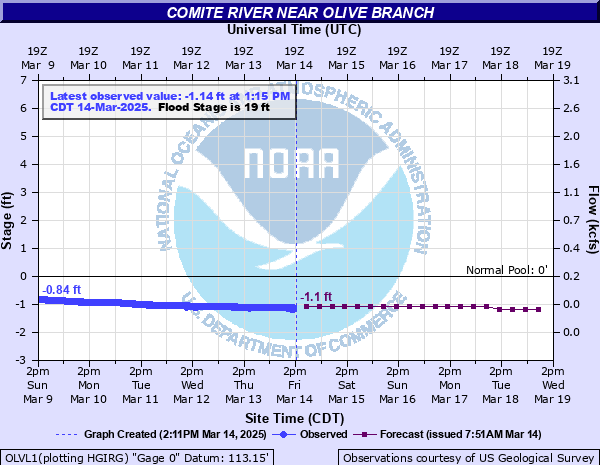
Comite River near Olive Branch
Critical Stages
16' - Action
19' - Flood
22' - Moderate
24' - Major
Latest Observation
Updated: 12:15 PM CST 12/5/25
Status: No Flooding
Stage: 0.67 ft
Flow: 0.31 kcfs
Forecast
| Time | Stage (ft) | Flow (kcfs) |
|---|---|---|
| 6 PM 12/5 | 0 | -999 |
| 12 AM 12/6 | -0.2 | -999 |
| 6 AM 12/6 | -0.4 | -999 |
| 12 PM 12/6 | -0.6 | -999 |
| 6 PM 12/6 | -0.8 | -999 |
| 12 AM 12/7 | -0.9 | -999 |
| 6 AM 12/7 | -0.9 | -999 |
| 12 PM 12/7 | -1 | -999 |
| 6 PM 12/7 | -1 | -999 |
| 12 AM 12/8 | -1 | -999 |
| 6 AM 12/8 | -1.1 | -999 |
| 12 PM 12/8 | -1.1 | -999 |
| 6 PM 12/8 | -1.1 | -999 |
| 12 AM 12/9 | -1.1 | -999 |
| 6 AM 12/9 | -1.1 | -999 |
| 12 PM 12/9 | -1.1 | -999 |
| 6 PM 12/9 | -1.1 | -999 |
| 12 AM 12/10 | -1.1 | -999 |
| 6 AM 12/10 | -1.2 | -999 |
| Time | Stage (ft) | Flow (kcfs) |
|---|---|---|
| 1:15 PM 12/5 | 0.57 | 0.282 |
| 1:00 PM 12/5 | 0.6 | 0.289 |
| 12:45 PM 12/5 | 0.63 | 0.298 |
| 12:30 PM 12/5 | 0.65 | 0.304 |
| 12:15 PM 12/5 | 0.67 | 0.31 |
| 12:00 PM 12/5 | 0.69 | 0.316 |
| 11:45 AM 12/5 | 0.72 | 0.324 |
| 11:30 AM 12/5 | 0.74 | 0.33 |
| 11:15 AM 12/5 | 0.76 | 0.336 |
| 11:00 AM 12/5 | 0.78 | 0.341 |
| 10:45 AM 12/5 | 0.8 | 0.347 |
| 10:30 AM 12/5 | 0.82 | 0.352 |
| 10:15 AM 12/5 | 0.84 | 0.358 |
| 10:00 AM 12/5 | 0.87 | 0.366 |
| 9:45 AM 12/5 | 0.89 | 0.371 |
| 9:30 AM 12/5 | 0.91 | 0.376 |
| 9:15 AM 12/5 | 0.93 | 0.381 |
| 9:00 AM 12/5 | 0.96 | 0.389 |
| 8:45 AM 12/5 | 0.99 | 0.397 |
| 8:30 AM 12/5 | 1 | 0.399 |
| 8:15 AM 12/5 | 1.03 | 0.407 |
| 8:00 AM 12/5 | 1.06 | 0.414 |
| 7:45 AM 12/5 | 1.08 | 0.419 |
| 7:30 AM 12/5 | 1.13 | 0.436 |
| 7:15 AM 12/5 | 1.14 | 0.439 |
| 7:00 AM 12/5 | 1.18 | 0.453 |
| 6:45 AM 12/5 | 1.19 | 0.456 |
| 6:30 AM 12/5 | 1.23 | 0.47 |
| 6:15 AM 12/5 | 1.28 | 0.486 |
| 6:00 AM 12/5 | 1.31 | 0.496 |
26.96' -
Flood of Record occurred August 13, 2016. Widespread flooding of agricultural lands will occur and LA Highway 67 will be inundated.
23' -
Homes along Louisiana Highway 67 and in the area between the Comite River and Little Sandy Creek will flood. Some secondary roads are subject to washouts. There will be extensive flooding of farm land.
22' -
There is extensive flooding of farm land. Secondary roads upstream and downstream from the Highway 67 Bridge crossing will flood. Pretty Creek will back up threatening homes in the western part of the city of Clinton.
20' -
Pretty Creek will back up threatening homes in the western part of the city of Clinton. Pasture and crop land near the river will be flooded.
19' -
Pasture and crop land near the river will be flooded.
| Date | Stage (ft) |
|---|---|
| Aug 13, 2016 | 26.96 |
| Mar 18, 1961 | 23.37 |
| Apr 22, 1977 | 22.88 |
| Feb 6, 1943 | 22.6 |
| Apr 13, 1955 | 22.45 |
| May 18, 1953 | 22.12 |
| Apr 28, 1962 | 21.74 |
| Jan 7, 1950 | 21.62 |
| Dec 17, 1948 | 21.58 |
| Oct 5, 1964 | 21.52 |
| Dec 7, 1971 | 21.47 |
| Mar 29, 1951 | 21.23 |
| Mar 3, 1947 | 21.2 |
| Mar 3, 1964 | 20.7 |
| Mar 12, 1956 | 20.68 |
| Apr 15, 1967 | 20.43 |
| Apr 22, 1979 | 20.36 |
| Apr 6, 1983 | 19.7 |
| Mar 14, 1947 | 19.6 |
| Oct 23, 2017 | 19.4 |
Data provided by the National Weather Service.