Leon River at Gatesville
Critical Stages
20' - Action
22' - Flood
28' - Moderate
34' - Major
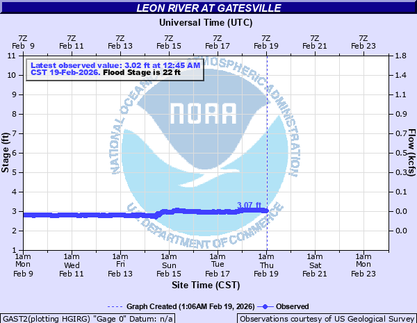
Latest Observation
Updated: 10:45 AM CST 12/11/25
Status: No Flooding
Stage: 2.79 ft
Flow: 0.0164 kcfs
Forecast
Forecast not available for this location.
| Time | Stage (ft) | Flow (kcfs) |
|---|---|---|
| 10:45 AM 12/11 | 2.79 | 0.0164 |
| 10:30 AM 12/11 | 2.79 | 0.0164 |
| 10:15 AM 12/11 | 2.79 | 0.0164 |
| 10:00 AM 12/11 | 2.8 | 0.017 |
| 9:45 AM 12/11 | 2.8 | 0.017 |
| 9:30 AM 12/11 | 2.8 | 0.017 |
| 9:15 AM 12/11 | 2.8 | 0.017 |
| 9:00 AM 12/11 | 2.8 | 0.017 |
| 8:45 AM 12/11 | 2.81 | 0.0175 |
| 8:30 AM 12/11 | 2.81 | 0.0175 |
| 8:15 AM 12/11 | 2.81 | 0.0175 |
| 8:00 AM 12/11 | 2.8 | 0.017 |
| 7:45 AM 12/11 | 2.81 | 0.0175 |
| 7:30 AM 12/11 | 2.81 | 0.0175 |
| 7:15 AM 12/11 | 2.81 | 0.0175 |
| 7:00 AM 12/11 | 2.81 | 0.0175 |
| 6:45 AM 12/11 | 2.81 | 0.0175 |
| 6:30 AM 12/11 | 2.81 | 0.0175 |
| 6:15 AM 12/11 | 2.81 | 0.0175 |
| 6:00 AM 12/11 | 2.81 | 0.0175 |
| 5:45 AM 12/11 | 2.81 | 0.0175 |
| 5:30 AM 12/11 | 2.81 | 0.0175 |
| 5:15 AM 12/11 | 2.81 | 0.0175 |
| 5:00 AM 12/11 | 2.82 | 0.0181 |
| 4:45 AM 12/11 | 2.81 | 0.0175 |
| 4:30 AM 12/11 | 2.82 | 0.0181 |
| 4:15 AM 12/11 | 2.82 | 0.0181 |
| 4:00 AM 12/11 | 2.82 | 0.0181 |
| 3:45 AM 12/11 | 2.82 | 0.0181 |
| 3:30 AM 12/11 | 2.82 | 0.0181 |
35' -
Major flooding will occur along the river near the us 84 bridge.
34' -
Major overbank flooding is expected as banks broaden to a wide open floodplain.
31' -
Moderate to major overbank flooding is expected through gatesville.
28' -
Moderate overbank flooding will occur near the highway bridge.
25' -
Minor to moderate lowland flooding will occur near the river. Some low water crossings will become dangerous.
22' -
Minor lowland flooding will occur along the river.
| Date | Stage (ft) |
|---|---|
| Dec 21, 1991 | 35 |
| May 1, 1908 | 35 |
| Oct 4, 1959 | 34.14 |
| May 5, 2024 | 33.78 |
| Oct 10, 1961 | 32.63 |
| Jun 29, 2007 | 32.33 |
| May 13, 1957 | 31.6 |
| May 1, 1956 | 31.06 |
| Feb 24, 1997 | 31.04 |
| May 16, 1965 | 31.02 |
| Oct 6, 1959 | 30.75 |
| Nov 8, 1965 | 30.5 |
| Oct 17, 2018 | 29.94 |
| Mar 16, 1998 | 29.14 |
| May 23, 2024 | 29.04 |
| May 5, 1990 | 28.63 |
| May 31, 2015 | 28.57 |
| Jun 8, 2016 | 28.52 |
| Oct 31, 1974 | 28.42 |
| Jan 29, 2010 | 28.42 |
Data provided by the National Weather Service.