« Back to Dyersburg Automatic Weather Observing Rivers
Obion River near Martin
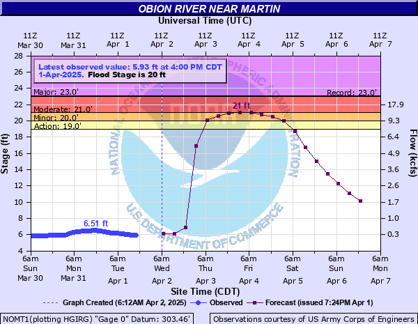
Critical Stages
19' - Action
20' - Flood
21' - Moderate
23' - Major
Latest Observation
Updated: 2:00 AM CST 12/5/25
Status: No Flooding
Stage: 5.29 ft
Flow: 0.272 kcfs
Forecast
| Time | Stage (ft) | Flow (kcfs) |
|---|---|---|
| 6 AM 12/5 | 5.3 | 0.274 |
| 12 PM 12/5 | 5.3 | 0.274 |
| 6 PM 12/5 | 5.3 | 0.274 |
| 12 AM 12/6 | 5.3 | 0.274 |
| 6 AM 12/6 | 5.3 | 0.274 |
| 12 PM 12/6 | 5.3 | 0.274 |
| 6 PM 12/6 | 5.3 | 0.274 |
| 12 AM 12/7 | 5.3 | 0.274 |
| 6 AM 12/7 | 5.3 | 0.274 |
| 12 PM 12/7 | 5.3 | 0.274 |
| 6 PM 12/7 | 5.3 | 0.274 |
| 12 AM 12/8 | 5.3 | 0.274 |
| 6 AM 12/8 | 5.3 | 0.274 |
| 12 PM 12/8 | 5.3 | 0.274 |
| 6 PM 12/8 | 5.3 | 0.274 |
| 12 AM 12/9 | 5.3 | 0.274 |
| 6 AM 12/9 | 5.3 | 0.274 |
| Time | Stage (ft) | Flow (kcfs) |
|---|---|---|
| 2:00 AM 12/5 | 5.29 | 0.272 |
| 1:00 AM 12/5 | 5.3 | 0.274 |
| 12:00 AM 12/5 | 5.29 | 0.272 |
| 11:00 PM 12/4 | 5.3 | 0.274 |
| 10:00 PM 12/4 | 5.3 | 0.274 |
| 9:00 PM 12/4 | 5.3 | 0.274 |
| 8:00 PM 12/4 | 5.3 | 0.274 |
| 7:00 PM 12/4 | 5.31 | 0.276 |
| 6:00 PM 12/4 | 5.31 | 0.276 |
| 5:00 PM 12/4 | 5.31 | 0.276 |
| 4:00 PM 12/4 | 5.32 | 0.278 |
| 3:00 PM 12/4 | 5.32 | 0.278 |
| 2:00 PM 12/4 | 5.32 | 0.278 |
| 1:00 PM 12/4 | 5.32 | 0.278 |
| 12:00 PM 12/4 | 5.33 | 0.28 |
| 11:00 AM 12/4 | 5.34 | 0.282 |
| 10:00 AM 12/4 | 5.34 | 0.282 |
| 9:00 AM 12/4 | 5.34 | 0.282 |
| 8:00 AM 12/4 | 5.34 | 0.282 |
| 7:00 AM 12/4 | 5.35 | 0.284 |
| 6:00 AM 12/4 | 5.35 | 0.284 |
| 5:00 AM 12/4 | 5.35 | 0.284 |
| 4:00 AM 12/4 | 5.36 | 0.286 |
| 3:00 AM 12/4 | 5.36 | 0.286 |
| 2:00 AM 12/4 | 5.37 | 0.288 |
| 1:00 AM 12/4 | 5.37 | 0.288 |
| 12:00 AM 12/4 | 5.38 | 0.29 |
| 11:00 PM 12/3 | 5.38 | 0.29 |
| 10:00 PM 12/3 | 5.39 | 0.292 |
| 9:00 PM 12/3 | 5.4 | 0.294 |
23' -
Extensive agricultural flooding is occurring along the river and numerous secondary roads are flooded causing access problems.
22' -
Widespread flooding is occurring in Rives and near Union City. Additional evacuations will be necessary. Agricultural land north of Martin is flooding and equipment and livestock may need to be moved to higher ground. Numerous secondary roads are covered by flood water.
21' -
Residents in the community of Rives should complete necessary flood precautions. Evacuations may be required. Extensive cropland flooding is occurring near the river in northeast Obion County and the northwest portion of Weakley County. Equipment and livestock should be moved to higher ground.
20' -
Flooding is occurring along the North Fork Obion River in northeast Obion County and northwest Weakley County. Flooding is also occurring in low-lying areas near Union City.
18' -
Lowland and agricultural flooding is occurring near the North Fork of the Obion River.
| Date | Stage (ft) |
|---|---|
| Nov 19, 1957 | 23.05 |
| Mar 2, 1998 | 22.98 |
| Apr 6, 2025 | 22.76 |
| Feb 16, 2025 | 22.26 |
| Mar 2, 1997 | 22.24 |
| Dec 1, 2001 | 21.5 |
| Feb 12, 2019 | 21.08 |
| Mar 2, 2021 | 21.06 |
| May 4, 2011 | 20.96 |
| Feb 1, 2025 | 20.4 |
| May 18, 2008 | 20.14 |
| Apr 5, 2008 | 19.95 |
| May 2, 2010 | 19.67 |
| May 5, 2003 | 19.5 |
| Apr 28, 2014 | 19.47 |
| Jul 31, 1996 | 19.39 |
| Dec 15, 2007 | 19.36 |
| May 1, 2009 | 19.32 |
| Sep 23, 2006 | 19.02 |
| Mar 28, 2005 | 18.76 |
Data provided by the National Weather Service.