« Back to East Brunswick Vocational School Rivers
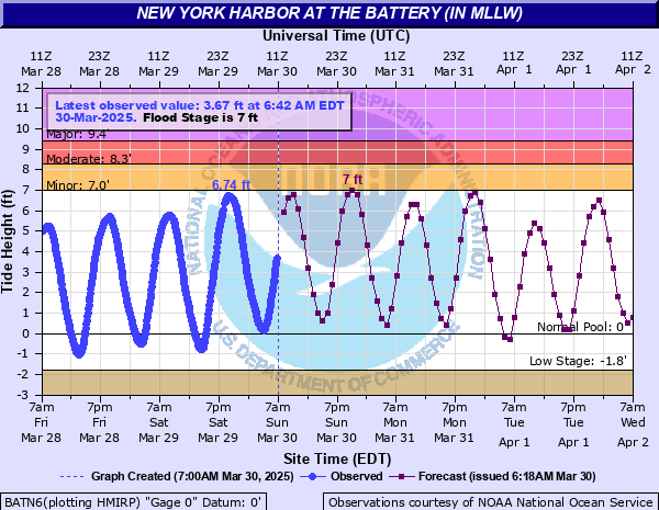
New York Harbor at The Battery (IN MLLW)
Critical Stages
7' - Action
7' - Flood
8.3' - Moderate
9.4' - Major
Latest Observation
Updated: 8:24 AM EST 12/6/25
Status: No Flooding
Stage: 6.37 ft
Flow: -999 kcfs
Forecast
| Time | Stage (ft) | Flow (kcfs) |
|---|---|---|
| 10 AM 12/6 | 6 | -999 |
| 11 AM 12/6 | 4.8 | -999 |
| 12 PM 12/6 | 3.3 | -999 |
| 1 PM 12/6 | 1.9 | -999 |
| 2 PM 12/6 | 0.7 | -999 |
| 3 PM 12/6 | -0.2 | -999 |
| 4 PM 12/6 | -0.1 | -999 |
| 5 PM 12/6 | 1.1 | -999 |
| 6 PM 12/6 | 2.6 | -999 |
| 7 PM 12/6 | 3.8 | -999 |
| 8 PM 12/6 | 4.8 | -999 |
| 9 PM 12/6 | 5.1 | -999 |
| 10 PM 12/6 | 4.9 | -999 |
| 11 PM 12/6 | 4.2 | -999 |
| 12 AM 12/7 | 3 | -999 |
| 1 AM 12/7 | 1.7 | -999 |
| 2 AM 12/7 | 0.7 | -999 |
| 3 AM 12/7 | 0 | -999 |
| 4 AM 12/7 | 0.1 | -999 |
| 5 AM 12/7 | 1.3 | -999 |
| 6 AM 12/7 | 2.9 | -999 |
| 7 AM 12/7 | 4.5 | -999 |
| 8 AM 12/7 | 5.6 | -999 |
| 9 AM 12/7 | 6.2 | -999 |
| 10 AM 12/7 | 6.2 | -999 |
| 11 AM 12/7 | 5.5 | -999 |
| 12 PM 12/7 | 4.3 | -999 |
| 1 PM 12/7 | 2.7 | -999 |
| 2 PM 12/7 | 1.4 | -999 |
| 3 PM 12/7 | 0.5 | -999 |
| 4 PM 12/7 | -0.3 | -999 |
| 5 PM 12/7 | 0.2 | -999 |
| 6 PM 12/7 | 1.2 | -999 |
| 7 PM 12/7 | 2.5 | -999 |
| 8 PM 12/7 | 3.6 | -999 |
| 9 PM 12/7 | 4.5 | -999 |
| 10 PM 12/7 | 5 | -999 |
| 11 PM 12/7 | 4.7 | -999 |
| 12 AM 12/8 | 3.9 | -999 |
| 1 AM 12/8 | 2.5 | -999 |
| 2 AM 12/8 | 1.3 | -999 |
| 3 AM 12/8 | 0.2 | -999 |
| 4 AM 12/8 | -0.5 | -999 |
| 5 AM 12/8 | -0.4 | -999 |
| 6 AM 12/8 | 0.5 | -999 |
| 7 AM 12/8 | 2 | -999 |
| 8 AM 12/8 | 3.4 | -999 |
| 9 AM 12/8 | 4.4 | -999 |
| 10 AM 12/8 | 5 | -999 |
| 11 AM 12/8 | 5.2 | -999 |
| 12 PM 12/8 | 4.7 | -999 |
| 1 PM 12/8 | 3.9 | -999 |
| 2 PM 12/8 | 2.5 | -999 |
| 3 PM 12/8 | 1.3 | -999 |
| 4 PM 12/8 | 0.5 | -999 |
| 5 PM 12/8 | 0.1 | -999 |
| 6 PM 12/8 | 0.4 | -999 |
| 7 PM 12/8 | 1.5 | -999 |
| 8 PM 12/8 | 2.8 | -999 |
| 9 PM 12/8 | 3.9 | -999 |
| 10 PM 12/8 | 4.8 | -999 |
| 11 PM 12/8 | 5.2 | -999 |
| 12 AM 12/9 | 5.1 | -999 |
| 1 AM 12/9 | 4.3 | -999 |
| 2 AM 12/9 | 3.2 | -999 |
| 3 AM 12/9 | 2 | -999 |
| 4 AM 12/9 | 1.2 | -999 |
| 5 AM 12/9 | 0.7 | -999 |
| 6 AM 12/9 | 1.1 | -999 |
| 7 AM 12/9 | 2.1 | -999 |
| 8 AM 12/9 | 3.3 | -999 |
| 9 AM 12/9 | 4.5 | -999 |
| 10 AM 12/9 | 5.3 | -999 |
| 11 AM 12/9 | 5.5 | -999 |
| 12 PM 12/9 | 5.6 | -999 |
| 1 PM 12/9 | 5 | -999 |
| 2 PM 12/9 | 3.9 | -999 |
| 3 PM 12/9 | 2.6 | -999 |
| Time | Stage (ft) | Flow (kcfs) |
|---|---|---|
| 8:42 AM 12/6 | 6.5 | -999 |
| 8:36 AM 12/6 | 6.46 | -999 |
| 8:30 AM 12/6 | 6.41 | -999 |
| 8:24 AM 12/6 | 6.37 | -999 |
| 8:18 AM 12/6 | 6.34 | -999 |
| 8:12 AM 12/6 | 6.3 | -999 |
| 8:06 AM 12/6 | 6.25 | -999 |
| 8:00 AM 12/6 | 6.21 | -999 |
| 7:54 AM 12/6 | 6.15 | -999 |
| 7:48 AM 12/6 | 6.11 | -999 |
| 7:42 AM 12/6 | 6.04 | -999 |
| 7:36 AM 12/6 | 5.97 | -999 |
| 7:30 AM 12/6 | 5.9 | -999 |
| 7:24 AM 12/6 | 5.86 | -999 |
| 7:18 AM 12/6 | 5.8 | -999 |
| 7:12 AM 12/6 | 5.74 | -999 |
| 7:06 AM 12/6 | 5.66 | -999 |
| 7:00 AM 12/6 | 5.57 | -999 |
| 6:54 AM 12/6 | 5.51 | -999 |
| 6:48 AM 12/6 | 5.42 | -999 |
| 6:42 AM 12/6 | 5.33 | -999 |
| 6:36 AM 12/6 | 5.24 | -999 |
| 6:30 AM 12/6 | 5.1 | -999 |
| 6:24 AM 12/6 | 4.93 | -999 |
| 6:18 AM 12/6 | 4.82 | -999 |
| 6:12 AM 12/6 | 4.69 | -999 |
| 6:06 AM 12/6 | 4.55 | -999 |
| 6:00 AM 12/6 | 4.38 | -999 |
| 5:54 AM 12/6 | 4.21 | -999 |
| 5:48 AM 12/6 | 4.06 | -999 |
14.2' -
Level reached during Superstorm Sandy. Three to four feet of inundation along Avenue C in Manhattan. Several feet of inundation along 1st Avenue and on the FDR/Harlem River Drive for much of it's length. Three to five feet of inundation along the West Side Drive, Battery Park, and FDR Drive with flooding extending several blocks inland. Several feet of inundation into Battery Park underpass at Battery tunnel and South Street Seaport.Red Hook and Hunter's Point experience 3 to 6 feet of inundation.
9.7' -
Inundation of three to four feet on water on the FDR drive occurs and portions of the West Side highway close. Flooding of parking lots and passenger waiting areas near ferry terminal. Inundation of the Belt Parkway closes parts of the road and flooding of several major roads near JFK Airport. Flood water inundates Neptune Avenue in Coney Island.
9.5' -
Red Hook, Brooklyn, along portions of the Gowanus Bay/Canal becomes inundated by one to three feet of water approximately 100 yards inland. Inundataion occurs along the promenade in Battery Park City with one to two feet of water and at the marina in front of Marcatile exchange.The FDR Drive closes in both directions at Houston Street, and approximately one foot of inundation at South Street Seaport.The southbound side of the Henry Hudson Drive becomes inundated with three feet of water.
8.5' -
Water reaches, covers, and washes over the Battery Park seawall and reaches the Battery Tide gague house. Flooding begins on the Boardwalk, covering it by nearly one foot.
7.7' -
Inundation on the East Shore of Staten Island in the Midland Beach area near Hempstead Avenue
7.5' -
Near the South Street Seaport along the East River, water spills over the lower walkway near Maiden Lane and South Street.
6.8' -
Inundation on Staten Island in the Fresh Kills area near Travis Avenue and Victory Boulevard.
6.7' -
Major flooding of one to three feet on the FDR Drive in several spots enhanced due to heavy rain.
| Date | Stage (ft) |
|---|---|
| Oct 29, 2012 | 13.88 |
| Sep 12, 1960 | 10.02 |
| Dec 11, 1992 | 9.7 |
| Aug 28, 2011 | 9.51 |
| Nov 25, 1950 | 9.12 |
| Mar 6, 1962 | 8.92 |
| Oct 31, 1991 | 8.73 |
| Mar 29, 1984 | 8.53 |
| Mar 14, 2010 | 8.51 |
| Mar 14, 1993 | 8.36 |
| Mar 20, 1996 | 8.29 |
| Sep 27, 1985 | 8.23 |
| Jan 23, 1966 | 8.12 |
Data provided by the National Weather Service.