Cottonwood Creek (OK) at Guthrie
Critical Stages
20' - Action
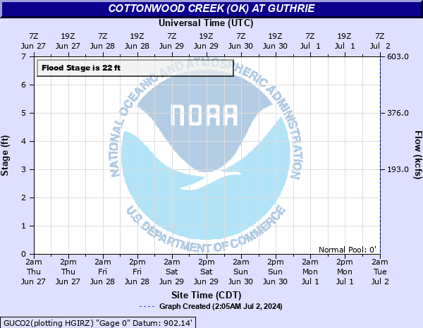
22' - Flood
25' - Moderate
27' - Major
Latest Observation
Updated: 6:09 PM LMT 12/31/00
Status: Obs Not Current
Stage: -999 ft
Flow: -999 kcfs
Forecast
Forecast not available for this location.
Observation history not available.
32' -
People living in south Guthrie west of the creek can evacuate only by routes to the west. Large areas in the city will suffer life-threatening currents and flood depths near 12 feet. Rural flood plain areas near Guthrie could see similar depths.
31' -
People living in south Guthrie west of the creek can evacuate only by routes to the west. Large areas in the city will suffer life-threatening currents and flood depths near 11 feet. Rural flood plain areas near Guthrie could see similar depths.
30' -
People living in south Guthrie west of the creek can evacuate only by routes to the west. Areas west of the railroads could suffer life-threatening currents and flood depths near 10 feet. Rural flood plain areas near Guthrie could see similar depths.
29' -
People living in south Guthrie west of the creek can evacuate only by routes to the west. Areas in town west of the railroads could suffer life-threatening currents and flood depths near 9 feet. Rural flood plain areas near Guthrie could see similar depths. Floodwaters close 5th Street near the Oklahoma State Highway 33 bridge.
28' -
People living in south Guthrie west of the creek can evacuate only by routes to the west. Many areas in town west of the railroads could suffer life-threatening currents and flood depths near 8 feet. Rural flood plain areas near Guthrie could see similar depths. Floodwaters close 5th Street near the Oklahoma State Highway 33 bridge.
27' -
People living in south Guthrie west of the creek can evacuate only by routes to the west. Many areas in town west of the railroads could suffer life-threatening currents and depths near 7 feet. Rural flood plain areas near Guthrie could see similar depths. Floodwaters close 5th Street near the Oklahoma State Highway 33 bridge.
26' -
Residential and business areas in town could suffer life-threatening currents and flood depths approaching 6 feet. Rural flood plain areas near Guthrie could see similar depths. Floodwaters close 5th Street near the Oklahoma State Highway 33 bridge.
25' -
Residential and business areas in town could suffer life-threatening currents and flood depths approaching 5 feet. Rural flood plain areas near Guthrie could see similar depths. Floodwaters close 5th Street near the Oklahoma State Highway 33 bridge.
24' -
Residential and business areas in town could see flood depths approaching 4 feet. Rural flood plain areas near Guthrie could experience similar depths. Floodwaters close 5th Street near the Oklahoma State Highway 33 bridge.
23' -
Bottomland residences and businesses in town may be flooded as deep as 3 feet. Rural flood plain areas near Guthrie could experience similar depths. Floodwaters close 5th Street near the Oklahoma State Highway 33 bridge.
22' -
Residences in southwest Guthrie may be flooded or isolated by water in streets. Rural flood plain areas near Guthrie and downstream to the Cimarron River could experience depths up to 2 feet. Floodwaters close 5th Street near the Oklahoma State Highway 33 bridge.
21' -
Residences in southwest Guthrie may be flooded or isolated by water in streets. Rural flood plain areas near Guthrie and downstream to the Cimarron River could be covered by depths up to a foot or more.
20' -
Cottonwood Creek reaches bankfull levels or higher in a few places along the rural flood plain downstream to the Cimarron River.
19' -
The creek remains with its banks downstream to the Cimarron River.
18' -
The creek remains with its banks downstream to the Cimarron River.
17' -
The creek remains with its banks downstream to the Cimarron River.
| Date | Stage (ft) |
|---|---|
| Oct 20, 1983 | 30 |
| May 9, 1993 | 29.6 |
| Oct 2, 1959 | 29.26 |
| May 15, 1949 | 28.58 |
| Sep 21, 1965 | 28.09 |
| Jun 9, 1995 | 27.9 |
| May 28, 1987 | 27.9 |
| Jun 1, 2013 | 27.4 |
| May 22, 2019 | 27.4 |
| Sep 13, 1989 | 27.2 |
| Jun 15, 2010 | 27 |
| May 6, 1955 | 26.9 |
| Jun 10, 1962 | 26.7 |
| Mar 11, 1990 | 26.5 |
| Aug 20, 2007 | 26.4 |
| Sep 25, 1959 | 26.34 |
| Apr 12, 1927 | 26.15 |
| Oct 1, 1986 | 25.9 |
| Apr 15, 1916 | 25.82 |
| Apr 29, 1912 | 25.73 |
Data provided by the National Weather Service.