Cimarron River near Perkins
Critical Stages
16' - Action
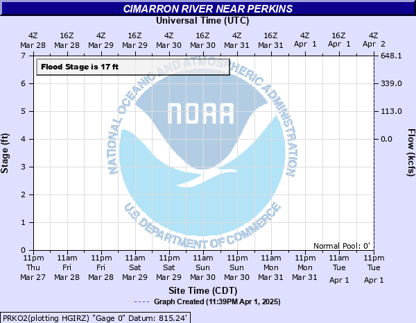
17' - Flood
20' - Moderate
22' - Major
Latest Observation
Updated: 6:09 PM LMT 12/31/00
Status: Obs Not Current
Stage: -999 ft
Flow: -999 kcfs
Forecast
Forecast not available for this location.
Observation history not available.
28' -
The Cimarron River valley in Payne County could suffer worse damages than from the great floods in October of 1986 and May 1957. Flood depths up to 11 feet devastate rural lands... oil fields... and other properties... Overflows continue... from many hours before to many hours after the crest passes Perkins. Floodwaters close U.S. Highway 177 south of Perkins.
27' -
The Cimarron River valley in Payne County could suffer worse damages than from the great floods in October 1986 and May 1957. Flood depths up to 10 feet devastate rural lands... oil fields... and other properties. Overflows continue from many hours before to many hours after the crest passes Perkins. Floodwaters close U.S. Highway 177 south of Perkins.
26' -
The Cimarron River valley in Payne County experiences water levels within a foot of the great flood of October 1986... and higher than the flood in May 1957... when the railroad line was destroyed between Guthrie and Perkins. Flood depths up to 9 feet inundate rural areas... from many hours before to many hours after the crest passes Perkins. Floodwaters close U.S. Highway 177 south of Perkins.
25' -
The Cimarron River valley in Payne County is covered by flood depths averaging 8 feet... worse than the flooding which occurred in May 1957... which destroyed the railroad line between Guthrie and Perkins. Rural lands and roads located near the river banks are inundated... from many hours before to many hours after the crest passes Perkins. Floodwaters close U.S. Highway 177 south of Perkins.
24' -
The Cimarron River valley in Payne County is covered by flood depths near 7 feet... nearly like the flood in May 1957... which destroyed the railroad line between Guthrie and Perkins. Rural lands and roads located near the river banks are inundated... from many hours before to many hours after the crest passes Perkins. Floodwaters close U.S. Highway 177 south of Perkins.
23' -
The Cimarron River valley in Payne County is covered by flood depths averaging 6 feet... with very hazardous currents. Agricultural lands... oil wells... and water wells located near the river banks are inundated... from many hours before to many hours after the crest passes Perkins. High water closes U.S. Highway 177 south of Perkins.
22' -
The Cimarron River valley in Payne County is covered by flood depths averaging 5 feet... with very hazardous currents. Agricultural lands... oil wells... and water wells located near the river banks are inundated... from many hours before to many hours after the crest passes Perkins. High water closes U.S. Highway 177 south of Perkins.
21' -
The Cimarron River valley in Payne County is covered by flood depths averaging 4 feet... with hazardous currents. Agricultural lands... oil wells... and water wells located near the river banks are inundated or cut off... from several hours before to several hours after the crest passes Perkins. High water closes U.S. Highway 177 south of Perkins.
20' -
The Cimarron River valley in Payne County is covered by flood depths averaging 3 feet... with hazardous currents. Agricultural lands... oil wells... and water wells located near the river banks are inundated or cut off... several hours before and after the crest passes Perkins. Water overtops and may close U.S. Highway 177 south of Perkins.
19.5' -
Places along the Cimarron River valley in Payne County are covered by flood depths averaging over 2 feet. Agricultural lands... oil wells... and water wells located near the river banks are inundated or cut off... for several hours... by water in side channels. Water overtops the roadway of U.S. Highway 177 south of Perkins... making crossing there hazardous.
19' -
Places along the Cimarron River valley in Payne County are covered by flood depths averaging 2 feet. Agricultural lands... oil wells... and water wells located near the river banks are inundated or cut off for several hours... by water in side channels.
18.5' -
Places along the Cimarron River valley in Payne County are briefly flooded. Agricultural lands and oil wells located near the river banks are inundated or cut off by water in side channels.
18' -
Places along the Cimarron River valley in Payne County are briefly flooded. Agricultural lands and oil wells located near the river banks are inundated or cut off by water in side channels.
17.5' -
Places along the Cimarron River valley in Payne County are briefly flooded. Agricultural lands and oil wells located near the river banks are isolated by water in cutoff channels along the valley. No major roads are threatened.
17' -
Places along the Cimarron River valley in Payne County are briefly flooded. Agricultural lands and oil wells located near the channel are isolated by water in cutoff channels along the valley. No major roads are threatened.
16' -
Expect the Cimarron River to reach bankfull levels through Payne County. Small areas of agricultural land and oil wells located near the channel are isolated by water in cutoff channels along the river valley. No major roads are threatened.
15' -
Expect the Cimarron River to remain mostly within its banks through Payne County. Small areas of agricultural land and oil wells located near the channel are isolated by water in cutoff channels along the valley. No major roads are river threatened.
| Date | Stage (ft) |
|---|---|
| Oct 4, 1986 | 26.75 |
| May 17, 1957 | 24.53 |
| Jun 21, 1935 | 23 |
| Mar 11, 1990 | 22.2 |
| May 19, 1982 | 22.03 |
| Mar 12, 1990 | 22 |
| Oct 5, 1926 | 22 |
| Nov 4, 1974 | 21.85 |
| Oct 3, 1959 | 21.4 |
| May 21, 1957 | 20.75 |
| May 19, 1949 | 20.22 |
| Mar 12, 1974 | 19.86 |
| May 21, 1955 | 19.8 |
| Aug 18, 1932 | 19.6 |
| Oct 23, 1986 | 19.53 |
| May 29, 1987 | 19.5 |
| Jun 10, 2008 | 19.4 |
| Apr 20, 1942 | 19.3 |
| Oct 25, 1941 | 19.25 |
| Apr 11, 1944 | 19.08 |
Data provided by the National Weather Service.