Little River (OK) near Tecumseh
Critical Stages
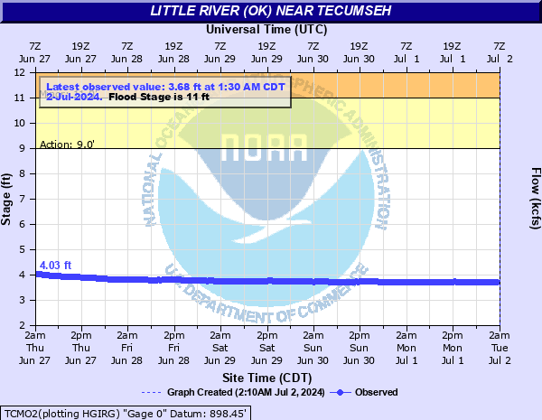
9' - Action
11' - Flood
15' - Moderate
17' - Major
Latest Observation
Updated: 4:30 AM CST 12/6/25
Status: No Flooding
Stage: 4.03 ft
Flow: 0.017 kcfs
Forecast
Forecast not available for this location.
| Time | Stage (ft) | Flow (kcfs) |
|---|---|---|
| 4:30 AM 12/6 | 4.03 | 0.017 |
| 4:00 AM 12/6 | 4.03 | 0.017 |
| 3:30 AM 12/6 | 4.03 | 0.017 |
| 3:00 AM 12/6 | 4.03 | 0.017 |
| 2:30 AM 12/6 | 4.03 | 0.017 |
| 2:00 AM 12/6 | 4.04 | 0.0174 |
| 1:30 AM 12/6 | 4.03 | 0.017 |
| 1:00 AM 12/6 | 4.04 | 0.0174 |
| 12:30 AM 12/6 | 4.04 | 0.0174 |
| 12:00 AM 12/6 | 4.04 | 0.0174 |
| 11:30 PM 12/5 | 4.04 | 0.0174 |
| 11:00 PM 12/5 | 4.04 | 0.0174 |
| 10:30 PM 12/5 | 4.04 | 0.0174 |
| 10:00 PM 12/5 | 4.04 | 0.0174 |
| 9:30 PM 12/5 | 4.04 | 0.0174 |
| 9:00 PM 12/5 | 4.04 | 0.0174 |
| 8:30 PM 12/5 | 4.04 | 0.0174 |
| 8:00 PM 12/5 | 4.04 | 0.0174 |
| 7:30 PM 12/5 | 4.04 | 0.0174 |
| 7:00 PM 12/5 | 4.04 | 0.0174 |
| 6:30 PM 12/5 | 4.05 | 0.0179 |
| 6:00 PM 12/5 | 4.05 | 0.0179 |
| 5:30 PM 12/5 | 4.05 | 0.0179 |
| 5:00 PM 12/5 | 4.05 | 0.0179 |
| 4:30 PM 12/5 | 4.06 | 0.0183 |
| 4:00 PM 12/5 | 4.06 | 0.0183 |
| 3:30 PM 12/5 | 4.06 | 0.0183 |
| 3:00 PM 12/5 | 4.06 | 0.0183 |
| 2:30 PM 12/5 | 4.06 | 0.0183 |
| 2:00 PM 12/5 | 4.06 | 0.0183 |
22' -
Significant flooding to depths of 11 feet damages croplands... pastures... and rural roads along the river... and overtops agricultural levees upstream of the U.S. Highway 177 bridge crossing. The area affected is entirely rural... and downstream of Lake Thunderbird... from near Macomb in Pottawatomie County to near Bowlegs in western Seminole County.
21' -
Significant flooding to depths of 10 feet damages croplands... pastures... and rural roads along the river... and overtops agricultural levees upstream of the U.S. Highway 177 bridge crossing. The area affected is entirely rural... and downstream of Lake Thunderbird... from near Macomb in Pottawatomie County to near Bowlegs in western Seminole County.
20' -
Significant flooding to depths of 9 feet damages croplands... pastures... and rural roads along the river downstream of the U.S. Highway 177 bridge crossing... with lesser damage occurring upstream of U.S. Highway 177. The area affected is entirely rural... and downstream of Lake Thunderbird... from near Macomb in Pottawatomie County to near Bowlegs in western Seminole County.
19' -
Significant flooding to depths of 8 feet damages croplands... pastures... and rural roads along the river downstream of the U.S. Highway 177 bridge crossing... with lesser damage occurring upstream of U.S. Highway 177. The area affected is entirely rural... and downstream of Lake Thunderbird... from near Macomb in Pottawatomie County to near Bowlegs in western Seminole County.
18' -
Significant flooding to depths of 7 feet damages croplands... pastures... and rural roads along the river downstream of the U.S. Highway 177 bridge crossing... with lesser damage occurring upstream of U.S. Highway 177. The area affected is entirely rural... and downstream of Lake Thunderbird... from near Macomb in Pottawatomie County to near Bowlegs in western Seminole County.
17' -
Significant flooding to depths of 6 feet damages croplands... pastures... and rural roads along the river downstream of the U.S. Highway 177 bridge crossing... with lesser damage occurring upstream of U.S. Highway 177. The area affected is entirely rural... and downstream of Lake Thunderbird... from near Macomb in Pottawatomie County to near Bowlegs in western Seminole County.
16' -
Significant flooding to depths of 5 feet damages croplands... pastures... and rural roads along the river downstream of the U.S. Highway 177 bridge crossing... with lesser damage occurring upstream of U.S. Highway 177. The area affected is entirely rural... and downstream of Lake Thunderbird... from near Macomb in Pottawatomie County to near Bowlegs in western Seminole County.
15' -
Significant flooding to depths of 4 feet damages croplands... pastures... and rural roads along the river downstream of the U.S. Highway 177 bridge crossing... with lesser damage occurring upstream of U.S. Highway 177. The area affected is entirely rural... and downstream of Lake Thunderbird... from near Macomb in Pottawatomie County to near Bowlegs in western Seminole County.
14' -
Flooding to depths of 3 feet occurs over croplands... pastures... and rural roads along the river. The area affected is entirely rural... and downstream of Lake Thunderbird... from near Macomb in Pottawatomie County to near Bowlegs in western Seminole County.
13' -
Flooding to depths of 2 feet occurs over croplands... pastures... and rural roads along the river. The area affected is entirely rural... and downstream of Lake Thunderbird... from near Macomb in Pottawatomie County to near Bowlegs in western Seminole County.
12' -
Flooding to depths of 1 foot occurs over croplands... pastures... and rural roads along the river. The area affected is entirely rural... and downstream of Lake Thunderbird... from near Macomb in Pottawatomie County to near Bowlegs in western Seminole County.
11' -
Low-lying croplands... pastures... and rural roads may experience shallow flooding or be isolated by deeper water in overflow channels cutting across the flood plain. The area affected is entirely rural... and downstream of Lake Thunderbird... from near Macomb in Pottawatomie County to near Bowlegs in western Seminole County.
10' -
Near bankfull flows occur along the river and downstream of Lake Thunderbird... from near Macomb in Pottawatomie County to near Bowlegs in western Seminole County.
| Date | Stage (ft) |
|---|---|
| May 24, 2015 | 20.65 |
| May 18, 1949 | 19.68 |
| Oct 20, 1984 | 19.24 |
| Jun 18, 2015 | 19.15 |
| Apr 30, 2025 | 19.08 |
| May 25, 1957 | 18.84 |
| May 3, 1990 | 18.28 |
| Apr 14, 1945 | 18 |
| Feb 23, 1985 | 17.97 |
| Apr 1, 1988 | 17.84 |
| May 10, 2015 | 17.24 |
| May 20, 2015 | 16.69 |
| Aug 20, 2007 | 16.64 |
| Jun 15, 2010 | 16.59 |
| May 11, 1992 | 16.53 |
| Sep 23, 1970 | 16.49 |
| Jun 9, 1979 | 16.34 |
| May 27, 1995 | 16.32 |
| May 8, 2007 | 16.31 |
| May 9, 1993 | 16.3 |
Data provided by the National Weather Service.