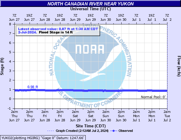
North Canadian River near Yukon
Critical Stages
11' - Action
14' - Flood
16' - Moderate
17' - Major
Latest Observation
Updated: 4:30 AM CST 12/6/25
Status: No Flooding
Stage: 1.05 ft
Flow: 0.05 kcfs
Forecast
Forecast not available for this location.
| Time | Stage (ft) | Flow (kcfs) |
|---|---|---|
| 4:30 AM 12/6 | 1.05 | 0.05 |
| 4:00 AM 12/6 | 1.05 | 0.05 |
| 3:30 AM 12/6 | 1.05 | 0.05 |
| 3:00 AM 12/6 | 1.05 | 0.05 |
| 2:30 AM 12/6 | 1.05 | 0.05 |
| 2:00 AM 12/6 | 1.05 | 0.05 |
| 1:30 AM 12/6 | 1.05 | 0.05 |
| 1:00 AM 12/6 | 1.05 | 0.05 |
| 12:30 AM 12/6 | 1.06 | 0.0511 |
| 12:00 AM 12/6 | 1.06 | 0.0511 |
| 11:30 PM 12/5 | 1.06 | 0.0511 |
| 11:00 PM 12/5 | 1.06 | 0.0511 |
| 10:30 PM 12/5 | 1.06 | 0.0511 |
| 10:00 PM 12/5 | 1.06 | 0.0511 |
| 9:30 PM 12/5 | 1.06 | 0.0511 |
| 9:00 PM 12/5 | 1.06 | 0.0511 |
| 8:30 PM 12/5 | 1.06 | 0.0511 |
| 8:00 PM 12/5 | 1.06 | 0.0511 |
| 7:30 PM 12/5 | 1.06 | 0.0511 |
| 7:00 PM 12/5 | 1.06 | 0.0511 |
| 6:30 PM 12/5 | 1.05 | 0.05 |
| 6:00 PM 12/5 | 1.06 | 0.0511 |
| 5:30 PM 12/5 | 1.06 | 0.0511 |
| 5:00 PM 12/5 | 1.06 | 0.0511 |
| 4:30 PM 12/5 | 1.07 | 0.0522 |
| 4:00 PM 12/5 | 1.07 | 0.0522 |
| 3:30 PM 12/5 | 1.07 | 0.0522 |
| 3:00 PM 12/5 | 1.07 | 0.0522 |
| 2:30 PM 12/5 | 1.07 | 0.0522 |
| 2:00 PM 12/5 | 1.07 | 0.0522 |
21' -
Flooding or isolation of suburban home sites and rural areas along the North Canadian River valley occurs... from near Banner Road to the headwaters of Lake Overholser. The Garth Brooks Avenue crossing northwest of town is closed. Ash and Cedar Streets at the north edge of town may see overflows. Low-lying rural roads are closed by flood depths of 9 or more feet with devastating currents.
20' -
Flooding or isolation of suburban home sites and rural areas along the North Canadian River valley occurs... from near Banner Road to the headwaters of Lake Overholser. The Garth Brooks Avenue crossing northwest of town is closed. Ash and Cedar Streets at the north edge of town may see overflows. Low-lying rural roads are closed by flood depths of 8 or more feet with devastating currents.
19' -
Flooding or isolation of suburban home sites and rural areas along the North Canadian River valley occurs... from near Banner Road to the headwaters of Lake Overholser. The Garth Brooks Avenue crossing northwest of town is closed. Ash and Cedar Streets at the north edge of town may see overflows. Low-lying rural roads are closed by flood depths of 7 or more feet with devastating currents.
18' -
Flooding or isolation of suburban home sites and rural areas along the North Canadian River valley occurs... from near Banner Road to the headwaters of Lake Overholser. The Garth Brooks Avenue crossing northwest of town is closed. Ash and Cedar Streets at the north edge of town may see overflows. Low-lying rural roads are closed by flood depths of 6 or more feet with devastating currents.
17' -
Flooding or isolation of suburban home sites and rural areas along the North Canadian River valley occurs... from near Banner Road to the headwaters of Lake Overholser. The Garth Brooks Avenue crossing northwest of town is closed by floodwaters. Low-lying rural roads are closed by flood depths near 5 feet with dangerously swift currents.
16' -
Flooding or isolation of suburban home sites and rural areas along the North Canadian River valley occurs... from near Banner Road to the headwaters of Lake Overholser. The Garth Brooks Avenue crossing northwest of town is closed by floodwaters. Low-lying rural roads are closed by flood depths near 4 feet with dangerously swift currents.
15' -
Flooding or isolation of suburban home sites and rural areas along the North Canadian River valley occurs... from near Banner Road to the headwaters of Lake Overholser. The Garth Brooks Avenue crossing northwest of town is closed by floodwaters. Low-lying rural roads are closed by flood depths near 3 feet with dangerously swift currents.
14' -
Flooding or isolation of suburban home sites and rural areas occurs along the North Canadian River valley... from near Banner Road to the headwaters of Lake Overholser. The Garth Brooks Avenue crossing northwest of Yukon floods. Low-lying rural roads are inundated by flood depths near 2 feet with swift currents.
13' -
Areas of shallow overflows extend along the North Canadian River valley from near Banner Road... downstream to the headwaters of Lake Overholser. The areas most affected are low-lying agricultural and suburban areas... oilfield facilities... and local roads.
12' -
Bankfull conditions with disperse points of shallow overflows near the river channel banks is prevalent... from near Banner Road to Yukon to the headwaters of Lake Overholser. The areas most affected are low-lying croplands and pastures... oilfields... and local roads.
| Date | Stage (ft) |
|---|---|
| Jun 10, 1995 | 19.2 |
| Aug 21, 2007 | 16.92 |
| May 21, 2019 | 16.85 |
| Oct 28, 1941 | 16.67 |
| Aug 19, 2007 | 16.21 |
| Sep 22, 1965 | 15.9 |
| Jun 24, 1948 | 15.8 |
| Oct 5, 1959 | 15.28 |
| May 19, 1949 | 15 |
| Jun 30, 2007 | 14.96 |
| Jun 1, 2013 | 14.56 |
| Sep 14, 1961 | 14.41 |
| Jun 13, 1944 | 14.4 |
| May 25, 2015 | 13.99 |
| Nov 2, 1974 | 13.9 |
| May 19, 1943 | 13.9 |
| Oct 5, 1955 | 13.89 |
| May 9, 2019 | 13.81 |
| Apr 25, 1942 | 13.7 |
| Sep 23, 1970 | 13.51 |
Data provided by the National Weather Service.