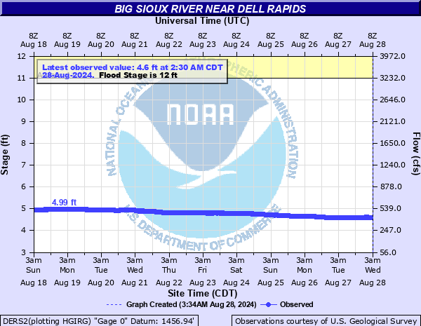
Big Sioux River near Dell Rapids
Critical Stages
11' - Action
12' - Flood
14' - Moderate
15' - Major
Latest Observation
Updated: 2:30 PM CST 12/15/25
Status: No Flooding
Stage: 4.67 ft
Flow: 0.952 kcfs
Forecast
Forecast not available for this location.
| Time | Stage (ft) | Flow (kcfs) |
|---|---|---|
| 2:30 PM 12/15 | 4.67 | 0.952 |
| 2:15 PM 12/15 | 4.67 | 0.952 |
| 2:00 PM 12/15 | 4.67 | 0.952 |
| 1:45 PM 12/15 | 4.67 | 0.952 |
| 1:30 PM 12/15 | 4.67 | 0.952 |
| 1:15 PM 12/15 | 4.67 | 0.952 |
| 1:00 PM 12/15 | 4.67 | 0.952 |
| 12:45 PM 12/15 | 4.67 | 0.952 |
| 12:30 PM 12/15 | 4.67 | 0.952 |
| 12:15 PM 12/15 | 4.67 | 0.952 |
| 12:00 PM 12/15 | 4.67 | 0.952 |
| 11:45 AM 12/15 | 4.67 | 0.952 |
| 11:30 AM 12/15 | 4.67 | 0.952 |
| 11:15 AM 12/15 | 4.67 | 0.952 |
| 11:00 AM 12/15 | 4.67 | 0.952 |
| 10:45 AM 12/15 | 4.67 | 0.952 |
| 10:30 AM 12/15 | 4.67 | 0.952 |
| 10:15 AM 12/15 | 4.67 | 0.952 |
| 10:00 AM 12/15 | 4.67 | 0.952 |
| 9:45 AM 12/15 | 4.67 | 0.952 |
| 9:30 AM 12/15 | 4.67 | 0.952 |
| 9:15 AM 12/15 | 4.67 | 0.952 |
| 9:00 AM 12/15 | 4.67 | 0.952 |
| 8:45 AM 12/15 | 4.67 | 0.952 |
| 8:30 AM 12/15 | 4.67 | 0.952 |
| 8:15 AM 12/15 | 4.67 | 0.952 |
| 8:00 AM 12/15 | 4.67 | 0.952 |
| 7:45 AM 12/15 | 4.67 | 0.952 |
| 7:30 AM 12/15 | 4.67 | 0.952 |
| 7:15 AM 12/15 | 4.67 | 0.952 |
21' -
The bridge at the gauge on 248th St is overtopped and several outbuildings near the gauge are flooded.
19' -
The bridge on 250th Street just west of Baltic is overtopped.
17.5' -
Water reaches the bottom of the bridge on 250th Street west of Baltic.
16.5' -
Water reaches the bottom of the bridge on 254th St.
16' -
248th Street east of the gauge is flooded, along with several other county roads. Flooding will affect the city of Renner with water going over the main road in town.
15.5' -
County Road 130 in Renner is flooded.
15' -
Some homes in Renner are flooded, and the Jaycee Camp between Baltic and Renner is also flooded.
14.5' -
250th Street west of Baltic is flooded, River Park Road in Baltic is flooded, and some homes and businesses along 1st Avenue are flooded.
14' -
Significant amounts of agricultural lands are flooded through the basin, and River Park in Baltic begins to flood.
12' -
Agricultural lands along the lower banks of the river begin to flood.
| Date | Stage (ft) |
|---|---|
| Sep 13, 2019 | 16.7 |
| Apr 9, 1969 | 16.47 |
| Sep 25, 2010 | 16.29 |
| Mar 15, 2007 | 16.02 |
| Mar 24, 2019 | 15.69 |
| Mar 24, 2011 | 15.63 |
| Jul 4, 1993 | 15.56 |
| Apr 7, 1997 | 15.47 |
| Jun 23, 1984 | 15.2 |
| Mar 30, 1962 | 15.14 |
| Jun 18, 1957 | 14.93 |
| Apr 5, 1952 | 14.85 |
| Mar 31, 1960 | 14.83 |
| Sep 22, 1986 | 14.71 |
| Apr 4, 1951 | 14.36 |
| Apr 24, 2001 | 14.32 |
| Apr 27, 2018 | 14.2 |
| Apr 8, 1965 | 14.14 |
| Apr 22, 1995 | 14.12 |
| May 7, 2012 | 14.07 |
Data provided by the National Weather Service.