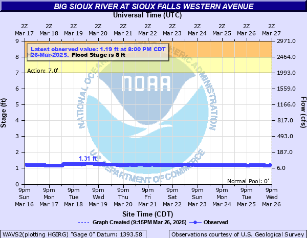
Big Sioux River at Sioux Falls Western Avenue
Critical Stages
7' - Action
8' - Flood
12' - Moderate
14' - Major
Latest Observation
Updated: 2:00 PM CST 12/15/25
Status: No Flooding
Stage: 1.25 ft
Flow: 0.0342 kcfs
Forecast
Forecast not available for this location.
| Time | Stage (ft) | Flow (kcfs) |
|---|---|---|
| 2:00 PM 12/15 | 1.25 | 0.0342 |
| 1:45 PM 12/15 | 1.26 | 0.0353 |
| 1:30 PM 12/15 | 1.25 | 0.0342 |
| 1:15 PM 12/15 | 1.25 | 0.0342 |
| 1:00 PM 12/15 | 1.26 | 0.0353 |
| 12:45 PM 12/15 | 1.25 | 0.0342 |
| 12:30 PM 12/15 | 1.26 | 0.0353 |
| 12:15 PM 12/15 | 1.26 | 0.0353 |
| 12:00 PM 12/15 | 1.25 | 0.0342 |
| 11:45 AM 12/15 | 1.25 | 0.0342 |
| 11:30 AM 12/15 | 1.25 | 0.0342 |
| 11:15 AM 12/15 | 1.25 | 0.0342 |
| 11:00 AM 12/15 | 1.25 | 0.0342 |
| 10:45 AM 12/15 | 1.26 | 0.0353 |
| 10:30 AM 12/15 | 1.25 | 0.0342 |
| 10:15 AM 12/15 | 1.25 | 0.0342 |
| 10:00 AM 12/15 | 1.25 | 0.0342 |
| 9:45 AM 12/15 | 1.26 | 0.0353 |
| 9:30 AM 12/15 | 1.25 | 0.0342 |
| 9:15 AM 12/15 | 1.25 | 0.0342 |
| 9:00 AM 12/15 | 1.26 | 0.0353 |
| 8:45 AM 12/15 | 1.26 | 0.0353 |
| 8:30 AM 12/15 | 1.26 | 0.0353 |
| 8:15 AM 12/15 | 1.26 | 0.0353 |
| 8:00 AM 12/15 | 1.26 | 0.0353 |
| 7:45 AM 12/15 | 1.26 | 0.0353 |
| 7:30 AM 12/15 | 1.26 | 0.0353 |
| 7:15 AM 12/15 | 1.25 | 0.0342 |
| 7:00 AM 12/15 | 1.26 | 0.0353 |
| 6:45 AM 12/15 | 1.26 | 0.0353 |
20' -
Many of the remaining levees between Skunk Creek and Western Ave are overtopped.
18.5' -
The lower levees below Skunk Creek and above the Western Avenue gage will be overtopped.
16.5' -
Numerous homes in southern Sioux Falls, especially between Minnesota Ave and S Phillips Ave, are in danger of flooding. The on and off ramps of I-229 at Cliff Ave begin to flood.
14.5' -
Some houses in the Rose Street and Lotta Street areas near South Minnesota Avenue begin flooding.
14' -
The bridge into Yanton Trail Park off of 57th St may be overtopped.
13.5' -
Water approaches Cliff Ave north of the bridge and may begin to flood the lowest portions.
12.8' -
East 41st Street begins flooding.
11' -
The entrances to Yankton Trail and Spencer Parks begin to flood.
10' -
City parks in southern Sioux Falls begin to have significant flooding.
9' -
The camp south of 26th St begins to flood.
8' -
Flooding begins to affect Spencer Dog Park and the lower portions of Tuthill Park in southern Sioux Falls. The access road under 26th St begins to flood.
6.5' -
The lowest portion of the bike trail near Spencer Dog Park may begin to flood.
| Date | Stage (ft) |
|---|---|
| Mar 14, 2019 | 16.9 |
| Jun 17, 1957 | 16.01 |
| Jun 21, 1984 | 15.8 |
| Mar 30, 1960 | 15.56 |
| Jun 22, 2024 | 15.44 |
| Apr 7, 1952 | 14.5 |
| Apr 6, 1951 | 14.3 |
| Apr 10, 1969 | 14.2 |
| Feb 28, 1948 | 13.9 |
| Aug 27, 2015 | 13.17 |
| Apr 23, 2001 | 13 |
| Apr 7, 2006 | 12.71 |
| Jul 30, 2010 | 12.44 |
| Sep 21, 2018 | 12 |
| Mar 11, 2007 | 11.92 |
| Mar 20, 1979 | 11.75 |
| May 26, 2013 | 11.26 |
| Mar 20, 1978 | 11.25 |
| Jul 27, 2011 | 10.89 |
| Jun 10, 1947 | 10.8 |
Data provided by the National Weather Service.