Wild Rice River (ND) near Abercrombie
Critical Stages
17' - Action
20' - Flood
22' - Moderate
28' - Major
Latest Observation
Updated: 10:00 AM CST 12/15/25
Status: No Flooding
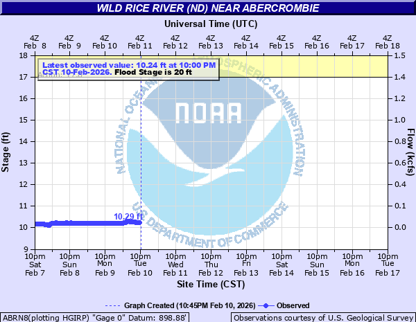
Stage: 10.46 ft
Flow: 0.0513 kcfs
Forecast
Forecast not available for this location.
| Time | Stage (ft) | Flow (kcfs) |
|---|---|---|
| 11:00 AM 12/15 | 10.46 | 0.0513 |
| 10:45 AM 12/15 | 10.46 | 0.0513 |
| 10:30 AM 12/15 | 10.46 | 0.0513 |
| 10:15 AM 12/15 | 10.46 | 0.0513 |
| 10:00 AM 12/15 | 10.46 | 0.0513 |
| 9:45 AM 12/15 | 10.46 | 0.0513 |
| 9:30 AM 12/15 | 10.46 | 0.0513 |
| 9:15 AM 12/15 | 10.46 | 0.0513 |
| 9:00 AM 12/15 | 10.46 | 0.0513 |
| 8:45 AM 12/15 | 10.46 | 0.0513 |
| 8:30 AM 12/15 | 10.46 | 0.0513 |
| 8:15 AM 12/15 | 10.46 | 0.0513 |
| 8:00 AM 12/15 | 10.46 | 0.0513 |
| 7:45 AM 12/15 | 10.46 | 0.0513 |
| 7:30 AM 12/15 | 10.47 | 0.0525 |
| 7:15 AM 12/15 | 10.46 | 0.0513 |
| 7:00 AM 12/15 | 10.47 | 0.0525 |
| 6:45 AM 12/15 | 10.47 | 0.0525 |
| 6:30 AM 12/15 | 10.47 | 0.0525 |
| 6:15 AM 12/15 | 10.47 | 0.0525 |
| 6:00 AM 12/15 | 10.47 | 0.0525 |
| 5:45 AM 12/15 | 10.47 | 0.0525 |
| 5:30 AM 12/15 | 10.47 | 0.0525 |
| 5:15 AM 12/15 | 10.47 | 0.0525 |
| 5:00 AM 12/15 | 10.47 | 0.0525 |
| 4:45 AM 12/15 | 10.47 | 0.0525 |
| 4:30 AM 12/15 | 10.47 | 0.0525 |
| 4:15 AM 12/15 | 10.47 | 0.0525 |
| 4:00 AM 12/15 | 10.47 | 0.0525 |
| 3:45 AM 12/15 | 10.47 | 0.0525 |
30' -
County Road 3 bridge (downstream of gage) starts to flood.
28' -
MAJOR FLOOD. Bridge near the gage is inaccessible due to agricultural flooding.
25' -
Some local flooding begins on rural roads and approaches to bridges.
22' -
MODERATE FLOOD. City begins to mobilize.
20' -
MINOR FLOOD.
18.4' -
Flood damage to the village of Great Bend, ND.
17.2' -
Agricultural damage from river mile 77 to river mile 108.
17' -
ACTION STAGE/FORECAST SERVICE STAGE.
14' -
Small dam 0.75 mile downstream floods.
| Date | Stage (ft) |
|---|---|
| Mar 25, 2009 | 37.78 |
| Jan 1, 1897 | 37.5 |
| Apr 6, 1997 | 36.59 |
| Apr 6, 2011 | 35.99 |
| Apr 9, 2001 | 35.2 |
| Apr 2, 2006 | 35.06 |
| Mar 19, 2010 | 34.61 |
| Apr 11, 1969 | 34.58 |
| Apr 6, 1989 | 33.62 |
| Apr 6, 2019 | 32.76 |
| Apr 15, 1979 | 32.39 |
| Apr 29, 2013 | 31.63 |
| Apr 2, 1943 | 31.02 |
| Jun 5, 2007 | 30.96 |
| Apr 12, 1952 | 30.62 |
| Mar 30, 1978 | 30.03 |
| Jul 4, 1975 | 29.16 |
| May 18, 1998 | 28.82 |
| Apr 19, 2023 | 28.44 |
| Mar 19, 1966 | 28.43 |
Data provided by the National Weather Service.