« Back to Evening Shade Rivers
Poteau River near Poteau
Critical Stages
24' - Action
24' - Flood
26' - Moderate
30' - Major
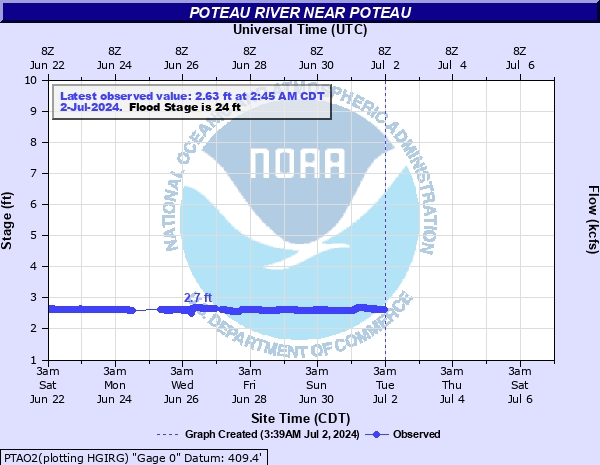
Latest Observation
Updated: 4:45 PM CST 12/15/25
Status: No Flooding
Stage: 2.6 ft
Flow: 0.192 kcfs
Forecast
Forecast not available for this location.
| Time | Stage (ft) | Flow (kcfs) |
|---|---|---|
| 4:45 PM 12/15 | 2.6 | 0.192 |
| 4:30 PM 12/15 | 2.6 | 0.192 |
| 4:15 PM 12/15 | 2.61 | 0.195 |
| 4:00 PM 12/15 | 2.6 | 0.192 |
| 3:45 PM 12/15 | 2.61 | 0.195 |
| 3:30 PM 12/15 | 2.61 | 0.195 |
| 3:15 PM 12/15 | 2.61 | 0.195 |
| 3:00 PM 12/15 | 2.61 | 0.195 |
| 2:45 PM 12/15 | 2.61 | 0.195 |
| 2:30 PM 12/15 | 2.61 | 0.195 |
| 2:15 PM 12/15 | 2.61 | 0.195 |
| 2:00 PM 12/15 | 2.61 | 0.195 |
| 1:45 PM 12/15 | 2.61 | 0.195 |
| 1:30 PM 12/15 | 2.61 | 0.195 |
| 1:15 PM 12/15 | 2.61 | 0.195 |
| 1:00 PM 12/15 | 2.61 | 0.195 |
| 12:45 PM 12/15 | 2.62 | 0.199 |
| 12:30 PM 12/15 | 2.61 | 0.195 |
| 12:15 PM 12/15 | 2.62 | 0.199 |
| 12:00 PM 12/15 | 2.62 | 0.199 |
| 11:45 AM 12/15 | 2.62 | 0.199 |
| 11:30 AM 12/15 | 2.62 | 0.199 |
| 11:15 AM 12/15 | 2.62 | 0.199 |
| 11:00 AM 12/15 | 2.63 | 0.202 |
| 10:45 AM 12/15 | 2.63 | 0.202 |
| 10:30 AM 12/15 | 2.63 | 0.202 |
| 10:15 AM 12/15 | 2.63 | 0.202 |
| 10:00 AM 12/15 | 2.63 | 0.202 |
| 9:45 AM 12/15 | 2.63 | 0.202 |
| 9:30 AM 12/15 | 2.63 | 0.202 |
32' -
extremely severe flooding affects pasture lands and county roads from southeast of Poteau to the mouth of Brazil Creek. The access road to the Robert S Kerr airport may be flooded. This is a dangerous and life threatening situation.
30' -
very severe flooding affects croplands and county roads from southeast of Poteau to the mouth of Brazil Creek. This is a dangerous and life threatening situation.
28' -
severe valley flooding affects croplands and county roads from southeast of Poteau to the mouth of Brazil Creek. Old Highway 112 may become impassable.
26' -
moderate valley flooding affects croplands and farm roads from southeast of Poteau to the mouth of Brazil Creek.
24' -
minor valley flooding affects croplands and farm roads from southeast of Poteau to the mouth of Brazil Creek.
| Date | Stage (ft) |
|---|---|
| Jun 18, 1935 | 39 |
| May 11, 1943 | 37 |
| May 16, 1945 | 36.42 |
| Feb 19, 1938 | 36.3 |
| Apr 17, 1939 | 36.2 |
| Jun 12, 1945 | 35.1 |
| Apr 15, 1927 | 34 |
| Dec 13, 1946 | 33.5 |
| Feb 22, 1945 | 32.89 |
| May 14, 1968 | 32.55 |
| Sep 1, 1926 | 32.5 |
| Mar 31, 1945 | 32.38 |
| Dec 10, 1971 | 32.2 |
| May 12, 1930 | 31.8 |
| Jan 25, 1938 | 31.8 |
| May 26, 2015 | 31.73 |
| Mar 20, 1945 | 31.55 |
| Dec 28, 2015 | 31.44 |
| Mar 1, 1945 | 31.02 |
| Feb 18, 1932 | 31 |
Data provided by the National Weather Service.