« Back to Evening Shade Rivers
Illinois River (AR OK) near Tahlequah
Critical Stages
9' - Action
11' - Flood
14' - Moderate
18' - Major
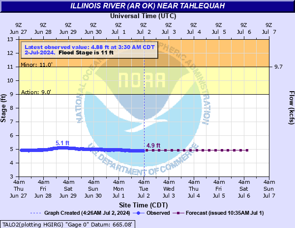
Latest Observation
Updated: 4:30 PM CST 12/15/25
Status: No Flooding
Stage: 5.12 ft
Flow: 0.364 kcfs
Forecast
| Time | Stage (ft) | Flow (kcfs) |
|---|---|---|
| 6 PM 12/15 | 5.2 | 0.403 |
| 12 AM 12/16 | 5.1 | 0.355 |
| 6 AM 12/16 | 5.1 | 0.355 |
| 12 PM 12/16 | 5.1 | 0.355 |
| 6 PM 12/16 | 5.1 | 0.355 |
| 12 AM 12/17 | 5.1 | 0.355 |
| 6 AM 12/17 | 5.1 | 0.355 |
| 12 PM 12/17 | 5.1 | 0.355 |
| 6 PM 12/17 | 5.1 | 0.355 |
| 12 AM 12/18 | 5.1 | 0.355 |
| 6 AM 12/18 | 5.1 | 0.355 |
| 12 PM 12/18 | 5.1 | 0.355 |
| 6 PM 12/18 | 5.1 | 0.355 |
| 12 AM 12/19 | 5.1 | 0.355 |
| 6 AM 12/19 | 5.1 | 0.355 |
| 12 PM 12/19 | 5.1 | 0.355 |
| 6 PM 12/19 | 5.1 | 0.355 |
| 12 AM 12/20 | 5.1 | 0.355 |
| 6 AM 12/20 | 5.1 | 0.355 |
| Time | Stage (ft) | Flow (kcfs) |
|---|---|---|
| 4:30 PM 12/15 | 5.12 | 0.364 |
| 4:00 PM 12/15 | 5.11 | 0.36 |
| 3:30 PM 12/15 | 5.11 | 0.36 |
| 3:00 PM 12/15 | 5.11 | 0.36 |
| 2:30 PM 12/15 | 5.11 | 0.36 |
| 2:00 PM 12/15 | 5.12 | 0.364 |
| 1:30 PM 12/15 | 5.11 | 0.36 |
| 1:00 PM 12/15 | 5.1 | 0.355 |
| 12:30 PM 12/15 | 5.13 | 0.369 |
| 12:00 PM 12/15 | 5.12 | 0.364 |
| 11:30 AM 12/15 | 5.12 | 0.364 |
| 11:00 AM 12/15 | 5.12 | 0.364 |
| 10:30 AM 12/15 | 5.11 | 0.36 |
| 10:00 AM 12/15 | 5.13 | 0.369 |
| 9:30 AM 12/15 | 5.13 | 0.369 |
| 9:00 AM 12/15 | 5.13 | 0.369 |
| 8:30 AM 12/15 | 5.14 | 0.374 |
| 8:00 AM 12/15 | 5.15 | 0.379 |
| 7:30 AM 12/15 | 5.14 | 0.374 |
| 7:00 AM 12/15 | 5.14 | 0.374 |
| 6:30 AM 12/15 | 5.13 | 0.369 |
| 6:00 AM 12/15 | 5.13 | 0.369 |
| 5:30 AM 12/15 | 5.12 | 0.364 |
| 5:00 AM 12/15 | 5.13 | 0.369 |
| 4:30 AM 12/15 | 5.14 | 0.374 |
| 4:00 AM 12/15 | 5.15 | 0.379 |
| 3:30 AM 12/15 | 5.15 | 0.379 |
| 3:00 AM 12/15 | 5.14 | 0.374 |
| 2:30 AM 12/15 | 5.14 | 0.374 |
| 2:00 AM 12/15 | 5.13 | 0.369 |
31' -
devastating flooding occurs along the Illinois River from near Hanging Rock to the headwaters of Lake Tenkiller. Impacts will be similar to the record flood of 30.7 feet in December 2015. State Highway 10 is closed northeast of its intersection with Highway 51. Many cabins and parks are severely flooded or are totally isolated for an extended duration. This is a very dangerous and life threatening situation.
29' -
devastating flooding occurs along the Illinois River from near Hanging Rock to the headwaters of Lake Tenkiller. State Highway 10 is closed northeast of its intersection with Highway 51. Many cabins and parks are severely flooded or are totally isolated for an extended duration. This is a very dangerous and life threatening situation. This will approach the record flood of 30.7 feet in December 2015.
27' -
devastating flooding occurs along the Illinois River from near Hanging Rock to the headwaters of Lake Tenkiller. State Highway 10 is closed northeast of its intersection with Highway 51. Many cabins and parks are severely flooded or are totally isolated for an extended duration. This is a very dangerous and life threatening situation. This will exceed the April 2011 flood of 26 feet and approach the May 1950 flood of 27.9 feet.
25' -
devastating flooding occurs along the Illinois River from near Hanging Rock to the headwaters of Lake Tenkiller. State Highway 10 is closed northeast of its intersection with Highway 51. Many cabins and parks are severely flooded or are totally isolated for an extended duration. This is a very dangerous and life threatening situation. This will approach the April 2011 flood, which reached 26 feet.
23' -
extremely severe flooding occurs along the Illinois River from near Hanging Rock to the headwaters of Lake Tenkiller. State Highway 10 is closed northeast of its intersection with Highway 62. Several cabins and parks are severely flooded and many others are isolated for an extended duration. This is a very dangerous and life threatening situation.
21' -
very severe flooding occurs from near Hanging Rock downstream towards Tahlequah. State Highway 10 is closed between Hanging Rock and No Head Hollow north of the Highway 10 intersection with Highway 62. Several cabins and parks are severely flooded and many others are isolated. This is a very dangerous and life threatening situation.
19' -
severe flooding occurs from near Hanging Rock downstream towards Tahlequah. State Highway 10 near Hanging Rock and near No Head Hollow north of the intersection with Highway 62 is impassable. Some cabins and parks are severely flooded. This is a very dangerous situation.
18' -
severe flooding occurs from near Hanging Rock downstream towards Tahlequah. Highway 10 near Hanging Rock northeast of Tahlequah is impassable. Some cabins and parks are severely flooded. This is a very dangerous situation. Extreme turbulence makes the river too hazardous for floating.
17' -
severe flooding occurs from Hanging Rock downstream towards Tahlequah. Access roads east of Combs Bridge near Eagles Bluff are impassable. Some cabins and parks may be flooded to a depth of a couple of feet. Extreme turbulence makes the river too hazardous for floating.
15' -
moderate flooding occurs from Hanging Rock downstream towards Tahlequah. Access roads east of the Combs Bridge near Eagles Bluff are impassable. Some cabins and parks may begin to flood. Extreme turbulence makes the river too hazardous for floating.
14' -
moderate flooding occurs from Hanging Rock downstream towards Tahlequah. Access roads east of the Combs Bridge near Eagles Bluff will be impassable. Extreme turbulence makes the river too hazardous for floating.
13' -
minor flooding occurs from near Hanging Rock downstream towards Tahlequah. Access roads east of the Combs Bridge near Eagles Bluff may be threatened. Extreme turbulence makes the river too hazardous for floating.
12' -
minor flooding occurs from near Hanging Rock downstream towards Tahlequah. Extreme turbulence makes the river too hazardous for floating.
11' -
minor flooding occurs from near Hanging Rock downstream towards Tahlequah. Floating the river is too hazardous due to strong turbulence.
9' -
no flooding occurs but all recreational floating along the Illinois River ceases at and above 9.5 feet.
| Date | Stage (ft) |
|---|---|
| Dec 28, 2015 | 30.69 |
| Apr 30, 2017 | 29.29 |
| May 10, 1950 | 27.94 |
| May 6, 2022 | 27.53 |
| Jan 1, 1916 | 26 |
| Apr 26, 2011 | 25.97 |
| May 11, 1943 | 25.37 |
| Apr 15, 1945 | 23.6 |
| Jun 9, 1974 | 23.02 |
| Oct 1, 1986 | 22.54 |
| Apr 1, 1927 | 22.3 |
| Mar 20, 2008 | 22.29 |
| Apr 29, 2021 | 21.83 |
| Nov 26, 1973 | 21.73 |
| Apr 4, 1957 | 21.6 |
| May 4, 1990 | 21.47 |
| May 8, 1961 | 21.38 |
| May 25, 2011 | 21.12 |
| Mar 20, 1945 | 21.12 |
| Oct 7, 2019 | 21.1 |
Data provided by the National Weather Service.