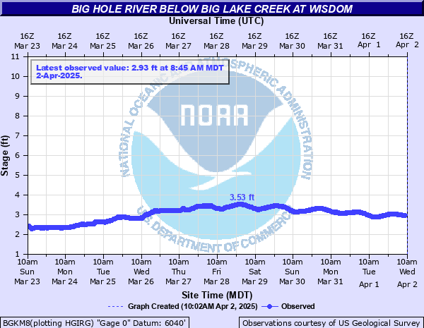
Big Hole River below Big Lake Creek at Wisdom
Critical Stages
Action
Flood
Moderate
Major
Latest Observation
Updated: 7:45 PM MST 12/9/25
Status: Not Defined
Stage: 2.46 ft
Flow: 0.116 kcfs
Forecast
Forecast not available for this location.
| Time | Stage (ft) | Flow (kcfs) |
|---|---|---|
| 7:45 PM 12/9 | 2.46 | 0.116 |
| 7:30 PM 12/9 | 2.45 | 0.114 |
| 7:15 PM 12/9 | 2.45 | 0.114 |
| 7:00 PM 12/9 | 2.45 | 0.114 |
| 6:45 PM 12/9 | 2.44 | 0.112 |
| 6:30 PM 12/9 | 2.45 | 0.114 |
| 6:15 PM 12/9 | 2.45 | 0.114 |
| 6:00 PM 12/9 | 2.44 | 0.112 |
| 5:45 PM 12/9 | 2.45 | 0.114 |
| 5:30 PM 12/9 | 2.45 | 0.114 |
| 5:15 PM 12/9 | 2.44 | 0.112 |
| 5:00 PM 12/9 | 2.44 | 0.112 |
| 4:45 PM 12/9 | 2.44 | 0.112 |
| 4:30 PM 12/9 | 2.44 | 0.112 |
| 4:15 PM 12/9 | 2.44 | 0.112 |
| 4:00 PM 12/9 | 2.44 | 0.112 |
| 3:45 PM 12/9 | 2.44 | 0.112 |
| 3:30 PM 12/9 | 2.44 | 0.112 |
| 3:15 PM 12/9 | 2.43 | 0.11 |
| 3:00 PM 12/9 | 2.43 | 0.11 |
| 2:45 PM 12/9 | 2.43 | 0.11 |
| 2:30 PM 12/9 | 2.43 | 0.11 |
| 2:15 PM 12/9 | 2.43 | 0.11 |
| 2:00 PM 12/9 | 2.43 | 0.11 |
| 1:45 PM 12/9 | 2.42 | 0.108 |
| 1:30 PM 12/9 | 2.43 | 0.11 |
| 1:15 PM 12/9 | 2.42 | 0.108 |
| 1:00 PM 12/9 | 2.42 | 0.108 |
| 12:45 PM 12/9 | 2.41 | 0.106 |
| 12:30 PM 12/9 | 2.42 | 0.108 |
8' -
Flood water reaching into northwest portions of Wisdom along Hwy 278, in vicinity of Pine and 1st St, and area on north side of intersections of 43 and 278, and 43 and Pine St.
6.8' -
6.8 Feet - June 2020 - Snowmelt from previous day. Big Hole at Melrose rose into flood stage to 6.5 feet.
| Date | Stage (ft) |
|---|---|
| Jun 18, 2020 | 6.82 |
| Jun 17, 2010 | 6.66 |
| Jun 6, 1995 | 6.37 |
| Jun 10, 2011 | 6.2 |
| Jun 9, 1997 | 6.17 |
| Jun 7, 1991 | 6.09 |
| May 19, 1996 | 5.87 |
| Apr 23, 2009 | 5.76 |
| Jun 10, 2006 | 5.59 |
| May 31, 1999 | 5.44 |
| Apr 30, 2008 | 5.44 |
| Apr 1, 2001 | 5.4 |
| Apr 28, 2012 | 5.35 |
| Jun 1, 2003 | 5.3 |
| May 24, 1998 | 5.27 |
| Jun 7, 2007 | 5.23 |
| Jun 17, 1993 | 5.08 |
| Jun 3, 2002 | 5.02 |
| Apr 23, 1994 | 4.62 |
| Jun 1, 1988 | 4.58 |
Data provided by the National Weather Service.