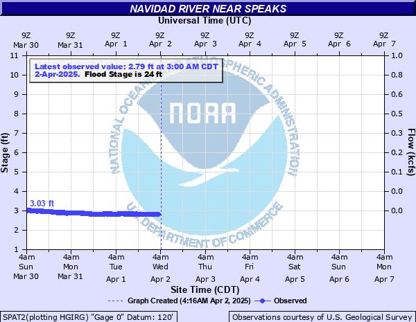
Navidad River near Speaks
Critical Stages
21' - Action
24' - Flood
27' - Moderate
29' - Major
Latest Observation
Updated: 12:00 AM CST 12/15/25
Status: No Flooding
Stage: 3.35 ft
Flow: 0.0195 kcfs
Forecast
Forecast not available for this location.
| Time | Stage (ft) | Flow (kcfs) |
|---|---|---|
| 12:00 AM 12/15 | 3.35 | 0.0195 |
| 11:45 PM 12/14 | 3.35 | 0.0195 |
| 11:30 PM 12/14 | 3.35 | 0.0195 |
| 11:15 PM 12/14 | 3.35 | 0.0195 |
| 11:00 PM 12/14 | 3.34 | 0.0192 |
| 10:45 PM 12/14 | 3.35 | 0.0195 |
| 10:30 PM 12/14 | 3.34 | 0.0192 |
| 10:15 PM 12/14 | 3.34 | 0.0192 |
| 10:00 PM 12/14 | 3.34 | 0.0192 |
| 9:45 PM 12/14 | 3.34 | 0.0192 |
| 9:30 PM 12/14 | 3.34 | 0.0192 |
| 9:15 PM 12/14 | 3.34 | 0.0192 |
| 9:00 PM 12/14 | 3.34 | 0.0192 |
| 8:45 PM 12/14 | 3.34 | 0.0192 |
| 8:30 PM 12/14 | 3.34 | 0.0192 |
| 8:15 PM 12/14 | 3.33 | 0.0189 |
| 8:00 PM 12/14 | 3.33 | 0.0189 |
| 7:45 PM 12/14 | 3.34 | 0.0192 |
| 7:30 PM 12/14 | 3.33 | 0.0189 |
| 7:15 PM 12/14 | 3.33 | 0.0189 |
| 7:00 PM 12/14 | 3.33 | 0.0189 |
| 6:45 PM 12/14 | 3.33 | 0.0189 |
| 6:30 PM 12/14 | 3.32 | 0.0186 |
| 6:15 PM 12/14 | 3.32 | 0.0186 |
| 6:00 PM 12/14 | 3.32 | 0.0186 |
| 5:45 PM 12/14 | 3.32 | 0.0186 |
| 5:30 PM 12/14 | 3.31 | 0.0183 |
| 5:15 PM 12/14 | 3.31 | 0.0183 |
| 5:00 PM 12/14 | 3.31 | 0.0183 |
| 4:45 PM 12/14 | 3.31 | 0.0183 |
33' -
Disastrous flooding occurs with the lowest homes upstream near Vienna and in the lower part of Lavaca and northern parts of Jackson counties are flooded. Flows are over one mile wide in much of the floodplain and numerous roads and bridges are impassable. Hundreds of head of livestock are cut off and can drown.
29' -
Major lowland flooding continues with the river close to one mile wide near Speaks and FM 530 cutting off large areas of the floodplain. Several roads and bridges near the river are inundated and impassable. Homes in low-lying areas of the floodplain upstream near Vienna and in the lowwer part of Lavaca County are threatened. Hundreds of head of livestock are threatened.
28' -
Major lowland flooding begins with the river several hundred yards wide in the vicinity of the gauge. Approaches to the FM 530 bridge are flooded and impassable. Much of the floodplain is cut off endangering livestock.
27' -
Moderate lowland flooding begins with the approaches to the FM 530 bridge inundated and the gage cut off. Large areas of the floodplain are cut off potentially isolated and drowning cattle.
24' -
Minor lowland flooding begins with the river one hundred yards wide in the vicinity of the gage. The approaches to the FM 530 bridge are flooded.
21' -
Flows exceed the lowest sections of both banks.
| Date | Stage (ft) |
|---|---|
| Aug 29, 2017 | 32.79 |
| Oct 18, 1998 | 30.24 |
| Apr 19, 2009 | 28.2 |
| May 14, 1982 | 27.89 |
| Jun 17, 2015 | 27.75 |
| Apr 20, 2016 | 27.73 |
| Oct 14, 1997 | 26.32 |
| Jun 8, 1997 | 25.62 |
| Nov 26, 1985 | 25.29 |
| Oct 5, 2009 | 25.03 |
| Jul 10, 2021 | 24.87 |
| Apr 20, 1985 | 24.56 |
| Jun 5, 1987 | 24.54 |
| Jun 26, 2004 | 24.2 |
| May 20, 2015 | 24 |
| Dec 9, 2018 | 23.89 |
| May 22, 1983 | 22.94 |
Data provided by the National Weather Service.