« Back to Fort Fairfield Rivers
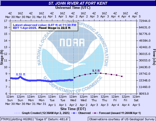
St. John River at Fort Kent
Critical Stages
18' - Action
22.5' - Flood
24.5' - Moderate
26.5' - Major
Latest Observation
Updated: 4:30 PM EST 12/15/25
Status: No Flooding
Stage: 4.84 ft
Flow: 4.54 kcfs
Forecast
| Time | Stage (ft) | Flow (kcfs) |
|---|---|---|
| 7 PM 12/15 | 3.9 | 1.81 |
| 1 AM 12/16 | 3.9 | 1.81 |
| 7 AM 12/16 | 3.9 | 1.81 |
| 1 PM 12/16 | 3.9 | 1.81 |
| 7 PM 12/16 | 3.9 | 1.81 |
| 1 AM 12/17 | 3.9 | 1.81 |
| 7 AM 12/17 | 3.9 | 1.81 |
| 1 PM 12/17 | 3.9 | 1.81 |
| 7 PM 12/17 | 3.9 | 1.81 |
| 1 AM 12/18 | 3.9 | 1.81 |
| 7 AM 12/18 | 3.9 | 1.81 |
| Time | Stage (ft) | Flow (kcfs) |
|---|---|---|
| 4:30 PM 12/15 | 4.84 | 4.54 |
| 4:15 PM 12/15 | 4.84 | 4.54 |
| 4:00 PM 12/15 | 4.84 | 4.54 |
| 3:45 PM 12/15 | 4.85 | 4.57 |
| 3:30 PM 12/15 | 4.85 | 4.57 |
| 3:15 PM 12/15 | 4.85 | 4.57 |
| 3:00 PM 12/15 | 4.85 | 4.57 |
| 2:45 PM 12/15 | 4.85 | 4.57 |
| 2:30 PM 12/15 | 4.86 | 4.61 |
| 2:15 PM 12/15 | 4.86 | 4.61 |
| 2:00 PM 12/15 | 4.86 | 4.61 |
| 1:45 PM 12/15 | 4.85 | 4.57 |
| 1:30 PM 12/15 | 4.86 | 4.61 |
| 1:15 PM 12/15 | 4.86 | 4.61 |
| 1:00 PM 12/15 | 4.85 | 4.57 |
| 12:45 PM 12/15 | 4.85 | 4.57 |
| 12:30 PM 12/15 | 4.85 | 4.57 |
| 12:15 PM 12/15 | 4.85 | 4.57 |
| 12:00 PM 12/15 | 4.85 | 4.57 |
| 11:45 AM 12/15 | 4.85 | 4.57 |
| 11:30 AM 12/15 | 4.85 | 4.57 |
| 11:15 AM 12/15 | 4.84 | 4.54 |
| 11:00 AM 12/15 | 4.84 | 4.54 |
| 10:45 AM 12/15 | 4.83 | 4.51 |
| 10:30 AM 12/15 | 4.84 | 4.54 |
| 10:15 AM 12/15 | 4.83 | 4.51 |
| 10:00 AM 12/15 | 4.83 | 4.51 |
| 9:45 AM 12/15 | 4.84 | 4.54 |
| 9:30 AM 12/15 | 4.82 | 4.48 |
| 9:15 AM 12/15 | 4.83 | 4.51 |
29.7' -
Dike along the Saint John River is overtopped, flooding downtown Fort Kent from Pearl Street to Blockhouse Road to Elm Street. Significant flooding of Residential and Commercial Structures between the Fish River to Market Street along East Main Street.
28.5' -
Dufour Street is completely impassable flooding the Fort Kent Fire Department. East Main Street is impassable west of Market Street to Aroostook Road. Backwater issues on the Fish River and Perley Brook will threaten structures along Route 161 near Perley Brook.
27.5' -
Near record flooding. Dike and levee system at full capacity. Flooding of lower east Main Street inundating several structures in the center of town. Fish River Flooding combined with Backwater causes water to flow over the Fish River bridge. Residential structures off Baker Street begin to flood. Athletic fields of the University Campus underwater.
26.5' -
Widespread flooding of lower East Main Street inundating several structures in the center of town. Water flowing over the top of the Fish River bridge.
25.5' -
Fish River nears the top of the Main Street Fish River bridge, bridge closed. Homes threatened on Meadow Lane, Blockhouse Road, Dufour Street and Church Street.
24.5' -
Fish River Backwater begins to flood parking lots to businesses & residences between East Main Street and the Fish River. Flooding in low lying areas along State Route 161 upstream of Fort Kent.
22.5' -
Lumber Yard near Fort Kent State Historic Site floods. Flood waters encroach on the State Historic Site.
20' -
Lowland flooding between East Main Street, Market Street and the University Campus.
18' -
Water begins to get into the basements of some houses and structures upstream along the Fish River.
16' -
Water inundates agricultural lands between Fort Kent and Upper Frenchville along Route 1.
| Date | Stage (ft) |
|---|---|
| Apr 30, 2008 | 30.07 |
| Apr 30, 1979 | 27.31 |
| May 1, 1974 | 26.95 |
| Apr 17, 1994 | 26.6 |
| Apr 19, 1983 | 26.33 |
| Apr 30, 1973 | 25.76 |
| May 16, 1961 | 25.3 |
| May 11, 1969 | 25.11 |
| May 5, 1933 | 25.1 |
| Apr 26, 1958 | 24.55 |
| May 11, 1939 | 24.53 |
| May 5, 1942 | 24.04 |
| Apr 26, 2005 | 23.89 |
| Apr 2, 1998 | 23.88 |
| Apr 23, 2019 | 23.39 |
| Apr 11, 1991 | 23.27 |
| Apr 27, 1983 | 23.25 |
| May 1, 2018 | 22.51 |
| May 9, 1947 | 21.65 |
| Apr 2, 1987 | 21.44 |
Data provided by the National Weather Service.