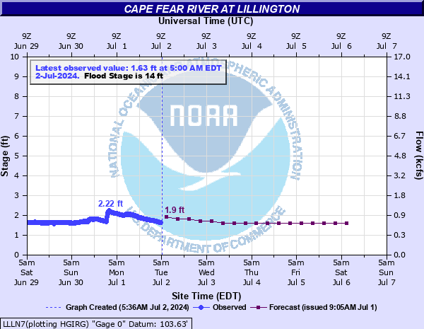
Cape Fear River at Lillington
Critical Stages
13' - Action
14' - Flood
19' - Moderate
27' - Major
Latest Observation
Updated: 12:28 AM EST 12/15/25
Status: No Flooding
Stage: 1.42 ft
Flow: 0.578 kcfs
Forecast
| Time | Stage (ft) | Flow (kcfs) |
|---|---|---|
| 7 AM 12/15 | 1.4 | 0.566 |
| 1 PM 12/15 | 1.4 | 0.566 |
| 7 PM 12/15 | 1.3 | 0.507 |
| 1 AM 12/16 | 1.3 | 0.507 |
| 7 AM 12/16 | 1.2 | 0.45 |
| 1 PM 12/16 | 1.2 | 0.45 |
| 7 PM 12/16 | 1.2 | 0.45 |
| 1 AM 12/17 | 1.2 | 0.45 |
| 7 AM 12/17 | 1.1 | 0.396 |
| 1 PM 12/17 | 1.1 | 0.396 |
| 7 PM 12/17 | 1.1 | 0.396 |
| 1 AM 12/18 | 1.1 | 0.396 |
| 7 AM 12/18 | 1.1 | 0.396 |
| 1 PM 12/18 | 1.1 | 0.396 |
| 7 PM 12/18 | 1.1 | 0.396 |
| 1 AM 12/19 | 1.1 | 0.396 |
| 7 AM 12/19 | 1.1 | 0.396 |
| Time | Stage (ft) | Flow (kcfs) |
|---|---|---|
| 12:28 AM 12/15 | 1.42 | 0.578 |
| 12:13 AM 12/15 | 1.42 | 0.578 |
| 11:58 PM 12/14 | 1.42 | 0.578 |
| 11:43 PM 12/14 | 1.46 | 0.603 |
| 11:28 PM 12/14 | 1.43 | 0.584 |
| 11:13 PM 12/14 | 1.42 | 0.578 |
| 10:58 PM 12/14 | 1.43 | 0.584 |
| 10:43 PM 12/14 | 1.43 | 0.584 |
| 10:28 PM 12/14 | 1.42 | 0.578 |
| 10:13 PM 12/14 | 1.44 | 0.591 |
| 9:58 PM 12/14 | 1.43 | 0.584 |
| 9:43 PM 12/14 | 1.45 | 0.597 |
| 9:28 PM 12/14 | 1.42 | 0.578 |
| 9:13 PM 12/14 | 1.49 | 0.622 |
| 8:58 PM 12/14 | 1.46 | 0.603 |
| 8:43 PM 12/14 | 1.45 | 0.597 |
| 8:28 PM 12/14 | 1.49 | 0.622 |
| 8:13 PM 12/14 | 1.46 | 0.603 |
| 7:58 PM 12/14 | 1.47 | 0.609 |
| 7:43 PM 12/14 | 1.46 | 0.603 |
| 7:28 PM 12/14 | 1.47 | 0.609 |
| 7:13 PM 12/14 | 1.49 | 0.622 |
| 6:58 PM 12/14 | 1.48 | 0.615 |
| 6:43 PM 12/14 | 1.45 | 0.597 |
| 6:28 PM 12/14 | 1.45 | 0.597 |
| 6:13 PM 12/14 | 1.46 | 0.603 |
| 5:58 PM 12/14 | 1.42 | 0.578 |
| 5:43 PM 12/14 | 1.44 | 0.591 |
| 5:28 PM 12/14 | 1.43 | 0.584 |
| 5:13 PM 12/14 | 1.47 | 0.609 |
34' -
Water reaches the road surface of the northbound 421 bridge.
30' -
Water reaches the base of the northbound Highway 421 bridge.
27' -
Major flooding begins. Flooding reaches Mermaid Point Restaurant on the south bank.
19' -
Moderate flooding begins. The storm drains on the north bank are inundated and water reaches the water treatment plant. Homes on Riverside Hills Drive are flooded.
17' -
Water threatens homes upstream on Riverside Hills Drive.
14' -
Minor flooding begins. The boat launch ramp and wooden deck at Mermaid Point Restaurant are flooded.
13' -
Action stage. The Cape Fear River reaches bankfull.
| Date | Stage (ft) |
|---|---|
| Sep 19, 1945 | 33.19 |
| Oct 2, 1929 | 27.55 |
| Sep 18, 2018 | 21.27 |
| Oct 9, 2016 | 19.41 |
| Sep 7, 1996 | 18.97 |
| Nov 14, 2018 | 17.98 |
| Aug 9, 2024 | 15.85 |
| Mar 1, 1987 | 15.59 |
| Nov 16, 2018 | 15.56 |
| Jun 14, 2006 | 14.6 |
| Jul 24, 1997 | 14.26 |
| Feb 9, 2020 | 13.61 |
| Oct 12, 2018 | 10.01 |
Data provided by the National Weather Service.