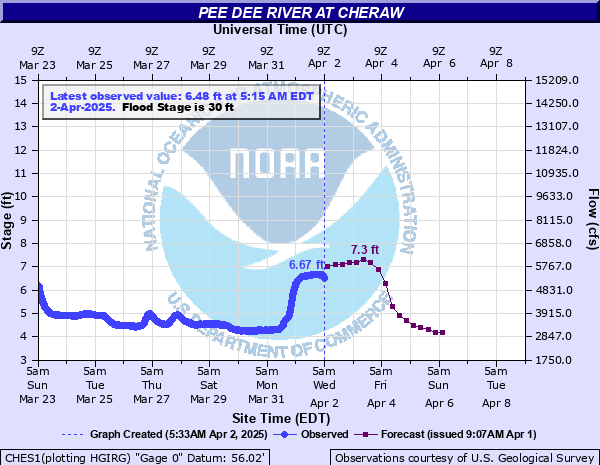
Pee Dee River at Cheraw
Critical Stages
20' - Action
30' - Flood
36' - Moderate
42' - Major
Latest Observation
Updated: 6:15 PM EST 12/15/25
Status: No Flooding
Stage: 7.11 ft
Flow: 5.88 kcfs
Forecast
| Time | Stage (ft) | Flow (kcfs) |
|---|---|---|
| 7 PM 12/15 | 7.1 | 5.87 |
| 1 AM 12/16 | 7.9 | 6.74 |
| 7 AM 12/16 | 8.2 | 7.1 |
| 1 PM 12/16 | 8.3 | 7.23 |
| 7 PM 12/16 | 8.3 | 7.23 |
| 1 AM 12/17 | 7.9 | 6.74 |
| 7 AM 12/17 | 6.6 | 5.35 |
| 1 PM 12/17 | 4.7 | 3.59 |
| 7 PM 12/17 | 3.7 | 2.5 |
| 1 AM 12/18 | 3.4 | 2.16 |
| 7 AM 12/18 | 3.3 | 2.06 |
| 1 PM 12/18 | 3.3 | 2.06 |
| 7 PM 12/18 | 3.2 | 1.95 |
| 1 AM 12/19 | 3.2 | 1.95 |
| 7 AM 12/19 | 3.2 | 1.95 |
| 1 PM 12/19 | 3.2 | 1.95 |
| 7 PM 12/19 | 3.2 | 1.95 |
| 1 AM 12/20 | 3.2 | 1.95 |
| 7 AM 12/20 | 3.2 | 1.95 |
| Time | Stage (ft) | Flow (kcfs) |
|---|---|---|
| 6:15 PM 12/15 | 7.11 | 5.88 |
| 6:00 PM 12/15 | 7.05 | 5.82 |
| 5:45 PM 12/15 | 6.98 | 5.75 |
| 5:30 PM 12/15 | 6.91 | 5.67 |
| 5:15 PM 12/15 | 6.84 | 5.6 |
| 5:00 PM 12/15 | 6.75 | 5.51 |
| 4:45 PM 12/15 | 6.65 | 5.4 |
| 4:30 PM 12/15 | 6.54 | 5.3 |
| 4:15 PM 12/15 | 6.45 | 5.22 |
| 4:00 PM 12/15 | 6.3 | 5.09 |
| 3:45 PM 12/15 | 6.17 | 4.98 |
| 3:30 PM 12/15 | 5.99 | 4.82 |
| 3:15 PM 12/15 | 5.82 | 4.67 |
| 3:00 PM 12/15 | 5.6 | 4.48 |
| 2:45 PM 12/15 | 5.38 | 4.29 |
| 2:30 PM 12/15 | 5.13 | 4.06 |
| 2:15 PM 12/15 | 4.87 | 3.77 |
| 2:00 PM 12/15 | 4.61 | 3.5 |
| 1:45 PM 12/15 | 4.35 | 3.23 |
| 1:30 PM 12/15 | 4.11 | 2.98 |
| 1:15 PM 12/15 | 3.9 | 2.73 |
| 1:00 PM 12/15 | 3.77 | 2.58 |
| 12:45 PM 12/15 | 3.66 | 2.45 |
| 12:30 PM 12/15 | 3.6 | 2.38 |
| 12:15 PM 12/15 | 3.56 | 2.34 |
| 12:00 PM 12/15 | 3.52 | 2.29 |
| 11:45 AM 12/15 | 3.53 | 2.3 |
| 11:30 AM 12/15 | 3.52 | 2.29 |
| 11:15 AM 12/15 | 3.52 | 2.29 |
| 11:00 AM 12/15 | 3.52 | 2.29 |
55' -
Extensive damage occurs in small communities downstream from Cheraw.
50' -
Extensive flooding of farmland around and downstream from Cheraw is expected.
42' -
Secondary roads downstream from Cheraw begin to flood.
40' -
Potential loss of livestock and farm equipment in river bottomland near Cheraw is possible.
36' -
Extensive overflow of the left bank will occur and large areas of farmland near Cheraw will be flooded. Livestock and farm equipment should be moved to higher ground.
35' -
Southeast of Wallace, Old River Road between Community Road and Highway 912 will become flooded and may need to be closed.
33' -
Southeast of Wallace, water spreads onto Old River Road between Community Road and Highway 912.
30' -
The higher bank begins to flood. Large areas of farmland and river bottomland near Cheraw will be flooded. Portions of Riverside Park become flooded.
20' -
River bottomland downstream from cheraw will begin to flood.
| Date | Stage (ft) |
|---|---|
| Sep 19, 1945 | 50.4 |
| Aug 27, 1908 | 47.2 |
| Sep 18, 2018 | 46.6 |
| Jan 1, 1864 | 45.5 |
| Sep 20, 1928 | 44.9 |
| Apr 12, 2003 | 43 |
| Apr 8, 1936 | 42.8 |
| Oct 4, 1929 | 42.7 |
| Feb 8, 2020 | 42.5 |
| Feb 27, 1979 | 42.44 |
| Mar 17, 1912 | 42.4 |
| Apr 2, 1973 | 42.32 |
| Mar 23, 2003 | 42.1 |
| Mar 3, 1987 | 41.75 |
| May 23, 2020 | 41.74 |
| Mar 16, 1975 | 41.72 |
| Oct 4, 1989 | 41.7 |
| Nov 15, 2020 | 41.44 |
| Nov 24, 2006 | 41.4 |
| Mar 5, 1952 | 41.34 |
Data provided by the National Weather Service.