« Back to Franconia Ridge Trail Rivers
East Branch of the Passumpsic River at East Haven
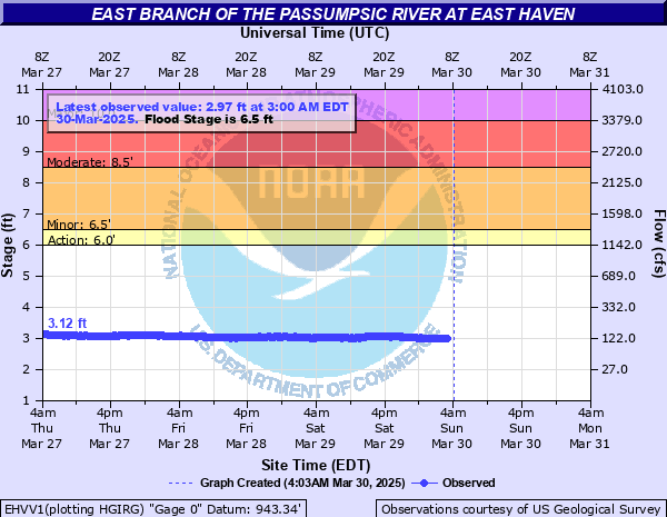
Critical Stages
6' - Action
6.5' - Flood
8.5' - Moderate
10' - Major
Latest Observation
Updated: 1:00 PM EST 12/10/25
Status: No Flooding
Stage: 2.38 ft
Flow: 0.0355 kcfs
Forecast
Forecast not available for this location.
| Time | Stage (ft) | Flow (kcfs) |
|---|---|---|
| 1:00 PM 12/10 | 2.38 | 0.0355 |
| 12:45 PM 12/10 | 2.37 | 0.0348 |
| 12:30 PM 12/10 | 2.38 | 0.0355 |
| 12:15 PM 12/10 | 2.38 | 0.0355 |
| 12:00 PM 12/10 | 2.39 | 0.0362 |
| 11:45 AM 12/10 | 2.39 | 0.0362 |
| 11:30 AM 12/10 | 2.39 | 0.0362 |
| 11:15 AM 12/10 | 2.39 | 0.0362 |
| 11:00 AM 12/10 | 2.39 | 0.0362 |
| 10:45 AM 12/10 | 2.4 | 0.037 |
| 10:30 AM 12/10 | 2.4 | 0.037 |
| 10:15 AM 12/10 | 2.4 | 0.037 |
| 10:00 AM 12/10 | 2.41 | 0.0377 |
| 9:45 AM 12/10 | 2.41 | 0.0377 |
| 9:30 AM 12/10 | 2.41 | 0.0377 |
| 9:15 AM 12/10 | 2.42 | 0.0385 |
| 9:00 AM 12/10 | 2.42 | 0.0385 |
| 8:45 AM 12/10 | 2.42 | 0.0385 |
| 8:30 AM 12/10 | 2.43 | 0.0393 |
| 8:15 AM 12/10 | 2.43 | 0.0393 |
| 8:00 AM 12/10 | 2.43 | 0.0393 |
| 7:45 AM 12/10 | 2.43 | 0.0393 |
| 7:30 AM 12/10 | 2.43 | 0.0393 |
| 7:15 AM 12/10 | 2.43 | 0.0393 |
| 7:00 AM 12/10 | 2.44 | 0.0401 |
| 6:45 AM 12/10 | 2.44 | 0.0401 |
| 6:30 AM 12/10 | 2.44 | 0.0401 |
| 6:15 AM 12/10 | 2.44 | 0.0401 |
| 6:00 AM 12/10 | 2.45 | 0.0554 |
| 5:45 AM 12/10 | 2.45 | 0.0554 |
10' -
Widespread flooding will occur downstream in Lyndonville and Saint Johnsbury Center. Homes and businesses on Route 5 along the Passumpsic from Lyndonville to Saint Johnsbury will be inundated. Flooding will be similar to Irene in August 2011 and most recently in July 2024. The river gauge at Passumpsic, Vermont downstream will exceed flood stage by several feet.
8.5' -
The Northeast Kingdom Mobile Home Park on Route 114 in Lyndonville will flood & evacuations may be necessary. Flooding of roads and bridges on portions of Routes 122, 114, & 5 will occur, & Stevens Loop Rd in Lyndonville will flood. Portions of Route 5 downstream between Lyndonville and Saint Johnsbury Center may flood at this stage. The river gauge downstream at Passumpsic, Vermont may exceed flood stage if precipitation widespread throughout basin.
7.5' -
Water covers Routes 114, 122, & 5, Stevens Loop Road on the north side of Lyndonville and widespread field flooding will occur. Water may threaten the Northeast Kingdom Mobile Home Park, but the flood control berm near the trailer park may protect it. At this stage Route 5 between Lyndonville and St. Johnsbury Center usually will not flood. The river at Passumpsic, Vermont downstream may reach flood stage if precipitation is widespread throughout basin.
6.5' -
Flooding begins downstream on the north side of Lyndonville. Low lying fields flood, and water will begin to threaten Northeast Kingdom Mobile Home Park on route 114. A berm has been built to protect the trailer park at minor flood stage. Water may approach low lying areas of Routes 5, 114, 122, and Stevens Loop Road north of Lyndonville.
6' -
Field flooding occurs north of Lyndonville near the confluence of the East and West Branches of the Passumpsic, and Miller Run. Water flowing out of the ungaged Miller Run or West Branch of the Passumpsic may cause minor road flooding on the north side of Lyndonville when none is indicated by the East Branch gage, especially if Miller Run and West Branch basins receive more rainfall.
| Date | Stage (ft) |
|---|---|
| Nov 4, 1927 | 12.6 |
| Jun 30, 1973 | 11.45 |
| Jun 12, 2002 | 10.65 |
| Jul 11, 2024 | 10.65 |
| Aug 29, 2011 | 9.76 |
| Apr 27, 2011 | 9.09 |
| Apr 16, 2014 | 8.93 |
| Dec 18, 2000 | 8.47 |
| Dec 18, 2023 | 8.46 |
| May 11, 2000 | 8.36 |
| Aug 4, 2010 | 8.31 |
| Apr 20, 2019 | 8.2 |
| Dec 21, 1973 | 8.18 |
| Oct 1, 2010 | 7.9 |
| Apr 1, 1976 | 7.62 |
| Apr 24, 2001 | 7.49 |
| Mar 31, 1998 | 7.38 |
| Aug 17, 1977 | 7.36 |
| Sep 17, 1999 | 7.28 |
| Apr 20, 2013 | 7.24 |
Data provided by the National Weather Service.