« Back to Franconia Ridge Trail Rivers
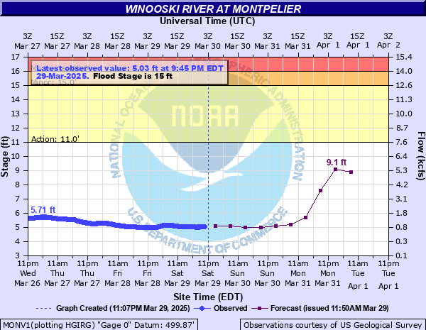
Winooski River at Montpelier
Critical Stages
11' - Action
15' - Flood
16' - Moderate
17.5' - Major
Latest Observation
Updated: 12:45 PM EST 12/10/25
Status: No Flooding
Stage: 4.27 ft
Flow: 0.425 kcfs
Forecast
| Time | Stage (ft) | Flow (kcfs) |
|---|---|---|
| 7 PM 12/10 | 3.8 | 0.237 |
| 1 AM 12/11 | 3.8 | 0.237 |
| 7 AM 12/11 | 3.7 | 0.205 |
| 1 PM 12/11 | 3.7 | 0.205 |
| 7 PM 12/11 | 3.7 | 0.205 |
| 1 AM 12/12 | 3.7 | 0.205 |
| 7 AM 12/12 | 3.7 | 0.205 |
| 1 PM 12/12 | 3.7 | 0.205 |
| 7 PM 12/12 | 3.7 | 0.205 |
| 1 AM 12/13 | 3.7 | 0.205 |
| 7 AM 12/13 | 3.7 | 0.205 |
| Time | Stage (ft) | Flow (kcfs) |
|---|---|---|
| 12:45 PM 12/10 | 4.27 | 0.425 |
| 12:30 PM 12/10 | 4.26 | 0.421 |
| 12:15 PM 12/10 | 4.26 | 0.421 |
| 12:00 PM 12/10 | 4.25 | 0.416 |
| 11:45 AM 12/10 | 4.24 | 0.411 |
| 11:30 AM 12/10 | 4.24 | 0.411 |
| 11:15 AM 12/10 | 4.23 | 0.407 |
| 11:00 AM 12/10 | 4.23 | 0.407 |
| 10:45 AM 12/10 | 4.23 | 0.407 |
| 10:30 AM 12/10 | 4.22 | 0.402 |
| 10:15 AM 12/10 | 4.21 | 0.398 |
| 10:00 AM 12/10 | 4.2 | 0.393 |
| 9:45 AM 12/10 | 4.19 | 0.389 |
| 9:30 AM 12/10 | 4.18 | 0.384 |
| 9:15 AM 12/10 | 4.17 | 0.38 |
| 9:00 AM 12/10 | 4.17 | 0.38 |
| 8:45 AM 12/10 | 4.16 | 0.375 |
| 8:30 AM 12/10 | 4.15 | 0.371 |
| 8:15 AM 12/10 | 4.15 | 0.371 |
| 8:00 AM 12/10 | 4.15 | 0.371 |
| 7:45 AM 12/10 | 4.15 | 0.371 |
| 7:30 AM 12/10 | 4.16 | 0.375 |
| 7:15 AM 12/10 | 4.16 | 0.375 |
| 7:00 AM 12/10 | 4.17 | 0.38 |
| 6:45 AM 12/10 | 4.17 | 0.38 |
| 6:30 AM 12/10 | 4.17 | 0.38 |
| 6:15 AM 12/10 | 4.17 | 0.38 |
| 6:00 AM 12/10 | 4.17 | 0.38 |
| 5:45 AM 12/10 | 4.17 | 0.38 |
| 5:30 AM 12/10 | 4.17 | 0.38 |
27' -
The Montpelier business district will be covered by water 8 to 10 feet deep. Widespread flooding of the Winooski valley will occur.
22' -
Downtown Montpelier will be inundated, and local roads will be covered by water. Route 2 and railroad tracks along the river will be covered with water. There will be widespread field flooding throughout the Winooski River valley. This stage is equivalent to the FEMA 1 Percent Annual Chance Flood.
17.5' -
Water covers the streets in downtown Montpelier. Local roads along the Winooski from Montpelier to Waterbury will be covered in water, and there will be widespread field flooding.
16' -
Route 2 will flood at Bailey Avenue bridge, and the entrance to the Montpelier High School. Parking lots behind state office buildings next to the river will flood between Taylor Street and Bailey Avenue, and the approach to Taylor Street bridge will be inundated. Low lying fields and farmland will be inundated.
15' -
Flooding will begin on State Street at the Bailey Avenue bridge. Flooding may occur along Route 302 between Montpelier and Barre. Downstream from Montpelier to Waterbury, low lying local roads and farmland will flood. Water will approach the State of Vermont office complex in Waterbury.
| Date | Stage (ft) |
|---|---|
| Nov 3, 1927 | 27.1 |
| Jul 11, 2023 | 21.29 |
| Aug 29, 2011 | 19.05 |
| May 27, 2011 | 17.59 |
| Jun 30, 1973 | 17.55 |
| Apr 7, 1912 | 17.31 |
| Feb 25, 1915 | 16.6 |
| Mar 18, 1936 | 16.57 |
| Dec 18, 2023 | 16.15 |
| Mar 11, 1992 | 15.7 |
| Apr 1, 1976 | 14.97 |
| Jan 10, 1935 | 14.89 |
| Apr 12, 1922 | 14.77 |
| Jan 19, 1996 | 14.64 |
| Mar 28, 1919 | 14.63 |
| Mar 27, 1913 | 14.6 |
| Jul 11, 2024 | 14.45 |
| Aug 5, 1989 | 14.4 |
| Apr 18, 1933 | 14.24 |
| Feb 12, 1981 | 14.16 |
Data provided by the National Weather Service.