« Back to Franconia Ridge Trail Rivers
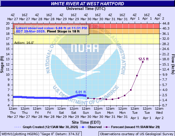
White River at West Hartford
Critical Stages
16' - Action
18' - Flood
19' - Moderate
21' - Major
Latest Observation
Updated: 1:30 PM EST 12/10/25
Status: No Flooding
Stage: 3.76 ft
Flow: 0.502 kcfs
Forecast
| Time | Stage (ft) | Flow (kcfs) |
|---|---|---|
| 7 PM 12/10 | 3.8 | 0.523 |
| 1 AM 12/11 | 3.8 | 0.523 |
| 7 AM 12/11 | 3.8 | 0.523 |
| 1 PM 12/11 | 3.8 | 0.523 |
| 7 PM 12/11 | 3.8 | 0.523 |
| 1 AM 12/12 | 3.8 | 0.523 |
| 7 AM 12/12 | 3.8 | 0.523 |
| 1 PM 12/12 | 3.8 | 0.523 |
| 7 PM 12/12 | 3.8 | 0.523 |
| 1 AM 12/13 | 3.8 | 0.523 |
| 7 AM 12/13 | 3.8 | 0.523 |
| Time | Stage (ft) | Flow (kcfs) |
|---|---|---|
| 1:30 PM 12/10 | 3.76 | 0.502 |
| 1:15 PM 12/10 | 3.74 | 0.491 |
| 1:00 PM 12/10 | 3.73 | 0.486 |
| 12:45 PM 12/10 | 3.72 | 0.481 |
| 12:30 PM 12/10 | 3.7 | 0.471 |
| 12:15 PM 12/10 | 3.7 | 0.471 |
| 12:00 PM 12/10 | 3.69 | 0.466 |
| 11:45 AM 12/10 | 3.68 | 0.461 |
| 11:30 AM 12/10 | 3.67 | 0.456 |
| 11:15 AM 12/10 | 3.66 | 0.451 |
| 11:00 AM 12/10 | 3.64 | 0.441 |
| 10:45 AM 12/10 | 3.63 | 0.436 |
| 10:30 AM 12/10 | 3.62 | 0.431 |
| 10:15 AM 12/10 | 3.62 | 0.431 |
| 10:00 AM 12/10 | 3.61 | 0.427 |
| 9:45 AM 12/10 | 3.61 | 0.427 |
| 9:30 AM 12/10 | 3.6 | 0.422 |
| 9:15 AM 12/10 | 3.59 | 0.417 |
| 9:00 AM 12/10 | 3.58 | 0.412 |
| 8:45 AM 12/10 | 3.56 | 0.403 |
| 8:30 AM 12/10 | 3.55 | 0.398 |
| 8:15 AM 12/10 | 3.53 | 0.389 |
| 8:00 AM 12/10 | 3.52 | 0.385 |
| 7:45 AM 12/10 | 3.51 | 0.38 |
| 7:30 AM 12/10 | 3.5 | 0.376 |
| 7:15 AM 12/10 | 3.48 | 0.367 |
| 7:00 AM 12/10 | 3.47 | 0.362 |
| 6:45 AM 12/10 | 3.46 | 0.358 |
| 6:30 AM 12/10 | 3.44 | 0.349 |
| 6:15 AM 12/10 | 3.43 | 0.345 |
28' -
This is an extremely dangerous situation and will equal Irene in 2011 and the 1927 flood. If you live, work, or travel near the White river evacuate uphill now! The White River will cover the entire valley in some areas, and there will be widespread, devastating damage. Homes and businesses near the river will be inundated and some may be swept off their foundations. Portions of Routes 14 and 107 will be covered and will be damaged or destroyed.
25' -
There will be widespread inundation and damage to buildings and roads throughout the White River Valley. The force of water will inundate roads and highways along the river, and will likely wash away sections of roadway. Homes and businesses will be inundated by water and may sustain structural damage. This stage is equivalent to the FEMA 0.2 Percent Annual Chance Flood.
21' -
Route 14 will be flooded in several locations, and water will inundate homes and businesses near the river. There will be widespread flooding of fields and lowlands throughout the White River Valley. This stage is equivalent to the FEMA 1 Percent Annual Chance Flood.
19' -
Floodwaters will approach homes and businesses near the river, and Route 14 will be inundated. There will be widespread flooding of fields and lowlands through the White River Valley.
18' -
Route 14 west of West Hartford will be flooded, and there will be widespread field flooding in the White River valley.
| Date | Stage (ft) |
|---|---|
| Nov 4, 1927 | 29.3 |
| Aug 29, 2011 | 28.36 |
| Sep 22, 1938 | 19.26 |
| Jun 30, 1973 | 19.13 |
| Mar 18, 1936 | 18.89 |
| Jul 11, 2023 | 18.87 |
| Jan 25, 1999 | 17.67 |
| Jun 27, 1998 | 17.38 |
| Apr 1, 1976 | 17.34 |
| Apr 12, 1922 | 17.1 |
| Apr 1, 1987 | 16.95 |
| Jun 3, 1947 | 16.6 |
| Dec 31, 1948 | 16.58 |
| Jan 22, 1959 | 16.37 |
| Mar 29, 1925 | 16.25 |
| Dec 18, 2023 | 16.17 |
| Jun 1, 1952 | 16.11 |
| Dec 18, 2000 | 16.04 |
| Mar 28, 1919 | 16 |
| Apr 14, 2019 | 15.66 |
Data provided by the National Weather Service.