« Back to Fredericksburg Rivers
Guadalupe River at Comfort
Critical Stages
10' - Action
21' - Flood
26' - Moderate
28' - Major
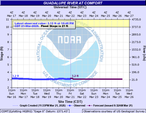
Latest Observation
Updated: 5:35 PM CST 12/4/25
Status: No Flooding
Stage: 2.91 ft
Flow: 0.0522 kcfs
Forecast
| Time | Stage (ft) | Flow (kcfs) |
|---|---|---|
| 7 PM 12/4 | 2.9 | 0.051 |
| 8 PM 12/4 | 2.9 | 0.051 |
| 9 PM 12/4 | 2.9 | 0.051 |
| 10 PM 12/4 | 2.9 | 0.051 |
| 11 PM 12/4 | 2.9 | 0.051 |
| 12 AM 12/5 | 2.9 | 0.051 |
| 1 AM 12/5 | 2.9 | 0.051 |
| 2 AM 12/5 | 2.9 | 0.051 |
| 3 AM 12/5 | 2.9 | 0.051 |
| 4 AM 12/5 | 2.9 | 0.051 |
| 5 AM 12/5 | 2.9 | 0.051 |
| 6 AM 12/5 | 2.9 | 0.051 |
| 7 AM 12/5 | 2.9 | 0.051 |
| 8 AM 12/5 | 2.9 | 0.051 |
| 9 AM 12/5 | 2.9 | 0.051 |
| 10 AM 12/5 | 2.9 | 0.051 |
| 11 AM 12/5 | 2.9 | 0.051 |
| 12 PM 12/5 | 2.9 | 0.051 |
| 1 PM 12/5 | 2.9 | 0.051 |
| 2 PM 12/5 | 2.9 | 0.051 |
| 3 PM 12/5 | 2.9 | 0.051 |
| 4 PM 12/5 | 2.9 | 0.051 |
| 5 PM 12/5 | 2.9 | 0.051 |
| 6 PM 12/5 | 2.9 | 0.051 |
| 7 PM 12/5 | 2.9 | 0.051 |
| 8 PM 12/5 | 2.9 | 0.051 |
| 9 PM 12/5 | 2.9 | 0.051 |
| 10 PM 12/5 | 2.9 | 0.051 |
| 11 PM 12/5 | 2.9 | 0.051 |
| 12 AM 12/6 | 2.9 | 0.051 |
| 1 AM 12/6 | 2.9 | 0.051 |
| 2 AM 12/6 | 2.9 | 0.051 |
| 3 AM 12/6 | 2.9 | 0.051 |
| 4 AM 12/6 | 2.9 | 0.051 |
| 5 AM 12/6 | 2.9 | 0.051 |
| 6 AM 12/6 | 2.9 | 0.051 |
| 7 AM 12/6 | 2.9 | 0.051 |
| 8 AM 12/6 | 2.9 | 0.051 |
| 9 AM 12/6 | 2.9 | 0.051 |
| 10 AM 12/6 | 2.9 | 0.051 |
| 11 AM 12/6 | 2.9 | 0.051 |
| 12 PM 12/6 | 2.9 | 0.051 |
| 1 PM 12/6 | 2.9 | 0.051 |
| 2 PM 12/6 | 2.9 | 0.051 |
| 3 PM 12/6 | 2.9 | 0.051 |
| 4 PM 12/6 | 2.9 | 0.051 |
| 5 PM 12/6 | 2.9 | 0.051 |
| 6 PM 12/6 | 2.9 | 0.051 |
| 7 PM 12/6 | 2.9 | 0.051 |
| 8 PM 12/6 | 2.9 | 0.051 |
| 9 PM 12/6 | 3 | 0.064 |
| 10 PM 12/6 | 3 | 0.064 |
| 11 PM 12/6 | 3 | 0.064 |
| 12 AM 12/7 | 3 | 0.064 |
| 1 AM 12/7 | 3 | 0.064 |
| 2 AM 12/7 | 3 | 0.064 |
| 3 AM 12/7 | 3 | 0.064 |
| 4 AM 12/7 | 3 | 0.064 |
| 5 AM 12/7 | 3 | 0.064 |
| 6 AM 12/7 | 3 | 0.064 |
| 7 AM 12/7 | 3 | 0.064 |
| 8 AM 12/7 | 3 | 0.064 |
| 9 AM 12/7 | 3 | 0.064 |
| 10 AM 12/7 | 3 | 0.064 |
| 11 AM 12/7 | 3 | 0.064 |
| 12 PM 12/7 | 3 | 0.064 |
| 1 PM 12/7 | 3 | 0.064 |
| 2 PM 12/7 | 3 | 0.064 |
| 3 PM 12/7 | 3 | 0.064 |
| 4 PM 12/7 | 3 | 0.064 |
| 5 PM 12/7 | 3 | 0.064 |
| 6 PM 12/7 | 3 | 0.064 |
| 7 PM 12/7 | 3 | 0.064 |
| 8 PM 12/7 | 3 | 0.064 |
| 9 PM 12/7 | 3 | 0.064 |
| 10 PM 12/7 | 3 | 0.064 |
| 11 PM 12/7 | 3 | 0.064 |
| 12 AM 12/8 | 3 | 0.064 |
| 1 AM 12/8 | 3 | 0.064 |
| 2 AM 12/8 | 3 | 0.064 |
| 3 AM 12/8 | 3 | 0.064 |
| 4 AM 12/8 | 3 | 0.064 |
| 5 AM 12/8 | 3 | 0.064 |
| 6 AM 12/8 | 3 | 0.064 |
| 7 AM 12/8 | 3 | 0.064 |
| 8 AM 12/8 | 3 | 0.064 |
| 9 AM 12/8 | 3 | 0.064 |
| 10 AM 12/8 | 3 | 0.064 |
| 11 AM 12/8 | 3 | 0.064 |
| 12 PM 12/8 | 3 | 0.064 |
| 1 PM 12/8 | 3 | 0.064 |
| 2 PM 12/8 | 3 | 0.064 |
| 3 PM 12/8 | 3 | 0.064 |
| 4 PM 12/8 | 3 | 0.064 |
| 5 PM 12/8 | 3 | 0.064 |
| 6 PM 12/8 | 3 | 0.064 |
| 7 PM 12/8 | 3 | 0.064 |
| 8 PM 12/8 | 3 | 0.064 |
| 9 PM 12/8 | 3 | 0.064 |
| 10 PM 12/8 | 3 | 0.064 |
| 11 PM 12/8 | 3 | 0.064 |
| 12 AM 12/9 | 3 | 0.064 |
| 1 AM 12/9 | 3 | 0.064 |
| 2 AM 12/9 | 3 | 0.064 |
| 3 AM 12/9 | 3 | 0.064 |
| 4 AM 12/9 | 3 | 0.064 |
| 5 AM 12/9 | 3 | 0.064 |
| 6 AM 12/9 | 3 | 0.064 |
| 7 AM 12/9 | 3 | 0.064 |
| 8 AM 12/9 | 3 | 0.064 |
| Time | Stage (ft) | Flow (kcfs) |
|---|---|---|
| 5:50 PM 12/4 | 2.91 | 0.0522 |
| 5:45 PM 12/4 | 2.9 | 0.051 |
| 5:40 PM 12/4 | 2.9 | 0.051 |
| 5:35 PM 12/4 | 2.91 | 0.0522 |
| 5:30 PM 12/4 | 2.9 | 0.051 |
| 5:25 PM 12/4 | 2.9 | 0.051 |
| 5:20 PM 12/4 | 2.9 | 0.051 |
| 5:15 PM 12/4 | 2.9 | 0.051 |
| 5:10 PM 12/4 | 2.9 | 0.051 |
| 5:05 PM 12/4 | 2.91 | 0.0522 |
| 5:00 PM 12/4 | 2.89 | 0.0497 |
| 4:55 PM 12/4 | 2.9 | 0.051 |
| 4:50 PM 12/4 | 2.9 | 0.051 |
| 4:45 PM 12/4 | 2.9 | 0.051 |
| 4:40 PM 12/4 | 2.9 | 0.051 |
| 4:35 PM 12/4 | 2.89 | 0.0497 |
| 4:30 PM 12/4 | 2.9 | 0.051 |
| 4:25 PM 12/4 | 2.9 | 0.051 |
| 4:20 PM 12/4 | 2.9 | 0.051 |
| 4:15 PM 12/4 | 2.9 | 0.051 |
| 4:10 PM 12/4 | 2.89 | 0.0497 |
| 4:05 PM 12/4 | 2.9 | 0.051 |
| 4:00 PM 12/4 | 2.9 | 0.051 |
| 3:55 PM 12/4 | 2.9 | 0.051 |
| 3:50 PM 12/4 | 2.9 | 0.051 |
| 3:45 PM 12/4 | 2.89 | 0.0497 |
| 3:40 PM 12/4 | 2.89 | 0.0497 |
| 3:35 PM 12/4 | 2.9 | 0.051 |
| 3:30 PM 12/4 | 2.9 | 0.051 |
| 3:25 PM 12/4 | 2.9 | 0.051 |
39' -
Disastrous life threatening flooding is over a mile across in some areas, flooding many homes below Kerrville to Canyon Lake, some to the roof. Large areas of the flood plain are cut off drowning hundreds of cattle. Most roads and bridges near the river flood and are extremely dangerous to motorists, cutting off residents in some areas until the water recedes.
35' -
Disastrous flooding damages many homes above Center Point to below Comfort. Roads, bridges, and crossings are extremely dangerous to motorists entering the Guadalupe River channel. Residents of flood prone areas below Kerrville to below Comfort should prepare to evacuate as emergency officials assess the threat.
31' -
Numerous homes flood above Center Point to near Comfort. Most roads and bridges near the river flood. Flow approaches homes in the western part of Comfort and additional runoff down Cypress Creek floods them. Major lowland flooding cuts livestock off in the flood plain, potentially drowning them.
28' -
Major flooding reaches the lowest residences above Center Point to near Comfort. Numerous secondary and primary roads are flooded making low bridges and crossings extremely dangerous. Water approaches a mobile home park in Center Point. As the Guadalupe River backs up Cypress Creek in the west part of Comfort, additional flow in Cypress creek floods homes.
26' -
Moderate flooding in the Guadalupe River backs up Cypress Creek in the west edge of Comfort and additional heavy runoff down Cypress Creek floods the lowest homes. Low roads, bridges, and crossings over the Guadalupe River are very dangerous.
25' -
Minor lowland flooding exceeds the banks into lowest areas of the flood plain. Lowest roads and bridges flood and are dangerous to motorists. As flow backs up Cypress Creek, additional flooding down the creek can flood homes in the west part of Comfort.
23' -
Minor lowland flooding exceeds the banks into lowest areas of the flood plain with little damage except flooded roads and low bridges. Motorists should enter crossings over the Guadalupe River with care.
21' -
Minor lowland flooding covers low areas of the flood plain flooding lowest roads and bridges. Motorists should enter crossings over the Guadalupe River with care.
| Date | Stage (ft) |
|---|---|
| Jul 1, 1869 | 42.3 |
| Aug 2, 1978 | 40.9 |
| Jun 14, 1935 | 36.9 |
| Sep 16, 1915 | 34.9 |
| Oct 4, 1959 | 33.15 |
| Jul 17, 1987 | 31.5 |
| Jul 4, 2002 | 31.33 |
| May 29, 2016 | 27.9 |
| Oct 19, 1985 | 27.5 |
| May 24, 2015 | 26.67 |
| Oct 16, 2018 | 25.3 |
Data provided by the National Weather Service.