« Back to Fredericksburg Rivers
Pedernales River at Fredericksburg
Critical Stages
12' - Action
22' - Flood
25' - Moderate
32' - Major
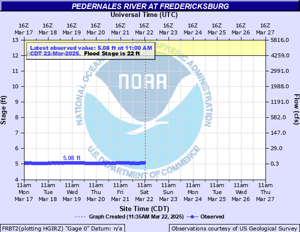
Latest Observation
Updated: 5:00 PM CST 12/4/25
Status: No Flooding
Stage: 5.49 ft
Flow: 0.0016 kcfs
Forecast
Forecast not available for this location.
| Time | Stage (ft) | Flow (kcfs) |
|---|---|---|
| 6:00 PM 12/4 | 5.5 | 0.0016 |
| 5:00 PM 12/4 | 5.49 | 0.0016 |
| 4:00 PM 12/4 | 5.49 | 0.0016 |
| 3:00 PM 12/4 | 5.5 | 0.0016 |
| 2:00 PM 12/4 | 5.5 | 0.0016 |
| 1:00 PM 12/4 | 5.5 | 0.0016 |
| 12:00 PM 12/4 | 5.5 | 0.0016 |
| 11:00 AM 12/4 | 5.5 | 0.0016 |
| 10:00 AM 12/4 | 5.5 | 0.0016 |
| 9:00 AM 12/4 | 5.51 | 0.0016 |
| 8:00 AM 12/4 | 5.5 | 0.0016 |
| 7:00 AM 12/4 | 5.5 | 0.0016 |
| 6:00 AM 12/4 | 5.5 | 0.0016 |
| 5:00 AM 12/4 | 5.5 | 0.0016 |
| 4:00 AM 12/4 | 5.5 | 0.0016 |
| 3:00 AM 12/4 | 5.5 | 0.0016 |
| 2:00 AM 12/4 | 5.5 | 0.0016 |
| 1:00 AM 12/4 | 5.5 | 0.0016 |
| 12:00 AM 12/4 | 5.5 | 0.0016 |
| 11:00 PM 12/3 | 5.5 | 0.0016 |
| 10:00 PM 12/3 | 5.5 | 0.0016 |
| 9:00 PM 12/3 | 5.5 | 0.0016 |
| 8:00 PM 12/3 | 5.5 | 0.0016 |
| 7:00 PM 12/3 | 5.51 | 0.0016 |
| 6:00 PM 12/3 | 5.5 | 0.0016 |
| 5:00 PM 12/3 | 5.5 | 0.0016 |
| 4:00 PM 12/3 | 5.5 | 0.0016 |
| 3:00 PM 12/3 | 5.5 | 0.0016 |
| 2:00 PM 12/3 | 5.5 | 0.0016 |
| 1:00 PM 12/3 | 5.51 | 0.0016 |
40' -
Major flooding of primary and secondary roads and bridges in the headwaters above Fredericksburg is very dangerous. The bridge floor of Highway 87 floods. Hundreds of livstock are cut off and potentially drowned Major flooding downstream in LBJ National Park damages the Junction School House, the Jordan House, fencing, signs and roads.
37' -
Flow reaches the slab elevation of the lowest buildings below the gauge and the south approach to the Highway 87 bridge. Secondary and primary roads and bridges flood in the headwaters above Fredericksburg. Major flooding downstream in LBJ National Park near Stonewall damages buildings, signs, fencing and roads. Hundreds of livestock are cut off and potentially drowned.
36' -
Major flooding is near the USGS 1:25 year level. Lowest buildings near Highway 87 are threatened as well as the Highway 87 bridge approaches. Major damage occurs downsteam at LBJ National Park to signs, fences, roads and the Junction School. Widepread scouring of roads and bridges occurs from the headwaters to below Stonewall.
32' -
Widespread major flooding of secondary and primary roads, low bridges and crossings in the headwaters above Fredericksburg make them very dangerous. Destructive flooding at LBJ National Park downstream will be ten feet over the Park Road 49 bridge at LBJ National Park. Many park signs and fences are destroyed and park roads damaged. This flow exceeds the USGS 1:10 year flood level.
29' -
Moderate lowland flooding inundates secondary roads and bridges from the headwaters above Harper to below Stonewall. Fences and signs are destroyed in LBJ National Park at Stonewall as flow is well into the flood plain and many feet over the Park Road 49 bridge.
27' -
Moderate lowland flooding is near the USGS 1:5 year level. Secondary roads and bridges from the headwaters above Harper to below Stonewall are flooded and dangerous. Significant damage to fences, signs, and roads occurs downstream in LBJ National Park near Stonewall.
25' -
Moderate lowland flooding covers many secondary roads and bridges from the headwaters to Stonewall making them very dangerous to motorists. Low areas of LBJ National Park and the Park Road 49 bridge are flooded.
22' -
Minor lowland flooding floods secondary roads and bridges from the headwaters downstream to below LBJ National Park. The Park Road 49 bridge in LBJ National Park floods. Fencing and signs are damaged in LBJ National Park.
16.6' -
Flow exceeds the banks and is near the USGS 1:2 year level.
15' -
Flow exceeds banks into lowest areas of the flood plain.
12' -
Flow exceeds lowest areas of the banks.
| Date | Stage (ft) |
|---|---|
| Aug 2, 1978 | 41.6 |
| Sep 1, 1979 | 38.7 |
| Jun 1, 1979 | 34.4 |
| Dec 20, 1991 | 32.09 |
| Jun 22, 1997 | 31.87 |
| Jul 5, 2002 | 27.4 |
| Jul 5, 2002 | 27.4 |
| May 3, 1990 | 25.68 |
| Oct 16, 2018 | 22.59 |
| May 29, 2016 | 14.88 |
| May 25, 2015 | 11.72 |
Data provided by the National Weather Service.