« Back to Fredericksburg Rivers
Pedernales River at Johnson City
Critical Stages
13' - Action
14' - Flood
17' - Moderate
19' - Major
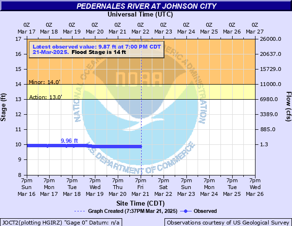
Latest Observation
Updated: 5:00 PM CST 12/4/25
Status: No Flooding
Stage: 10.09 ft
Flow: 0.0028 kcfs
Forecast
Forecast not available for this location.
| Time | Stage (ft) | Flow (kcfs) |
|---|---|---|
| 5:00 PM 12/4 | 10.09 | 0.0028 |
| 4:55 PM 12/4 | 10.08 | 0.0026 |
| 4:50 PM 12/4 | 10.09 | 0.0028 |
| 4:45 PM 12/4 | 10.09 | 0.0028 |
| 4:40 PM 12/4 | 10.08 | 0.0026 |
| 4:35 PM 12/4 | 10.09 | 0.0028 |
| 4:30 PM 12/4 | 10.09 | 0.0028 |
| 4:25 PM 12/4 | 10.09 | 0.0028 |
| 4:20 PM 12/4 | 10.09 | 0.0028 |
| 4:15 PM 12/4 | 10.09 | 0.0028 |
| 4:10 PM 12/4 | 10.09 | 0.0028 |
| 4:05 PM 12/4 | 10.08 | 0.0026 |
| 4:00 PM 12/4 | 10.09 | 0.0028 |
| 3:55 PM 12/4 | 10.09 | 0.0028 |
| 3:50 PM 12/4 | 10.09 | 0.0028 |
| 3:45 PM 12/4 | 10.09 | 0.0028 |
| 3:40 PM 12/4 | 10.09 | 0.0028 |
| 3:35 PM 12/4 | 10.09 | 0.0028 |
| 3:30 PM 12/4 | 10.08 | 0.0026 |
| 3:25 PM 12/4 | 10.09 | 0.0028 |
| 3:20 PM 12/4 | 10.09 | 0.0028 |
| 3:15 PM 12/4 | 10.09 | 0.0028 |
| 3:10 PM 12/4 | 10.09 | 0.0028 |
| 3:05 PM 12/4 | 10.08 | 0.0026 |
| 3:00 PM 12/4 | 10.09 | 0.0028 |
| 2:55 PM 12/4 | 10.09 | 0.0028 |
| 2:50 PM 12/4 | 10.08 | 0.0026 |
| 2:45 PM 12/4 | 10.09 | 0.0028 |
| 2:40 PM 12/4 | 10.1 | 0.0028 |
| 2:35 PM 12/4 | 10.09 | 0.0028 |
40' -
Flow reaches the slab elevation of the lowest homes in the Pedernales River flood plain near Johnson City, the rodeo grounds and the south approach of Highway 281. An RV park just below Highway 281 has up to six feet of water over the lowest sites. Widespread lowland flooding can cut off and drown hundreds of livestock. Much of Pedernales Falls State Park floods.
37' -
Several feet of turbulent water is flowing through low areas of an RV park below Highway 281 on the right bank. Many roads and bridges in the flood plain are life threatening. Fencing and roads are damaged or destroyed. Much of Pedernales Falls State Park is flooded.
34' -
Flow is to the lowest trailer sites of an RV park just below Highway 281 near Johnson City. Hundreds of cattle can be cut off and drowned in the flood plain. Low areas of Pedernales Falls State Park downstream flood. Roads and bridges near the river are extremely dangerous. Flow is approaching the rodeo grounds. Near the USGS 1:100 year flood level.
30' -
Flow is within four feet of an RV park in the northeast part of Johnson City just below Highway 281 on the left bank. Lowest camp sites are at thirty four feet gauge height. Hundreds of livestock in the flood plain can be cut off and drowned. Roads and low bridges near the river flood. Low sections of Pedernales Falls State Park downstream are under turbulent water and very dangerous. Exceeds the USGS 1:50 year flood.
28' -
Secondary and primary roads and bridges are severely flooded in the flood plain. Fencing and roads are damaged or destroyed. Low areas of Pedernales State Park downstream are severely flooded. Exceeds USGS 1:25 year flood.
25' -
Extensive damage occurs to roads, bridges, fences and signs in the flood plain below Stonewall to Lake Travis. Lower sections of Pedernales Falls State Park flood. Roads and low bridges near the river are flooded and dangerous to motorists. Exceeds USGS 1:10 year flood.
22' -
Secondary roads, bridges and crossings are dangerously flooded near the Pedernales River. Low areas of Pedernales Falls State Park are flooded and dangerous. Fencing and roads are damaged or destroyed in the flood plain.
19' -
Major flooding makes secondary and primary roads below Stonewall to Lake Travis very dangerous. Low park areas downstream in Pedernales Falls State Park flood.
17' -
Moderate lowland flooding makes secondary roads, bridges and low crossings very dangerous. Swimmers and recreationists should move from the flood plain downstream in Pedernales Falls State Park. Near the USGS 1:2 year flood.
14' -
Minor lowland flooding reaches secondary roads, crossings and low bridges. Low areas of LBJ National Park upstream are flooded. Swimmers and recreationists should leave the river downstream in Pedernales Falls State Park.
13' -
Low water crossings upstream flood.
| Date | Stage (ft) |
|---|---|
| Sep 11, 1952 | 42.5 |
| Jul 3, 1869 | 33 |
| Aug 30, 1944 | 26.1 |
| Oct 4, 1959 | 26.1 |
| Jul 4, 2002 | 26 |
| Jun 22, 1997 | 25.16 |
| Aug 3, 1978 | 24.9 |
| Apr 24, 1957 | 24.8 |
| May 28, 1929 | 22.9 |
| Apr 15, 1977 | 22.6 |
| Nov 15, 2001 | 22.45 |
| Oct 31, 1974 | 21.95 |
| Feb 4, 1992 | 21.87 |
| Dec 21, 1991 | 21.86 |
| May 30, 1995 | 21.38 |
| May 25, 2007 | 20.36 |
| May 24, 2015 | 19.25 |
| May 8, 2019 | 18.5 |
| Jul 17, 1987 | 17.98 |
| Nov 17, 2004 | 17.73 |
Data provided by the National Weather Service.