« Back to Fredericksburg Rivers
Sandy Creek near Kingsland
Critical Stages
8' - Action
12' - Flood
14' - Moderate
20' - Major
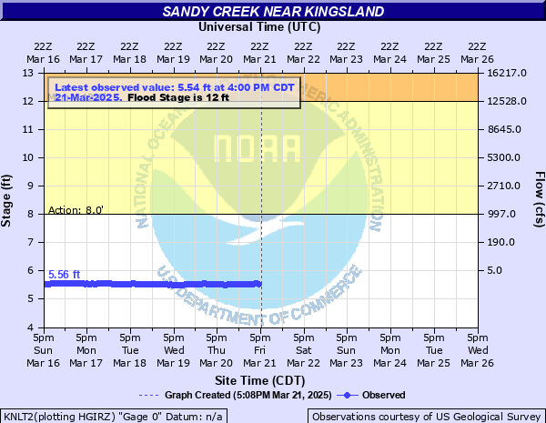
Latest Observation
Updated: 5:00 PM CST 12/4/25
Status: No Flooding
Stage: 5.27 ft
Flow: 0.0022 kcfs
Forecast
Forecast not available for this location.
| Time | Stage (ft) | Flow (kcfs) |
|---|---|---|
| 5:00 PM 12/4 | 5.27 | 0.0022 |
| 4:55 PM 12/4 | 5.27 | 0.0022 |
| 4:50 PM 12/4 | 5.27 | 0.0022 |
| 4:45 PM 12/4 | 5.27 | 0.0022 |
| 4:40 PM 12/4 | 5.27 | 0.0022 |
| 4:35 PM 12/4 | 5.27 | 0.0022 |
| 4:30 PM 12/4 | 5.26 | 0.0021 |
| 4:25 PM 12/4 | 5.27 | 0.0022 |
| 4:20 PM 12/4 | 5.27 | 0.0022 |
| 4:15 PM 12/4 | 5.27 | 0.0022 |
| 4:10 PM 12/4 | 5.27 | 0.0022 |
| 4:05 PM 12/4 | 5.27 | 0.0022 |
| 4:00 PM 12/4 | 5.26 | 0.0021 |
| 3:55 PM 12/4 | 5.27 | 0.0022 |
| 3:50 PM 12/4 | 5.26 | 0.0021 |
| 3:45 PM 12/4 | 5.27 | 0.0022 |
| 3:40 PM 12/4 | 5.26 | 0.0021 |
| 3:35 PM 12/4 | 5.26 | 0.0021 |
| 3:30 PM 12/4 | 5.26 | 0.0021 |
| 3:25 PM 12/4 | 5.27 | 0.0022 |
| 3:20 PM 12/4 | 5.27 | 0.0022 |
| 3:15 PM 12/4 | 5.26 | 0.0021 |
| 3:10 PM 12/4 | 5.26 | 0.0021 |
| 3:05 PM 12/4 | 5.26 | 0.0021 |
| 3:00 PM 12/4 | 5.26 | 0.0021 |
| 2:55 PM 12/4 | 5.27 | 0.0022 |
| 2:50 PM 12/4 | 5.27 | 0.0022 |
| 2:45 PM 12/4 | 5.26 | 0.0021 |
| 2:40 PM 12/4 | 5.27 | 0.0022 |
| 2:35 PM 12/4 | 5.26 | 0.0021 |
30' -
Life threatening flow down Sandy and Walnut Creeks will put water to the roofs of homes in Sandy Harbor in minutes. Destruction of boats, jet skis, docks, marinas and any facilities in the flood plain in Sandy Harbor and Sunrise Beach will be disastrous. Roads and bridges near the river will be extremely dangerous.
27' -
Flow will be life threatening below Highway 71 in Sandy Harbor and Sunrise Beach. Lowest homes will have several feet of water through them. Docks and boats will be severely damaged. Flow exceeds the USGS 1:100 year flood level.
24' -
Lowest homes below Highway 71 in Sandy Harbor and Sunrise Beach will flood. Residents should prepare to evacuate as emergency officials assess the threat. Boats and docks will be severely damaged. Near the USGS 1:100 year flood level.
20' -
Major flooding will approach the lowest homes in Sandy Harbor. Depending on additional runoff down Walnut Creek, boats, docks and facilities along the Lower Sandy Creek banks in Sandy Harbor and Sunrise Beach will flood severely. Flow exceeds USGS 1:25 year flood level.
17' -
Flow will be well into the flood plain above Highway 71 to Lake LBJ. Residents of flood prone areas in Sandy Harbor should monitor NOAA Weather Radio for developing heavy rain and flood conditions. Flow will threaten lowest homes in Sandy Harbor. Boats and docks will be severely flooded and damaged. Flow exceeds USGS 1:10 year flood level.
14' -
Moderate lowland flooding will extends well into the flood plain damaging docks, boats and property in low areas of the flood plain downstream in Kingsland. Flow exceeds USGS 1:5 year flood level.
12' -
Lowland flooding will threaten lowest boats at sandy harbor and sunrise beach at the lower end of sandy creek.
10' -
Flow exceeds lowest banks. Near the usgs 1:2 year flood level
8' -
Flow exceeds lowest areas of banks
| Date | Stage (ft) |
|---|---|
| Sep 11, 1952 | 34.2 |
| May 30, 1995 | 31.5 |
| Oct 16, 2018 | 19.88 |
| Dec 20, 1991 | 17.62 |
| Jun 27, 2007 | 15.2 |
| May 31, 2016 | 13.01 |
| May 25, 2015 | 11.5 |
Data provided by the National Weather Service.