« Back to Freshwater Lagoon Rivers
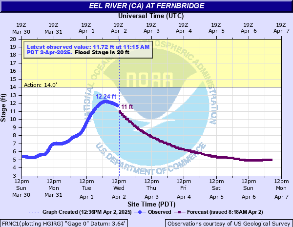
Eel River (CA) at Fernbridge
Critical Stages
14' - Action
20' - Flood
22' - Moderate
25' - Major
Latest Observation
Updated: 11:15 PM PST 12/14/25
Status: No Flooding
Stage: -0.71 ft
Flow: -999 kcfs
Forecast
| Time | Stage (ft) | Flow (kcfs) |
|---|---|---|
| 1 AM 12/15 | 0.1 | 3.2 |
| 2 AM 12/15 | 0.1 | 3.2 |
| 3 AM 12/15 | 0.1 | 3.2 |
| 4 AM 12/15 | 0.1 | 3.2 |
| 5 AM 12/15 | 0.1 | 3.2 |
| 6 AM 12/15 | 0.1 | 3.2 |
| 7 AM 12/15 | 0.1 | 3.2 |
| 8 AM 12/15 | 0.1 | 3.2 |
| 9 AM 12/15 | 0.1 | 3.2 |
| 10 AM 12/15 | 0.1 | 3.2 |
| 11 AM 12/15 | 0.1 | 3.2 |
| 12 PM 12/15 | 0.1 | 3.2 |
| 1 PM 12/15 | 0.1 | 3.2 |
| 2 PM 12/15 | 0.1 | 3.2 |
| 3 PM 12/15 | 0.1 | 3.2 |
| 4 PM 12/15 | 0.1 | 3.2 |
| 5 PM 12/15 | 0.1 | 3.2 |
| 6 PM 12/15 | 0.1 | 3.2 |
| 7 PM 12/15 | 0.1 | 3.2 |
| 8 PM 12/15 | 0.1 | 3.2 |
| 9 PM 12/15 | 0.1 | 3.2 |
| 10 PM 12/15 | 0.1 | 3.2 |
| 11 PM 12/15 | 0.1 | 3.2 |
| 12 AM 12/16 | 0.1 | 3.2 |
| 1 AM 12/16 | 0.1 | 3.2 |
| 2 AM 12/16 | 0.1 | 3.2 |
| 3 AM 12/16 | 0.1 | 3.2 |
| 4 AM 12/16 | 0.1 | 3.2 |
| 5 AM 12/16 | 0.1 | 3.2 |
| 6 AM 12/16 | 0.1 | 3.2 |
| 7 AM 12/16 | 0.1 | 3.2 |
| 8 AM 12/16 | 0.1 | 3.2 |
| 9 AM 12/16 | 0.1 | 3.2 |
| 10 AM 12/16 | 0.1 | 3.2 |
| 11 AM 12/16 | 0.1 | 3.2 |
| 12 PM 12/16 | 0.1 | 3.2 |
| 1 PM 12/16 | 0.1 | 3.2 |
| 2 PM 12/16 | 0.1 | 3.2 |
| 3 PM 12/16 | 0.1 | 3.2 |
| 4 PM 12/16 | 0.1 | 3.2 |
| 5 PM 12/16 | 0.1 | 3.2 |
| 6 PM 12/16 | 0.1 | 3.2 |
| 7 PM 12/16 | 0.1 | 3.2 |
| 8 PM 12/16 | 0.1 | 3.2 |
| 9 PM 12/16 | 0.1 | 3.2 |
| 10 PM 12/16 | 0.1 | 3.2 |
| 11 PM 12/16 | 0.1 | 3.2 |
| 12 AM 12/17 | 0.1 | 3.2 |
| 1 AM 12/17 | 0.1 | 3.2 |
| 2 AM 12/17 | 0.1 | 3.2 |
| 3 AM 12/17 | 0.1 | 3.2 |
| 4 AM 12/17 | 0.1 | 3.2 |
| 5 AM 12/17 | 0.1 | 3.2 |
| 6 AM 12/17 | 0.1 | 3.2 |
| 7 AM 12/17 | 0.1 | 3.2 |
| 8 AM 12/17 | 0.1 | 3.2 |
| 9 AM 12/17 | 0.1 | 3.2 |
| 10 AM 12/17 | 0.1 | 3.2 |
| 11 AM 12/17 | 0.1 | 3.2 |
| 12 PM 12/17 | 0.1 | 3.2 |
| 1 PM 12/17 | 0.1 | 3.2 |
| 2 PM 12/17 | 0.1 | 3.2 |
| 3 PM 12/17 | 0.1 | 3.2 |
| 4 PM 12/17 | 0.1 | 3.2 |
| 5 PM 12/17 | 0.1 | 3.2 |
| 6 PM 12/17 | 0.14 | 3.42 |
| 7 PM 12/17 | 0.2 | 3.67 |
| 8 PM 12/17 | 0.25 | 3.84 |
| 9 PM 12/17 | 0.3 | 3.98 |
| 10 PM 12/17 | 0.34 | 4.08 |
| 11 PM 12/17 | 0.37 | 4.15 |
| 12 AM 12/18 | 0.39 | 4.19 |
| 1 AM 12/18 | 0.4 | 4.21 |
| 2 AM 12/18 | 0.4 | 4.21 |
| 3 AM 12/18 | 0.39 | 4.19 |
| 4 AM 12/18 | 0.37 | 4.15 |
| 5 AM 12/18 | 0.35 | 4.1 |
| 6 AM 12/18 | 0.34 | 4.08 |
| 7 AM 12/18 | 0.33 | 4.05 |
| 8 AM 12/18 | 0.32 | 4.03 |
| 9 AM 12/18 | 0.31 | 4 |
| 10 AM 12/18 | 0.31 | 4 |
| 11 AM 12/18 | 0.3 | 3.98 |
| 12 PM 12/18 | 0.31 | 4 |
| 1 PM 12/18 | 0.32 | 4.03 |
| 2 PM 12/18 | 0.33 | 4.05 |
| 3 PM 12/18 | 0.34 | 4.08 |
| 4 PM 12/18 | 0.37 | 4.15 |
| 5 PM 12/18 | 0.4 | 4.21 |
| 6 PM 12/18 | 0.45 | 4.31 |
| 7 PM 12/18 | 0.5 | 4.4 |
| 8 PM 12/18 | 0.53 | 4.52 |
| 9 PM 12/18 | 0.57 | 4.67 |
| 10 PM 12/18 | 0.61 | 4.81 |
| 11 PM 12/18 | 0.65 | 4.95 |
| 12 AM 12/19 | 0.7 | 5.11 |
| 1 AM 12/19 | 0.76 | 5.31 |
| 2 AM 12/19 | 0.82 | 5.49 |
| 3 AM 12/19 | 0.88 | 5.67 |
| 4 AM 12/19 | 0.95 | 5.86 |
| Time | Stage (ft) | Flow (kcfs) |
|---|---|---|
| 11:15 PM 12/14 | -0.71 | -999 |
| 11:00 PM 12/14 | -0.71 | -999 |
| 10:45 PM 12/14 | -0.71 | -999 |
| 10:30 PM 12/14 | -0.71 | -999 |
| 10:15 PM 12/14 | -0.71 | -999 |
| 10:00 PM 12/14 | -0.71 | -999 |
| 9:45 PM 12/14 | -0.71 | -999 |
| 9:30 PM 12/14 | -0.7 | -999 |
| 9:15 PM 12/14 | -0.71 | -999 |
| 9:00 PM 12/14 | -0.71 | -999 |
| 8:45 PM 12/14 | -0.71 | -999 |
| 8:30 PM 12/14 | -0.71 | -999 |
| 8:15 PM 12/14 | -0.71 | -999 |
| 8:00 PM 12/14 | -0.71 | -999 |
| 7:45 PM 12/14 | -0.71 | -999 |
| 7:30 PM 12/14 | -0.71 | -999 |
| 7:15 PM 12/14 | -0.71 | -999 |
| 7:00 PM 12/14 | -0.71 | -999 |
| 6:45 PM 12/14 | -0.71 | -999 |
| 6:30 PM 12/14 | -0.71 | -999 |
| 6:15 PM 12/14 | -0.71 | -999 |
| 6:00 PM 12/14 | -0.71 | -999 |
| 5:45 PM 12/14 | -0.71 | -999 |
| 5:30 PM 12/14 | -0.71 | -999 |
| 5:15 PM 12/14 | -0.71 | -999 |
| 5:00 PM 12/14 | -0.71 | -999 |
| 4:45 PM 12/14 | -0.71 | -999 |
| 4:30 PM 12/14 | -0.71 | -999 |
| 4:15 PM 12/14 | -0.71 | -999 |
| 4:00 PM 12/14 | -0.71 | -999 |
30' -
Record level flooding is forecast with disastrous flooding throughout the Eel Delta. Most roads will be impassable including Highway 211 to Ferndale, and access will be severely restricted. A Special Action Advisory is being issued to all owners of livestock in adjacent or low-lying areas. All persons should take action to protect life and property.
28' -
Near record river levels are expected, with extensive severe flooding throughout the Eel Delta. Expect numerous road closures including Highway 211 to Ferndale. All persons in the area should be prepared to take action to protect life and property. A Special Action Advisory is issued to all owners of livestock in low-lying areas adjacent to the river. Appropriate action should be taken to protect livestock.
26' -
Extensive flooding of the Eel Delta. Closure of Highway 211 to Ferndale and many other roads in the Delta is likely. All persons in the area should be prepared to take action to protect life and property. A Special Action Advisory is issued for all owners of livestock in low-lying areas near the River. Appropriate action should be taken to protect livestock.
25' -
Severe flooding of the Eel River Delta including areas northwest of Loleta and the western portion of Cannibal Island Road. Numerous road closures in low-lying areas, including Highway 211 to Ferndale. A Special Action Advisory is issued to all owners of livestock in low-lying areas near the river. Appropriate action should be taken to protect livestock.
24' -
Minor flooding of Highway 211 to Ferndale south of Fernbridge. Much of the Eel Delta may be flooded, including areas northwest of Loleta and the western portion of Cannibal Island Road. Flooding will be enhanced for longer duration events. A Special Action Advisory is being issued to all owners of livestock in all low-lying areas adjacent to the Eel River. Appropriate action should be taken to protect livestock.
22' -
The western half of the Eel Delta may be completely flooded, especially if at or above this level for an extended period of time. This includes areas northwest of Loleta and Cannibal Island Road. A Special Action Advisory is being issued to all owners of livestock in low-lying areas of the Eel River Delta. Owners of livestock should take appropriate action to protect their animals.
20' -
Significant flooding of the western portions of Cannibal Island Road, Camp Weott Road, the Salt and Old Rivers, and all adjacent low-lying areas. Flooding in these areas is exaggerated when crest timing is coincident with high tides and strong onshore winds, and for longer duration events. A Special Action Advisory is being issued to all owners of livestock in low-lying areas of the Eel Delta. Owners of livestock should consider taking appropriate action to protect livestock.
18' -
Flooding of western portions of Cannibal Island Road, Camp Weott Road, and adjacent areas is likely. This level may also cause flooding of the Salt River, Old River and other low-lying slough areas. Flooding in these areas is exaggerated when crest timing is coincident with high tides and strong onshore winds, and when the river remains high for longer periods of time.
16' -
Minor flooding of western portions of Cannibal Island Road, Camp Weott Road, and adjacent low-lying areas. Flooding will be enhanced when the crest occurs during times of high tide.
15' -
Minor flooding of western portions of Cannibal Island Road, Camp Weott Road, and adjacent areas may occur if the crest time is coincident with an ocean tide of 6.0 feet or greater.
14' -
Minor flooding of western portions of Cannibal Island Road, Camp Weott Road, and adjacent areas may occur if the crest time is coincident with an ocean tide of 6.5 feet or greater.
13' -
Minor flooding of western portions of Cannibal Island Road, Camp Weott Road, and adjacent areas may occur if the time of crest is coincident with an ocean tide of 7.5 feet or greater.
| Date | Stage (ft) |
|---|---|
| Dec 23, 1964 | 29.5 |
| Dec 22, 1955 | 27.7 |
| Jan 16, 1974 | 26.33 |
| Feb 18, 1986 | 26 |
| Feb 27, 2019 | 25.62 |
| Dec 11, 1937 | 25.4 |
| Jan 1, 2006 | 25.39 |
| Jan 9, 1995 | 25.31 |
| Jan 1, 1997 | 25.22 |
| Jan 11, 2017 | 24.94 |
| Feb 8, 1960 | 24.85 |
| Mar 30, 1974 | 24.81 |
| Jan 24, 1970 | 24.8 |
| Dec 29, 2005 | 24.72 |
| Feb 28, 1940 | 24.43 |
| Jan 5, 1966 | 24.2 |
| Nov 22, 2024 | 23.72 |
| Dec 19, 1981 | 23.7 |
| Jan 27, 1983 | 23.6 |
| Jan 21, 1993 | 23.46 |
Data provided by the National Weather Service.