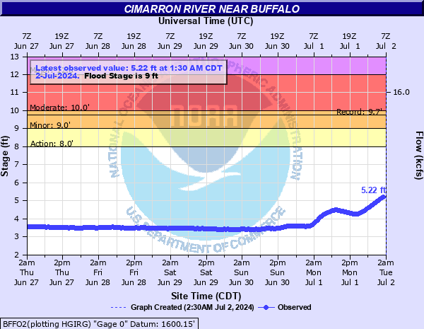
Cimarron River near Buffalo
Critical Stages
8' - Action
9' - Flood
10' - Moderate
12' - Major
Latest Observation
Updated: 3:30 AM CST 12/16/25
Status: No Flooding
Stage: 4.01 ft
Flow: 0.0749 kcfs
Forecast
Forecast not available for this location.
| Time | Stage (ft) | Flow (kcfs) |
|---|---|---|
| 3:30 AM 12/16 | 4.01 | 0.0749 |
| 3:00 AM 12/16 | 4.01 | 0.0749 |
| 2:30 AM 12/16 | 4.01 | 0.0749 |
| 2:00 AM 12/16 | 4.01 | 0.0749 |
| 1:30 AM 12/16 | 4 | 0.0733 |
| 1:00 AM 12/16 | 4 | 0.0733 |
| 12:30 AM 12/16 | 4.01 | 0.0749 |
| 12:00 AM 12/16 | 4.01 | 0.0749 |
| 11:30 PM 12/15 | 4.01 | 0.0749 |
| 11:00 PM 12/15 | 4.01 | 0.0749 |
| 10:30 PM 12/15 | 4 | 0.0733 |
| 10:00 PM 12/15 | 4.01 | 0.0749 |
| 9:30 PM 12/15 | 4.02 | 0.0765 |
| 9:00 PM 12/15 | 4.02 | 0.0765 |
| 8:30 PM 12/15 | 4.02 | 0.0765 |
| 8:00 PM 12/15 | 4.03 | 0.0781 |
| 7:30 PM 12/15 | 4.03 | 0.0781 |
| 7:00 PM 12/15 | 4.04 | 0.0797 |
| 6:30 PM 12/15 | 4.03 | 0.0781 |
| 6:00 PM 12/15 | 4.05 | 0.0814 |
| 5:30 PM 12/15 | 4.05 | 0.0814 |
| 5:00 PM 12/15 | 4.06 | 0.0831 |
| 4:30 PM 12/15 | 4.06 | 0.0831 |
| 4:00 PM 12/15 | 4.06 | 0.0831 |
| 3:30 PM 12/15 | 4.07 | 0.0848 |
| 3:00 PM 12/15 | 4.06 | 0.0831 |
| 2:30 PM 12/15 | 4.06 | 0.0831 |
| 2:00 PM 12/15 | 4.06 | 0.0831 |
| 1:30 PM 12/15 | 4.05 | 0.0814 |
| 1:00 PM 12/15 | 4.05 | 0.0814 |
12' -
Flood depths up to three feet cover croplands... pastures... and other low-lying areas near the river. Areas affected extend from near the Oklahoma-Kansas state line... downstream to near Freedom. Cattle and other property should be relocated to places which are higher than nearby river banks... to avoid being isolated by deep water in side channels.
11' -
Flood depths up to two feet cover croplands... pastures... and other low-lying areas near the river. Areas affected extend from near the Oklahoma-Kansas state line... downstream to near Freedom. Cattle and other property should be relocated to places which are higher than nearby river banks... to avoid being isolated by deep water in side channels.
10' -
Flood depths up to a foot affect croplands... pastures... and other low-lying areas near the river. Areas affected extend from near the Oklahoma-Kansas state line... downstream to near Freedom. Cattle and other property should be relocated to places which are higher than nearby river banks... to avoid being isolated by deep water in side channels.
9' -
Shallow flooding affects croplands... pastures... and other low-lying areas near the river. Areas affected extend from near the Oklahoma-Kansas state line... downstream to near Freedom. Cattle and other property should be relocated to places which are higher than nearby river banks... to avoid being isolated for several hours by water in side channels.
8' -
Some inundation of low-lying areas may occur near the river. Areas affected extend from near the Oklahoma-Kansas state line... downstream to near Freedom.
| Date | Stage (ft) |
|---|---|
| May 9, 2019 | 9.74 |
| May 27, 2019 | 9.09 |
| May 27, 1987 | 9.04 |
| Apr 24, 1987 | 8.82 |
| May 8, 2007 | 8.71 |
| Jun 12, 1989 | 8.63 |
| May 22, 2019 | 8.56 |
| May 2, 1993 | 8.43 |
| Apr 29, 1985 | 8.41 |
| May 18, 1989 | 8.34 |
| Jun 11, 1985 | 8.33 |
| Aug 11, 2020 | 8.23 |
| Jul 23, 2023 | 8.2 |
| May 5, 1987 | 8.19 |
| Apr 13, 1985 | 8.11 |
| Aug 7, 2007 | 7.87 |
| Jul 3, 2014 | 7.69 |
| Jun 15, 2007 | 7.51 |
| Aug 10, 2013 | 7.49 |
Data provided by the National Weather Service.