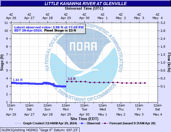
Little Kanawha River at Glenville
Critical Stages
21' - Action
23' - Flood
26' - Moderate
28' - Major
Latest Observation
Updated: 12:45 AM EST 12/5/25
Status: No Flooding
Stage: 5.22 ft
Flow: 0.667 kcfs
Forecast
| Time | Stage (ft) | Flow (kcfs) |
|---|---|---|
| 7 AM 12/5 | 4.1 | 0.3 |
| 1 PM 12/5 | 4 | 0.275 |
| 7 PM 12/5 | 3.7 | 0.206 |
| 1 AM 12/6 | 3.7 | 0.206 |
| 7 AM 12/6 | 3.6 | 0.186 |
| 1 PM 12/6 | 3.6 | 0.186 |
| 7 PM 12/6 | 3.6 | 0.186 |
| 1 AM 12/7 | 3.5 | 0.167 |
| 7 AM 12/7 | 3.5 | 0.167 |
| 1 PM 12/7 | 3.5 | 0.167 |
| 7 PM 12/7 | 3.5 | 0.167 |
| 1 AM 12/8 | 3.4 | 0.149 |
| 7 AM 12/8 | 3.4 | 0.149 |
| 1 PM 12/8 | 3.4 | 0.149 |
| 7 PM 12/8 | 3.3 | 0.132 |
| 1 AM 12/9 | 3.3 | 0.132 |
| 7 AM 12/9 | 3.2 | 0.116 |
| Time | Stage (ft) | Flow (kcfs) |
|---|---|---|
| 12:45 AM 12/5 | 5.22 | 0.667 |
| 12:30 AM 12/5 | 5.22 | 0.667 |
| 12:15 AM 12/5 | 5.21 | 0.663 |
| 12:00 AM 12/5 | 5.21 | 0.663 |
| 11:45 PM 12/4 | 5.2 | 0.659 |
| 11:30 PM 12/4 | 5.2 | 0.659 |
| 11:15 PM 12/4 | 5.19 | 0.655 |
| 11:00 PM 12/4 | 5.18 | 0.651 |
| 10:45 PM 12/4 | 5.16 | 0.643 |
| 10:30 PM 12/4 | 5.15 | 0.639 |
| 10:15 PM 12/4 | 5.14 | 0.635 |
| 10:00 PM 12/4 | 5.12 | 0.627 |
| 9:45 PM 12/4 | 5.11 | 0.623 |
| 9:30 PM 12/4 | 5.08 | 0.612 |
| 9:15 PM 12/4 | 5.06 | 0.604 |
| 9:00 PM 12/4 | 5.04 | 0.597 |
| 8:45 PM 12/4 | 5 | 0.582 |
| 8:30 PM 12/4 | 4.98 | 0.575 |
| 8:15 PM 12/4 | 4.95 | 0.564 |
| 8:00 PM 12/4 | 4.91 | 0.549 |
| 7:45 PM 12/4 | 4.85 | 0.528 |
| 7:30 PM 12/4 | 4.78 | 0.503 |
| 7:15 PM 12/4 | 4.73 | 0.486 |
| 7:00 PM 12/4 | 4.68 | 0.469 |
| 6:45 PM 12/4 | 4.63 | 0.453 |
| 6:30 PM 12/4 | 4.59 | 0.44 |
| 6:15 PM 12/4 | 4.55 | 0.428 |
| 6:00 PM 12/4 | 4.52 | 0.418 |
| 5:45 PM 12/4 | 4.49 | 0.409 |
| 5:30 PM 12/4 | 4.47 | 0.403 |
31' -
Major flooding of lower half of town, adjacent to river. Several businesses along State Route 5 flood.
29' -
Water affects several businesses at the intersection of South Lewis Street and Main Street. Some homes along College Street, near the intersection with East Main Street, begin to flood. Several homes on Hunter Street, Brooklyn Drive, and Park Street flood. Gas utility company off State Route 5, adjacent to river, floods.
28' -
US Route 119 and 33 are closed, east and west of town. Portions of West Main Street along with the intersection with South Lewis Street flood.
27' -
Backwater flooding from Town Run covers most of South Street and affects a few homes and and business. A few homes adjacent to the river on River Street flood.
26' -
Backwater flooding on Town Run covers portions of South Street and affects home. Home on Brooklyn Drive adjacent to river floods.
25' -
Most of Elm Street floods. Water reaches the hotel foundation on Conrad Court next to the old 1885 bridge.
23' -
Low spots on Brooklyn Drive, Elm Street, and River Street flood.
22' -
Water begins to cover low spots on Brooklyn Drive, Elm Street, and River Street.
| Date | Stage (ft) |
|---|---|
| Nov 5, 1985 | 36.46 |
| Mar 7, 1967 | 34.5 |
| Nov 16, 1926 | 33.6 |
| Apr 16, 1939 | 33.22 |
| Mar 14, 1918 | 32.9 |
| Jun 5, 2008 | 32.16 |
| Feb 19, 2000 | 31.3 |
| Feb 1, 1951 | 31.15 |
| Jun 25, 1950 | 31.1 |
| May 29, 1950 | 31.1 |
| Aug 5, 1943 | 30.73 |
| Nov 20, 2003 | 30.37 |
| Feb 9, 1994 | 30.33 |
| Feb 10, 1957 | 30.15 |
| Jan 26, 1978 | 29.75 |
| May 13, 1924 | 29.7 |
| May 26, 1918 | 29.7 |
| Mar 27, 1913 | 29.5 |
| Mar 2, 1997 | 29.3 |
| Mar 7, 1989 | 29.3 |
Data provided by the National Weather Service.