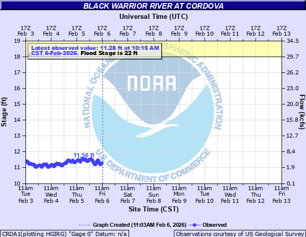
Black Warrior River at Cordova
Critical Stages
18' - Action
22' - Flood
24' - Moderate
28' - Major
Latest Observation
Updated: 1:15 PM CST 12/15/25
Status: No Flooding
Stage: 11.11 ft
Flow: 2.58 kcfs
Forecast
Forecast not available for this location.
| Time | Stage (ft) | Flow (kcfs) |
|---|---|---|
| 1:15 PM 12/15 | 11.11 | 2.58 |
| 1:00 PM 12/15 | 11.11 | 2.58 |
| 12:45 PM 12/15 | 11.1 | 2.51 |
| 12:30 PM 12/15 | 11.09 | 2.44 |
| 11:15 AM 12/15 | 11.07 | 2.3 |
| 11:00 AM 12/15 | 11.06 | 2.24 |
| 10:45 AM 12/15 | 11.07 | 2.3 |
| 10:30 AM 12/15 | 11.08 | 2.37 |
| 10:15 AM 12/15 | 11.08 | 2.37 |
| 10:00 AM 12/15 | 11.07 | 2.3 |
| 9:45 AM 12/15 | 11.08 | 2.37 |
| 9:30 AM 12/15 | 11.09 | 2.44 |
| 9:15 AM 12/15 | 11.11 | 2.58 |
| 9:00 AM 12/15 | 11.11 | 2.58 |
| 8:45 AM 12/15 | 11.09 | 2.44 |
| 8:30 AM 12/15 | 11.07 | 2.3 |
| 8:15 AM 12/15 | 11.03 | 2.05 |
| 8:00 AM 12/15 | 11 | 1.88 |
| 7:45 AM 12/15 | 10.97 | 1.62 |
| 7:30 AM 12/15 | 10.94 | 1.4 |
| 7:15 AM 12/15 | 10.87 | 0.983 |
| 7:00 AM 12/15 | 10.81 | 0.717 |
| 6:45 AM 12/15 | 10.81 | 0.717 |
| 6:30 AM 12/15 | 10.86 | 0.933 |
| 6:15 AM 12/15 | 10.9 | 1.15 |
| 6:00 AM 12/15 | 10.94 | 1.4 |
| 5:45 AM 12/15 | 10.98 | 1.7 |
| 5:30 AM 12/15 | 11.04 | 2.11 |
| 5:15 AM 12/15 | 11.1 | 2.51 |
| 5:00 AM 12/15 | 11.17 | 3.06 |
40' -
The Vulcan Asphalt Plant is totally inundated with major flooding.
36' -
The River Road bridge at the Vulcan Asphalt Plant begins to flood with most of the plant inundated.
34' -
Flooding of the Vulcan Asphalt office basement and lower parking lot occurs. Widespread flooding of the Vulcan Asphalt storage tank area occurs.
29' -
Water reaches the basement level of the Vulcan Asphalt office building and overflows portions of the lower storage tank area west of River Road.
28' -
Flooding of industries in the area increases. The highest levels of Barney Loop Road become inundated with significant flooding of homes in the area.
26' -
Water overflows sections of Dr George Weaver Road.
25' -
Areas along Burnt Cane Creek, Reed's Ferry, River Front Drive and other areas along the banks of Shepards Bend will flood.
24' -
The outlet valve at the Vulcan Asphalt Plant is overtopped. Some flooding of the Vulcan Asphalt Plant may occur and some low lying areas and homes on Cain Creek and in the Barney and Dovertown areas become cutoff. Homes are at risk along Barton Creek Road.
22' -
Flooding of dock and boat houses in the Barney Beach and Dovertown areas increases. Water begins to overflow property in the Washington Fish Camp and Barton Creek road areas.
20' -
Some minor overflow in the area may occur...especially in low lying areas downstream of the railroad bridge at Cordova. Water begins to overflow the river bank of the BAE facility just downstream of Cordova. Portions of Gross Camp and Bagget Camp in the Copeland Ferry and Underwood Ferry areas are flooded.
18' -
Caution Stage. Low lying banks in areas downstream of Cordova begin to overflow...including the Barney Beach...Copeland Ferry and Underwood Ferry areas. Docks also begin to be impacted in these areas.
| Date | Stage (ft) |
|---|---|
| Mar 14, 1909 | 41.5 |
| Mar 30, 1951 | 39.8 |
| Feb 23, 1961 | 27.5 |
| Jan 7, 2009 | 24.7 |
| Feb 17, 1990 | 24.27 |
| Dec 27, 2015 | 23.83 |
| Apr 13, 1979 | 23.79 |
| Dec 27, 2015 | 23.65 |
| Dec 26, 1973 | 22.8 |
| Apr 4, 2001 | 20.95 |
| Dec 28, 2018 | 19.88 |
| Mar 29, 1994 | 19.61 |
| Jan 16, 2013 | 19.26 |
| May 7, 2003 | 19.11 |
| Mar 10, 2011 | 18.74 |
| Mar 31, 1973 | 18.15 |
| Feb 20, 1991 | 18.06 |
| Feb 22, 2019 | 17.9 |
| Jan 5, 1982 | 17.85 |
| May 3, 2010 | 17.72 |
Data provided by the National Weather Service.