« Back to Greenfield Community College Rivers
Connecticut River at Montague
Critical Stages
26' - Action
28' - Flood
32' - Moderate
40' - Major
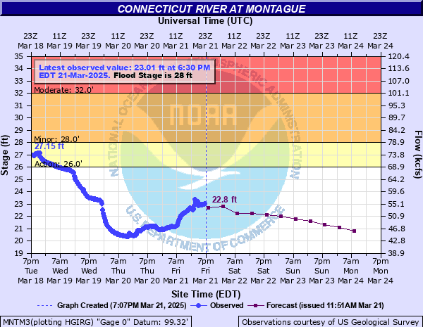
Latest Observation
Updated: 9:30 AM EST 12/9/25
Status: No Flooding
Stage: 9.18 ft
Flow: 6.84 kcfs
Forecast
| Time | Stage (ft) | Flow (kcfs) |
|---|---|---|
| 1 PM 12/9 | 8 | 4.43 |
| 7 PM 12/9 | 8 | 4.43 |
| 1 AM 12/10 | 8.1 | 4.62 |
| 7 AM 12/10 | 8 | 4.43 |
| 1 PM 12/10 | 8 | 4.43 |
| 7 PM 12/10 | 8 | 4.43 |
| 1 AM 12/11 | 8.1 | 4.62 |
| 7 AM 12/11 | 8.2 | 4.8 |
| Time | Stage (ft) | Flow (kcfs) |
|---|---|---|
| 10:30 AM 12/9 | 8.91 | 6.24 |
| 10:15 AM 12/9 | 9.17 | 6.82 |
| 10:00 AM 12/9 | 9.17 | 6.82 |
| 9:45 AM 12/9 | 9.17 | 6.82 |
| 9:30 AM 12/9 | 9.18 | 6.84 |
| 9:15 AM 12/9 | 9.17 | 6.82 |
| 9:00 AM 12/9 | 9.17 | 6.82 |
| 8:45 AM 12/9 | 9.18 | 6.84 |
| 8:30 AM 12/9 | 9.18 | 6.84 |
| 8:15 AM 12/9 | 9.19 | 6.86 |
| 8:00 AM 12/9 | 9.19 | 6.86 |
| 7:45 AM 12/9 | 9.2 | 6.88 |
| 7:30 AM 12/9 | 9.2 | 6.88 |
| 7:15 AM 12/9 | 9.2 | 6.88 |
| 7:00 AM 12/9 | 9.2 | 6.88 |
| 6:45 AM 12/9 | 9.2 | 6.88 |
| 6:30 AM 12/9 | 9.21 | 6.91 |
| 6:15 AM 12/9 | 9.21 | 6.91 |
| 6:00 AM 12/9 | 9.23 | 6.95 |
| 5:45 AM 12/9 | 9.24 | 6.98 |
| 5:30 AM 12/9 | 9.25 | 7 |
| 5:15 AM 12/9 | 9.26 | 7.02 |
| 5:00 AM 12/9 | 9.27 | 7.04 |
| 4:45 AM 12/9 | 9.29 | 7.09 |
| 4:30 AM 12/9 | 9.31 | 7.14 |
| 4:15 AM 12/9 | 9.33 | 7.18 |
| 4:00 AM 12/9 | 9.33 | 7.18 |
| 3:45 AM 12/9 | 9.34 | 7.21 |
| 3:30 AM 12/9 | 9.36 | 7.25 |
| 3:15 AM 12/9 | 9.38 | 7.3 |
44' -
This is a dangerous flood situation. Areas along the reach of the Connecticut River from the Vermont border to Northampton should prepare for widespread flooding. If you are asked to evacuate, do so immediately.
40' -
Widespread river flooding is expected from Deerfield and Montague City south through Whately and Sunderland. Take action now to protect life and property. Follow the directions of your emergency management officials. If asked to evacuate, do so immediately.
37' -
Flooding will expand into portions of Montague and Greenfield downstream through Sunderland and Whately. Some residential areas may become inundated and localized road closures may be needed.
35' -
Flooding will expand into portions of Montague and Greenfield downstream through Sunderland and Whately. Some residential areas may become inundated and localized road closures may be needed.
33' -
Flooding of low lying areas outside of levee protection is likely from Greenfield and Montague downstream through Hatfield.
31' -
Flooding of low lying areas outside of levee protection is likely from Greenfield through Hatfield.
30' -
Flooding of low lying areas outside of levee protection is likely from Greenfield through Hatfield.
29' -
Flooding of low lying areas is expected primarily from Montague downstream through Sunderland and Whately.
28' -
Minor flooding is expected to overspread some of the farmland along the river from the Vermont border downstream through Hatfield and Hadley. Farming interests should take the necessary precautions to protect livestock and equipment.
| Date | Stage (ft) |
|---|---|
| Mar 19, 1936 | 49.2 |
| Sep 22, 1938 | 44.74 |
| May 31, 1984 | 38.17 |
| Apr 6, 1960 | 38.13 |
| Dec 31, 1948 | 37.76 |
| Apr 19, 1933 | 37.56 |
| Aug 29, 2011 | 35.91 |
| Mar 23, 1948 | 35.9 |
| Apr 1, 1987 | 35.89 |
| Mar 28, 1953 | 35.4 |
| Oct 9, 2005 | 35.04 |
| May 5, 1940 | 34.88 |
| Apr 23, 1969 | 34.46 |
| Apr 13, 1934 | 33.9 |
| Jun 2, 1952 | 33.27 |
| Mar 14, 1977 | 33.15 |
| Jul 11, 2023 | 32.4 |
| Apr 1, 1951 | 32.3 |
| Apr 2, 1976 | 32.25 |
| Apr 23, 1958 | 32.11 |
Data provided by the National Weather Service.