« Back to Greenfield Community College Rivers
Connecticut River at Northampton
Critical Stages
110' - Action
112' - Flood
115' - Moderate
120' - Major
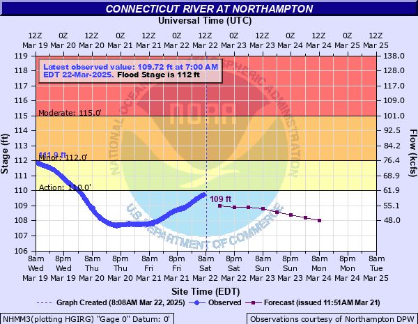
Latest Observation
Updated: 10:00 AM EST 12/9/25
Status: No Flooding
Stage: 103.02 ft
Flow: -999 kcfs
Forecast
Forecast not available for this location.
| Time | Stage (ft) | Flow (kcfs) |
|---|---|---|
| 10:00 AM 12/9 | 103.02 | -999 |
| 9:45 AM 12/9 | 103.02 | -999 |
| 9:30 AM 12/9 | 103.02 | -999 |
| 9:15 AM 12/9 | 103.02 | -999 |
| 9:00 AM 12/9 | 103.02 | -999 |
| 8:45 AM 12/9 | 103.03 | -999 |
| 8:30 AM 12/9 | 103.03 | -999 |
| 8:15 AM 12/9 | 103.03 | -999 |
| 8:00 AM 12/9 | 103.03 | -999 |
| 7:45 AM 12/9 | 103.03 | -999 |
| 7:30 AM 12/9 | 103.03 | -999 |
| 7:15 AM 12/9 | 103.03 | -999 |
| 7:00 AM 12/9 | 103.03 | -999 |
| 6:45 AM 12/9 | 103.03 | -999 |
| 6:30 AM 12/9 | 103.03 | -999 |
| 6:15 AM 12/9 | 103.03 | -999 |
| 6:00 AM 12/9 | 103.03 | -999 |
| 5:45 AM 12/9 | 103.03 | -999 |
| 5:30 AM 12/9 | 103.03 | -999 |
| 5:15 AM 12/9 | 103.03 | -999 |
| 5:00 AM 12/9 | 103.03 | -999 |
| 4:45 AM 12/9 | 103.03 | -999 |
| 4:30 AM 12/9 | 103.04 | -999 |
| 4:15 AM 12/9 | 103.04 | -999 |
| 4:00 AM 12/9 | 103.03 | -999 |
| 3:45 AM 12/9 | 103.04 | -999 |
| 3:30 AM 12/9 | 103.03 | -999 |
| 3:15 AM 12/9 | 103.03 | -999 |
| 3:00 AM 12/9 | 103.03 | -999 |
| 2:45 AM 12/9 | 103.03 | -999 |
130' -
This is near the flood of record, a very dangerous flood. Numerous road closures along the river are likely. Portions of Route 5 may be flooded in Northampton, Easthampton, and northern Holyoke. Know alternate routes. Follow detours to avoid these flooded areas. The Connecticut River may overtop the flood dike in some areas. Widespread inundation along the Mill River in Hatfield through the Valley and South Street neighborhood is expected.
126' -
The river elevation is approaching the flood of record. Significant impact to both residential and business interests is expected. Follow evacuation orders from local officials. Some roadways, including portions of Route 5 will be closed due to flooding. Know alternate routes and obey all road closures to avoid these areas.
123' -
Significant flooding will impact Northampton, Easthampton, Hadley and South Hadley. Avoid flooded areas. Follow the directions of local officials, and evacuate if asked to do so. This is a major flood, various low lying residential areas in the vicinity of the river will become inundated and various road closures will occur.
121' -
Extensive flooding is likely to impact Northampton, Easthampton, Hadley and South Hadley. Follow the directions of local officials and evacuate immediately if asked to do so.
119' -
Hatfield will continue to experience more extensive flooding as flood waters spread across King Street as well as parts of Main Street on the north side of town. Multiple street closures are likely. Significant flooding occurs in Northampton, Easthampton, Hadley and South Hadley. Follow the directions of local officials and evacuate immediately if asked to do so.
118' -
Flooding spreads across sections of Hatfield, Hadley, Northampton, Easthampton and South Hadley. Should evacuations be required, follow the directions of local officials and head to higher ground quickly. Farming interests will be significantly impacted in the Pioneer Valley as flood waters continue to rise.
117' -
Flooding impacts a large portion of the Oxbow in Northampton. Flooding associated with back water from the Connecticut will continue to impact Hatfield. Flooding will continue to worsen along the Mill River in Hatfield while flooding begins to affect parts of Cronin Hill. Some streets may be closed and some local evacuations may be required. Flooding will also become more widespread throughout Northampton.
115' -
Flooding affects a large portion of the Oxbow in Northampton. Flood waters also reach Route 5, a portion of which may be impassable. Flooding spreads across the lower lying sections of Hadley. In Hatfield, back water from the Connecticut River will push the Mill River over its banks, flooding parts of Valley Street and surrounding areas.
114' -
Flooding affects the Oxbow in Northampton, including Riverside Homes on Island Road. Flooding also spreads across parts of Hadley. In Hatfield, back water from the Connecticut River will push the Mill River over its banks flooding parts of Valley Street and surrounding areas.
113' -
Minor flooding will affect portions of Northampton in the vicinity of the Oxbow and Hadley along Aqua Vitae Road. Farming interests in Hatfield outside flood dike protection will experience flooding.
112' -
Lowland flooding is expected in and around Northampton including low lying sections of the Oxbow. Minor flooding affects Hadley along Aqua Vitae Road. In Hatfield, flooding is expected in the lowest lying sections, primarily farming interests outside flood dike protection.
| Date | Stage (ft) |
|---|---|
| Mar 19, 1936 | 129.4 |
| Sep 22, 1938 | 125 |
| May 31, 1984 | 120.8 |
| Apr 6, 1960 | 119.9 |
| Jan 1, 1949 | 118.6 |
| Apr 1, 1987 | 118 |
| Mar 23, 1948 | 117.7 |
| Mar 29, 1953 | 117.6 |
| Aug 30, 2011 | 117.16 |
| May 5, 1940 | 117 |
| Oct 9, 2005 | 116.3 |
| Mar 15, 1977 | 116.2 |
| Jun 3, 1952 | 116 |
| Apr 3, 1976 | 115.7 |
| Jul 12, 2023 | 115.53 |
| Apr 23, 1969 | 115.5 |
| Apr 1, 1951 | 115.4 |
| Apr 24, 1958 | 115.3 |
| Mar 24, 1968 | 115.2 |
| May 1, 1956 | 115 |
Data provided by the National Weather Service.