White Lick Creek at Mooresville
Critical Stages
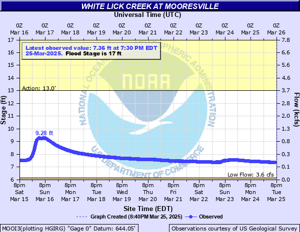
13' - Action
17' - Flood
20' - Moderate
23' - Major
Latest Observation
Updated: 8:30 PM EST 12/7/25
Status: No Flooding
Stage: 6.76 ft
Flow: 0.0347 kcfs
Forecast
Forecast not available for this location.
| Time | Stage (ft) | Flow (kcfs) |
|---|---|---|
| 8:30 PM 12/7 | 6.76 | 0.0347 |
| 8:15 PM 12/7 | 6.76 | 0.0347 |
| 8:00 PM 12/7 | 6.76 | 0.0347 |
| 7:45 PM 12/7 | 6.76 | 0.0347 |
| 7:30 PM 12/7 | 6.76 | 0.0347 |
| 7:15 PM 12/7 | 6.76 | 0.0347 |
| 7:00 PM 12/7 | 6.76 | 0.0347 |
| 6:45 PM 12/7 | 6.75 | 0.0336 |
| 6:30 PM 12/7 | 6.75 | 0.0336 |
| 6:15 PM 12/7 | 6.75 | 0.0336 |
| 6:00 PM 12/7 | 6.75 | 0.0336 |
| 5:45 PM 12/7 | 6.75 | 0.0336 |
| 5:30 PM 12/7 | 6.75 | 0.0336 |
| 5:15 PM 12/7 | 6.75 | 0.0336 |
| 5:00 PM 12/7 | 6.75 | 0.0336 |
| 4:45 PM 12/7 | 6.75 | 0.0336 |
| 4:30 PM 12/7 | 6.76 | 0.0347 |
| 4:15 PM 12/7 | 6.76 | 0.0347 |
| 4:00 PM 12/7 | 6.76 | 0.0347 |
| 3:45 PM 12/7 | 6.75 | 0.0336 |
| 3:30 PM 12/7 | 6.75 | 0.0336 |
| 3:15 PM 12/7 | 6.76 | 0.0347 |
| 3:00 PM 12/7 | 6.76 | 0.0347 |
| 2:45 PM 12/7 | 6.76 | 0.0347 |
| 2:30 PM 12/7 | 6.76 | 0.0347 |
| 2:15 PM 12/7 | 6.76 | 0.0347 |
| 2:00 PM 12/7 | 6.76 | 0.0347 |
| 1:45 PM 12/7 | 6.76 | 0.0347 |
| 1:30 PM 12/7 | 6.76 | 0.0347 |
| 1:15 PM 12/7 | 6.76 | 0.0347 |
23' -
Major flooding in progress along White Lick Creek from the Plainfield area to Brooklyn. Numerous local roads flooded. Flood waters beginning to affect shopping center complex in southern Mooresville north and south of Indiana 67. Water is close to bottom of bridge on Indiana 67.
21' -
Greencastle Road and North White Lick Road on west side of creek flood. Water on the edge of Bottom Road at Rinker Road. Extensive flooding of Old SR 267 just north of I-70.
20.81' -
During June 2010...a flood bigger than June 2008 occurred upstream in Hendricks County as a result of a partial dam failure and nearly five inches of rain. Crystal Bay at the southern end of Hummel Park flooded. Water flowed over CR 600S. After debris removal on a county road near Hummel Park, Old SR 267 north of I-70 and SR 267 on the north side of Mooresville near the Gravel Pits flooded. This flood wave attenuated as it reached SR 42 because the level was about 3 feet lower than June 2008.
20.8' -
During June 2010 flood...additional roads flooded included...in Hendricks County...CR 600E about one half mile north of CR 300N, south entrance to Indiana's Boy School from CR 700E, CR 725 E near CR 600S, and in Morgan County...Bottom Road south of Brooklyn.
20' -
Extensive agricultural flooding is in progress.
17.9' -
South portion of Blue Heron Trail in Plainfield Park flooded by two to three feet of water in fishing lake area.
17' -
Flooding begins along portions of White Lick Creek.
13.6' -
The lowest portion of Blue Heron Lake area just west of Crystal Bay Condos has water on the paved walking trail in the fishing lake area.
11.4' -
The lowest portion of Blue Heron Lake Trail in Hummell Park in Plainfield has water over the paved trail between the two fishing lakes. This may begin as low as the 10.5 level.
| Date | Stage (ft) |
|---|---|
| Jun 7, 2008 | 23.8 |
| Apr 19, 2013 | 23.65 |
| Jul 13, 1979 | 23.31 |
| Sep 2, 2003 | 23.28 |
| Mar 4, 1963 | 22.95 |
| Jun 28, 1957 | 22.5 |
| Nov 14, 1993 | 22.27 |
| Dec 30, 1990 | 22.15 |
| Jul 29, 1979 | 21.86 |
| Mar 14, 1978 | 21.82 |
| Jan 14, 1950 | 21.8 |
| Jan 21, 1959 | 21.71 |
| Aug 2, 1979 | 21.64 |
| May 8, 1961 | 21.56 |
| Jun 7, 2008 | 21.52 |
| Jul 20, 1969 | 21.51 |
| Feb 23, 1975 | 21.31 |
| Jun 23, 1960 | 21.21 |
| May 24, 1968 | 21.16 |
| Jan 13, 2013 | 21.11 |
Data provided by the National Weather Service.