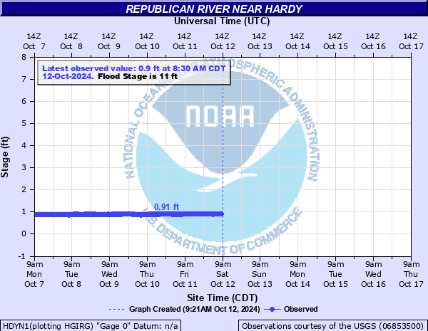
Republican River near Hardy
Critical Stages
9' - Action
11' - Flood
13.5' - Moderate
15.5' - Major
Latest Observation
Updated: 4:30 AM CST 12/16/25
Status: No Flooding
Stage: 1.38 ft
Flow: 0.0504 kcfs
Forecast
Forecast not available for this location.
| Time | Stage (ft) | Flow (kcfs) |
|---|---|---|
| 4:30 AM 12/16 | 1.38 | 0.0504 |
| 4:15 AM 12/16 | 1.38 | 0.0504 |
| 4:00 AM 12/16 | 1.38 | 0.0504 |
| 3:45 AM 12/16 | 1.39 | 0.0517 |
| 3:30 AM 12/16 | 1.39 | 0.0517 |
| 3:15 AM 12/16 | 1.39 | 0.0517 |
| 3:00 AM 12/16 | 1.4 | 0.053 |
| 2:45 AM 12/16 | 1.4 | 0.053 |
| 2:30 AM 12/16 | 1.41 | 0.0541 |
| 2:15 AM 12/16 | 1.41 | 0.0541 |
| 2:00 AM 12/16 | 1.41 | 0.0541 |
| 1:45 AM 12/16 | 1.42 | 0.0553 |
| 1:30 AM 12/16 | 1.42 | 0.0553 |
| 1:15 AM 12/16 | 1.42 | 0.0553 |
| 1:00 AM 12/16 | 1.43 | 0.0564 |
| 12:45 AM 12/16 | 1.43 | 0.0564 |
| 12:30 AM 12/16 | 1.42 | 0.0553 |
| 12:15 AM 12/16 | 1.43 | 0.0564 |
| 12:00 AM 12/16 | 1.43 | 0.0564 |
| 11:45 PM 12/15 | 1.42 | 0.0553 |
| 11:30 PM 12/15 | 1.42 | 0.0553 |
| 11:15 PM 12/15 | 1.42 | 0.0553 |
| 11:00 PM 12/15 | 1.42 | 0.0553 |
| 10:45 PM 12/15 | 1.42 | 0.0553 |
| 10:30 PM 12/15 | 1.41 | 0.0541 |
| 10:15 PM 12/15 | 1.41 | 0.0541 |
| 10:00 PM 12/15 | 1.4 | 0.053 |
| 9:45 PM 12/15 | 1.39 | 0.0517 |
| 9:30 PM 12/15 | 1.38 | 0.0504 |
| 9:15 PM 12/15 | 1.37 | 0.0492 |
17' -
Water nears the bottom of the county road bridge south of Hardy.
14' -
The left bank overflows and the river reaches a maximum width of around 1 mile. One tributary crossing Highway 14 and entering the river on the left, immediately below the river bridge will carry overflow water.
13.5' -
The county road going south out of Hardy will be inundated and unpassable along both the north and south approach of the Republican River bridge. In addition, a house will be threatened on the south side of the river off of Road 3600 south of Superior. This home required sandbagging during the July flooding of 2019 when the river reached a stage of 13.77 feet.
12.5' -
The north and south approach of the Republican River Bridge south of Hardy will see shallow flooding as the river expands outward reaching a maximum width of 0.9 mile.
12' -
The north and south approaches to the river bridge can flood. However, even at extreme flows, the town of Hardy is not threatened by flooding. A record flood of 19.4 feet occurred in June of 1935.
11' -
Water floods rural agricultural land.
| Date | Stage (ft) |
|---|---|
| Jun 2, 1935 | 19.4 |
| Jun 24, 1947 | 17 |
| Jun 17, 1957 | 14.83 |
| May 7, 2015 | 13.92 |
| Jul 11, 2019 | 13.77 |
| Jul 10, 1950 | 13.7 |
| Oct 1, 1983 | 13.65 |
| Jun 9, 1941 | 13.2 |
| Jun 9, 1949 | 12.6 |
| Jun 2, 1951 | 12.59 |
| Sep 4, 1973 | 12.57 |
| Jul 27, 1993 | 12.48 |
| Sep 13, 1977 | 11.83 |
| May 14, 1982 | 11.68 |
| May 21, 2011 | 11.65 |
| Mar 28, 1960 | 11.48 |
| Aug 4, 1985 | 11.29 |
| Jun 14, 2010 | 11.22 |
| Jul 7, 1946 | 11.2 |
| Jul 14, 1992 | 11.19 |
Data provided by the National Weather Service.