West Fork Des Moines River above Windom
Critical Stages
17' - Action
19' - Flood
21' - Moderate
25' - Major
Latest Observation
Updated: 3:00 PM CST 12/15/25
Status: No Flooding
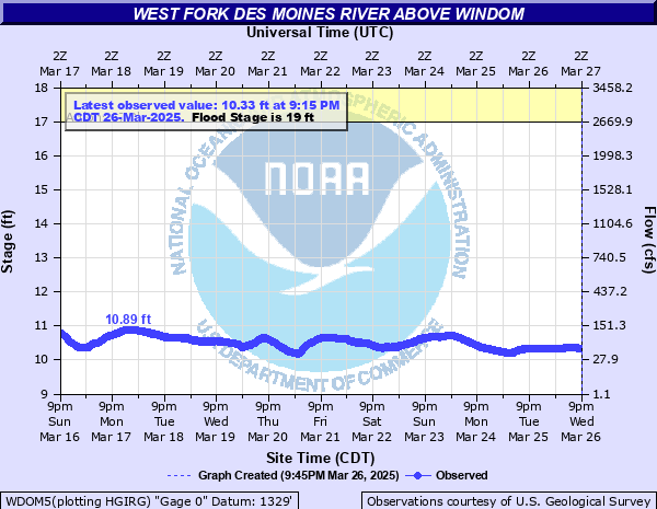
Stage: 10.25 ft
Flow: 0.0828 kcfs
Forecast
Forecast not available for this location.
| Time | Stage (ft) | Flow (kcfs) |
|---|---|---|
| 3:00 PM 12/15 | 10.25 | 0.0828 |
| 2:45 PM 12/15 | 10.25 | 0.0828 |
| 2:30 PM 12/15 | 10.25 | 0.0828 |
| 2:15 PM 12/15 | 10.25 | 0.0828 |
| 2:00 PM 12/15 | 10.25 | 0.0828 |
| 1:45 PM 12/15 | 10.25 | 0.0828 |
| 1:30 PM 12/15 | 10.25 | 0.0828 |
| 1:15 PM 12/15 | 10.25 | 0.0828 |
| 1:00 PM 12/15 | 10.25 | 0.0828 |
| 12:45 PM 12/15 | 10.25 | 0.0828 |
| 12:30 PM 12/15 | 10.25 | 0.0828 |
| 12:15 PM 12/15 | 10.24 | 0.0816 |
| 12:00 PM 12/15 | 10.24 | 0.0816 |
| 11:45 AM 12/15 | 10.24 | 0.0816 |
| 11:30 AM 12/15 | 10.24 | 0.0816 |
| 11:15 AM 12/15 | 10.24 | 0.0816 |
| 11:00 AM 12/15 | 10.24 | 0.0816 |
| 10:45 AM 12/15 | 10.23 | 0.0804 |
| 10:30 AM 12/15 | 10.24 | 0.0816 |
| 10:15 AM 12/15 | 10.23 | 0.0804 |
| 10:00 AM 12/15 | 10.23 | 0.0804 |
| 9:45 AM 12/15 | 10.23 | 0.0804 |
| 9:30 AM 12/15 | 10.23 | 0.0804 |
| 9:15 AM 12/15 | 10.23 | 0.0804 |
| 9:00 AM 12/15 | 10.23 | 0.0804 |
| 8:45 AM 12/15 | 10.23 | 0.0804 |
| 8:30 AM 12/15 | 10.23 | 0.0804 |
| 8:15 AM 12/15 | 10.23 | 0.0804 |
| 8:00 AM 12/15 | 10.22 | 0.0793 |
| 7:45 AM 12/15 | 10.23 | 0.0804 |
30' -
The bridge at the gage location on Country Club Dr is overtopped and nearby homes are flooded. Portions of County Road 13 begin to flood.
27' -
Highway 71 in Windom is flooded and significant flooding of homes and businesses will be ongoing. The main levee at the golf course in Windom is overtopped.
25' -
Water approaches Hwy 71 in Windom as well as the bottom of the railroad bridge. A significant amount of water overtops River Rd and backs up through the Perkins Creek floodplain, flooding nearby homes and outbuildings.
24' -
Water reaches the bottom beams of the bridge on Country Club Dr.
23' -
Water begins to approach at least a couple home and businesses in Windom. Water also approaches River Rd southeast of 15th Ave and at least one private driveway is flooded off of Country Club Dr.
22' -
Water begins to approach or flood some some outbuildings near Valley Ln and also south of 6th St.
21' -
The lower portions of the road through Island Park are overtopped and water approaches a couple of the gravel parking lots on the east side of Hwy 71 in Windom.
19' -
Lowland flooding begins along several stretches of the river and Island Park in Windom floods in several areas.
18' -
The boat launch area off of River Rd begins to flood.
17' -
The lower parking lot on the south side of Island Park begins to flood.
15' -
The lower banks at Island Park begin to overflow.
| Date | Stage (ft) |
|---|---|
| Jun 25, 2024 | 25.01 |
| Apr 11, 1969 | 24.7 |
| Jul 7, 2018 | 23.4 |
| Mar 23, 2019 | 23.01 |
| Sep 24, 2010 | 23 |
| Apr 4, 1984 | 21.9 |
| Mar 25, 2011 | 21.79 |
| Jun 22, 2014 | 21.57 |
| Apr 27, 2001 | 21.57 |
| Mar 30, 1997 | 21.34 |
| May 12, 1993 | 21.3 |
| Jul 7, 1993 | 21.1 |
| Mar 10, 2020 | 19.77 |
| Jun 23, 1996 | 19.77 |
| Mar 16, 2007 | 19.7 |
| May 5, 2006 | 19.5 |
| Apr 17, 2023 | 18.13 |
| Jun 13, 2022 | 17.64 |
| Apr 12, 2021 | 12.57 |
Data provided by the National Weather Service.