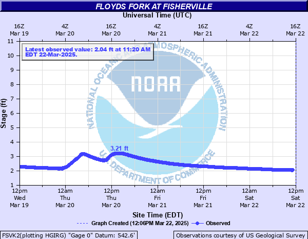
Floyds Fork at Fisherville
Critical Stages
Action
Flood
Moderate
Major
Latest Observation
Updated: 12:20 AM EST 12/15/25
Status: Not Defined
Stage: 1.37 ft
Flow: -999 kcfs
Forecast
Forecast not available for this location.
| Time | Stage (ft) | Flow (kcfs) |
|---|---|---|
| 1:20 AM 12/15 | 1.41 | -999 |
| 1:15 AM 12/15 | 1.41 | -999 |
| 1:10 AM 12/15 | 1.41 | -999 |
| 1:05 AM 12/15 | 1.4 | -999 |
| 1:00 AM 12/15 | 1.39 | -999 |
| 12:55 AM 12/15 | 1.38 | -999 |
| 12:50 AM 12/15 | 1.35 | -999 |
| 12:45 AM 12/15 | 1.31 | -999 |
| 12:40 AM 12/15 | 1.3 | -999 |
| 12:35 AM 12/15 | 1.3 | -999 |
| 12:30 AM 12/15 | 1.33 | -999 |
| 12:25 AM 12/15 | 1.36 | -999 |
| 12:20 AM 12/15 | 1.37 | -999 |
| 12:15 AM 12/15 | 1.39 | -999 |
| 12:10 AM 12/15 | 1.4 | -999 |
| 12:05 AM 12/15 | 1.4 | -999 |
| 12:00 AM 12/15 | 1.41 | -999 |
| 11:55 PM 12/14 | 1.41 | -999 |
| 11:50 PM 12/14 | 1.42 | -999 |
| 11:45 PM 12/14 | 1.42 | -999 |
| 11:40 PM 12/14 | 1.42 | -999 |
| 11:35 PM 12/14 | 1.42 | -999 |
| 11:30 PM 12/14 | 1.42 | -999 |
| 11:25 PM 12/14 | 1.42 | -999 |
| 11:20 PM 12/14 | 1.41 | -999 |
| 11:15 PM 12/14 | 1.4 | -999 |
| 11:10 PM 12/14 | 1.39 | -999 |
| 11:05 PM 12/14 | 1.38 | -999 |
| 11:00 PM 12/14 | 1.36 | -999 |
| 10:55 PM 12/14 | 1.35 | -999 |
7' -
The Strand portion of The Parklands of the Louisville loop floods.
| Date | Stage (ft) |
|---|---|
| Mar 2, 1997 | 17.39 |
| Jan 1, 1937 | 16.8 |
| Apr 2, 1970 | 16.15 |
| Mar 1, 1943 | 15.7 |
| Sep 14, 1979 | 15.26 |
| Apr 9, 1964 | 15.24 |
| Sep 23, 2006 | 15.1 |
| Feb 15, 1990 | 15.07 |
| May 8, 1961 | 14.7 |
| Feb 18, 2000 | 14.48 |
| Apr 4, 1989 | 14.22 |
| May 1, 1983 | 14.08 |
| Jun 23, 1960 | 13.7 |
| Feb 23, 1975 | 13.68 |
| Apr 12, 2011 | 13.67 |
| Apr 3, 2015 | 13.38 |
| Apr 12, 1948 | 13.34 |
| Apr 4, 2008 | 13.13 |
| May 10, 1950 | 13.12 |
| Oct 1, 1977 | 13.09 |
Data provided by the National Weather Service.