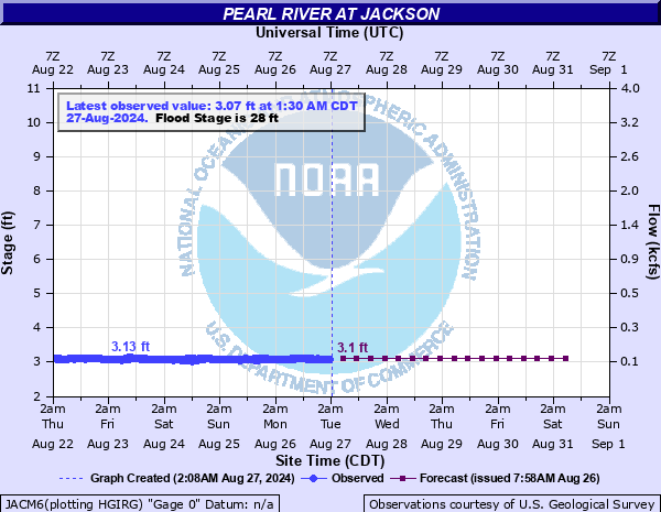
Pearl River at Jackson
Critical Stages
24' - Action
28' - Flood
33' - Moderate
36' - Major
Latest Observation
Updated: 11:30 AM CST 12/11/25
Status: No Flooding
Stage: 3.83 ft
Flow: 0.267 kcfs
Forecast
| Time | Stage (ft) | Flow (kcfs) |
|---|---|---|
| 6 PM 12/11 | 3.8 | 0.26 |
| 12 AM 12/12 | 3.8 | 0.26 |
| 6 AM 12/12 | 3.8 | 0.26 |
| 12 PM 12/12 | 3.8 | 0.26 |
| 6 PM 12/12 | 3.8 | 0.26 |
| 12 AM 12/13 | 3.8 | 0.26 |
| 6 AM 12/13 | 3.8 | 0.26 |
| 12 PM 12/13 | 3.8 | 0.26 |
| 6 PM 12/13 | 3.8 | 0.26 |
| 12 AM 12/14 | 3.8 | 0.26 |
| 6 AM 12/14 | 3.8 | 0.26 |
| 12 PM 12/14 | 3.8 | 0.26 |
| 6 PM 12/14 | 3.8 | 0.26 |
| 12 AM 12/15 | 3.8 | 0.26 |
| 6 AM 12/15 | 3.8 | 0.26 |
| 12 PM 12/15 | 3.8 | 0.26 |
| 6 PM 12/15 | 3.8 | 0.26 |
| 12 AM 12/16 | 3.8 | 0.26 |
| 6 AM 12/16 | 3.8 | 0.26 |
| Time | Stage (ft) | Flow (kcfs) |
|---|---|---|
| 11:30 AM 12/11 | 3.83 | 0.267 |
| 11:15 AM 12/11 | 3.84 | 0.269 |
| 11:00 AM 12/11 | 3.83 | 0.267 |
| 10:45 AM 12/11 | 3.84 | 0.269 |
| 10:30 AM 12/11 | 3.83 | 0.267 |
| 10:15 AM 12/11 | 3.84 | 0.269 |
| 10:00 AM 12/11 | 3.84 | 0.269 |
| 9:45 AM 12/11 | 3.83 | 0.267 |
| 9:30 AM 12/11 | 3.84 | 0.269 |
| 9:15 AM 12/11 | 3.84 | 0.269 |
| 9:00 AM 12/11 | 3.83 | 0.267 |
| 8:45 AM 12/11 | 3.83 | 0.267 |
| 8:30 AM 12/11 | 3.83 | 0.267 |
| 8:15 AM 12/11 | 3.83 | 0.267 |
| 8:00 AM 12/11 | 3.83 | 0.267 |
| 7:45 AM 12/11 | 3.84 | 0.269 |
| 7:30 AM 12/11 | 3.83 | 0.267 |
| 7:15 AM 12/11 | 3.83 | 0.267 |
| 7:00 AM 12/11 | 3.83 | 0.267 |
| 6:45 AM 12/11 | 3.83 | 0.267 |
| 6:30 AM 12/11 | 3.83 | 0.267 |
| 6:15 AM 12/11 | 3.83 | 0.267 |
| 6:00 AM 12/11 | 3.83 | 0.267 |
| 5:45 AM 12/11 | 3.83 | 0.267 |
| 5:30 AM 12/11 | 3.83 | 0.267 |
| 5:15 AM 12/11 | 3.83 | 0.267 |
| 5:00 AM 12/11 | 3.84 | 0.269 |
| 4:45 AM 12/11 | 3.83 | 0.267 |
| 4:30 AM 12/11 | 3.83 | 0.267 |
| 4:15 AM 12/11 | 3.83 | 0.267 |
43.28' -
Major flooding is occurring along the river from Northeast Jackson to Flowood toRichland and Byram.
38' -
A large number of homes are flooded in Northeast Jackson and water is in some buildings in Downtown Jackson.
35.79' -
Water is close to entering homes in Northeast Jackson.
35.4' -
Water approaches homes in the Hightower Area.
35' -
Some businesses are affected near Town Creek. River waters will flood some of the streets of Northeast Jackson subdivisions which are close to the river and a number of additional streets in downtown Jackson.
34' -
Dozens of additional streets flood in downtown Jackson.
33' -
Rosemary Road is closed. Sidney Street is impassable. There is water on West Street. The playing field off Westbrook Road is underwater. Water is on Nichols and Julienne streets in the Hightower Area; however, both are passable. Water is approaching packs auto detail shop on South West Street.
32' -
Water begins to affect businesses on South President and South Farish streets. Sidney Street is flooded.
31' -
Water begins to impact approaches to additional homes and businesses in the Byram area.
30' -
Water backs up into several creeks and streams in the Jackson area. Water is under some homes near the river in the Byram area.
29' -
Farmland in southern Rankin County begins to flood and water begins to affect home access near the river in the Byram area.
28' -
Minor flooding of lowland near the river is occurring. Water begins to back up into several creeks and streams in the Jackson area.
26' -
Roads near the river in Lefleurs Bluff State Park begin to flood.
24' -
The Jackson waste water treatment plant loses its natural outflow and must initiate pumping.
| Date | Stage (ft) |
|---|---|
| Apr 17, 1979 | 43.28 |
| May 25, 1983 | 39.58 |
| Feb 17, 2020 | 36.67 |
| Mar 31, 1902 | 36.3 |
| Dec 5, 1880 | 36.3 |
| Dec 7, 1982 | 36.07 |
| Dec 21, 1961 | 36.04 |
| Apr 25, 1874 | 36 |
| Apr 3, 1976 | 35.74 |
| Jan 27, 1979 | 35.7 |
| Apr 15, 1980 | 35.63 |
| Apr 8, 1983 | 35.58 |
| Apr 21, 1900 | 35.5 |
| Aug 29, 2022 | 35.38 |
| Feb 24, 2003 | 35.25 |
| Apr 8, 2003 | 35.16 |
| May 4, 1991 | 35.12 |
| Feb 12, 1983 | 35.08 |
| Mar 21, 1980 | 35 |
| Mar 30, 1980 | 35 |
Data provided by the National Weather Service.