« Back to Hickory Hills Rivers
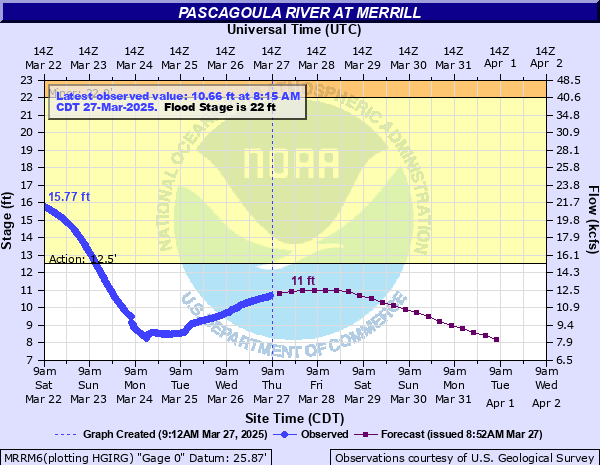
Pascagoula River at Merrill
Critical Stages
12.5' - Action
22' - Flood
25' - Moderate
32' - Major
Latest Observation
Updated: 1:15 PM CST 12/15/25
Status: No Flooding
Stage: 3.38 ft
Flow: 2.3 kcfs
Forecast
| Time | Stage (ft) | Flow (kcfs) |
|---|---|---|
| 6 PM 12/15 | 3.4 | 2.32 |
| 12 AM 12/16 | 3.4 | 2.32 |
| 6 AM 12/16 | 3.4 | 2.32 |
| 12 PM 12/16 | 3.4 | 2.32 |
| 6 PM 12/16 | 3.4 | 2.32 |
| 12 AM 12/17 | 3.3 | 2.22 |
| 6 AM 12/17 | 3.3 | 2.22 |
| 12 PM 12/17 | 3.3 | 2.22 |
| 6 PM 12/17 | 3.3 | 2.22 |
| 12 AM 12/18 | 3.3 | 2.22 |
| 6 AM 12/18 | 3.3 | 2.22 |
| 12 PM 12/18 | 3.2 | 2.13 |
| 6 PM 12/18 | 3.2 | 2.13 |
| 12 AM 12/19 | 3.2 | 2.13 |
| 6 AM 12/19 | 3.2 | 2.13 |
| 12 PM 12/19 | 3.1 | 2.04 |
| 6 PM 12/19 | 3.1 | 2.04 |
| 12 AM 12/20 | 3.1 | 2.04 |
| 6 AM 12/20 | 3.1 | 2.04 |
| Time | Stage (ft) | Flow (kcfs) |
|---|---|---|
| 1:15 PM 12/15 | 3.38 | 2.3 |
| 1:00 PM 12/15 | 3.38 | 2.3 |
| 12:45 PM 12/15 | 3.38 | 2.3 |
| 12:30 PM 12/15 | 3.39 | 2.31 |
| 12:15 PM 12/15 | 3.38 | 2.3 |
| 12:00 PM 12/15 | 3.38 | 2.3 |
| 11:45 AM 12/15 | 3.39 | 2.31 |
| 11:30 AM 12/15 | 3.39 | 2.31 |
| 11:15 AM 12/15 | 3.39 | 2.31 |
| 11:00 AM 12/15 | 3.38 | 2.3 |
| 10:45 AM 12/15 | 3.39 | 2.31 |
| 10:30 AM 12/15 | 3.39 | 2.31 |
| 10:15 AM 12/15 | 3.39 | 2.31 |
| 10:00 AM 12/15 | 3.4 | 2.32 |
| 9:45 AM 12/15 | 3.39 | 2.31 |
| 9:30 AM 12/15 | 3.4 | 2.32 |
| 9:15 AM 12/15 | 3.39 | 2.31 |
| 9:00 AM 12/15 | 3.39 | 2.31 |
| 8:45 AM 12/15 | 3.39 | 2.31 |
| 8:30 AM 12/15 | 3.39 | 2.31 |
| 8:15 AM 12/15 | 3.39 | 2.31 |
| 8:00 AM 12/15 | 3.4 | 2.32 |
| 7:45 AM 12/15 | 3.4 | 2.32 |
| 7:30 AM 12/15 | 3.4 | 2.32 |
| 7:15 AM 12/15 | 3.4 | 2.32 |
| 7:00 AM 12/15 | 3.4 | 2.32 |
| 6:45 AM 12/15 | 3.4 | 2.32 |
| 6:30 AM 12/15 | 3.4 | 2.32 |
| 6:15 AM 12/15 | 3.4 | 2.32 |
| 6:00 AM 12/15 | 3.41 | 2.33 |
32' -
A portion of the railroad tracks will become flooded. USGS 100 year flood.
25' -
Flooding of some residences will occur as the level rises above 25 feet.
24' -
Streets of Merrill will become flooded. At 24 feet the bridge becomes inaccessible by vehicles.
23.5' -
Water is under homes in Plum Bluff Estates. Streets of Merrill flood.
22' -
Flood Stage. Water approaches homes in west Merrill.
20' -
Water covers the main road at Plum Bluff in southern George County.
18.5' -
Water covers roads at Smith's Fish Camp in Southern George County.
18' -
Some roads west of the river become flooded.
15' -
Water is under homes in Cedar Creek Estates.
14' -
Roads to Cedar Creek Estates are impassable.
13' -
Water covers the roads in Cedar Creek Estates in northern Jackson County.
| Date | Stage (ft) |
|---|---|
| Apr 1, 1900 | 32.5 |
| Jul 9, 1916 | 31 |
| Feb 27, 1961 | 30.66 |
| Apr 22, 1912 | 30.2 |
| Apr 13, 1938 | 29.71 |
| Dec 15, 1919 | 29.5 |
| Jun 4, 1909 | 29.1 |
| Jun 8, 1928 | 28.6 |
| Apr 19, 1974 | 28.37 |
| Mar 16, 2016 | 28.02 |
| Jan 1, 2019 | 27.52 |
| Feb 15, 1905 | 27.5 |
| Mar 24, 1943 | 27.06 |
| Apr 3, 1980 | 26.98 |
| Apr 21, 1921 | 26.9 |
| Apr 9, 1983 | 26.89 |
| Mar 21, 1929 | 26.4 |
| Feb 23, 1990 | 26.38 |
| Feb 18, 1966 | 26.01 |
| Feb 15, 2013 | 26 |
Data provided by the National Weather Service.