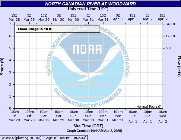
North Canadian River at Woodward
Critical Stages
9' - Action
10' - Flood
12' - Moderate
13' - Major
Latest Observation
Updated: 6:09 PM LMT 12/31/00
Status: Obs Not Current
Stage: -999 ft
Flow: -999 kcfs
Forecast
Forecast not available for this location.
Observation history not available.
17' -
Very serious flooding of mobile and suburban homes occurs at the northern edge of Woodward. In addition... flooding affects croplands... pastures... oil and gas wells... and rural roads... extending along the river from southern Harper County east of Laverne... to central Woodward County. Flooding affects areas in Harper County several hours before the crest reaches the Woodward vicinity. Property should be moved to places 7 feet higher than nearby river banks to avoid being stranded for several hours.
16' -
Serious flooding of mobile and suburban homes occurs at the northern edge of Woodward. In addition... flooding affects croplands... pastures... oil and gas wells... and rural roads... extending along the river from southern Harper County east of Laverne to central Woodward County. Flooding affects areas in Harper County several hours before the crest reaches the Woodward vicinity. Property should be moved to places 6 feet higher than nearby river banks to avoid being stranded for several hours.
15' -
Serious flooding or isolation of mobile and suburban homes occurs at the northern edge of Woodward. In addition... flooding affects croplands... pastures... oil and gas wells... and rural roads... extending along the river from southern Harper County east of Laverne to mid Woodward County. Flooding affects areas in Harper County several hours before the crest reaches the Woodward vicinity. Property should be moved to places 5 feet higher than nearby river banks to avoid being stranded for several hours.
14' -
Shallow flooding or isolation of mobile and suburban homes occurs at the northern edge of Woodward. In addition... flooding affects croplands... pastures... oil wells... and rural roads... extending along the river from southern Harper County east of Laverne... to central Woodward County. Flooding affects areas in Harper County several hours before the crest reaches the Woodward vicinity. Property should be moved to places 4 feet higher than nearby river banks to avoid being stranded for several hours.
13' -
Shallow flooding or isolation of mobile and suburban homes occurs at the northern edge of Woodward. Deeper flooding affects croplands... pastures... oil and gas wells... and rural roads... and extend along the river from southern Harper County east of Laverne... to central Woodward County. Flooding affects areas in Harper County several hours before the crest reaches the Woodward vicinity. Property should be moved to places 3 feet higher than nearby river banks to avoid being stranded for several hours.
12' -
Flooding of croplands... pastures... oil and gas wells... and rural roads... extends along the river from southern Harper County east of Laverne... to central Woodward County. Shallow depths may approach the edge of Woodward. Flooding affects areas in Harper County several hours before the crest reaches the Woodward vicinity. Cattle and other property should be moved to locations 2 feet higher than nearby river banks to avoid being stranded for hours.
11' -
Flooding of croplands... pastures... oil and gas wells... and rural roads... extends along the river from southern Harper County east of Laverne... to central Woodward County. Shallow depths may approach the edge of Woodward. Flooding affects areas in Harper County several hours before the crest reaches the Woodward vicinity. Cattle and other property should be moved to locations 1 foot higher than nearby river banks to avoid being stranded for hours.
10' -
Flooding of croplands... pastures... oil and gas wells... and rural roads... extends along the river from southern Harper County east of Laverne... to central Woodward County. Flooding affects areas in Harper County several hours before the crest reaches the Woodward vicinity. Cattle and other property should be moved to locations higher than nearby river banks to avoid being stranded for hours by high water in side channels.
9' -
Near bankfull conditions extend along the river from southern Harper County east of Laverne... to central Woodward County. Cattle and other property should be moved to locations higher than nearby river banks to avoid being stranded for hours by high water in side channels.
| Date | Stage (ft) |
|---|---|
| Oct 12, 1923 | 15.85 |
| May 18, 1935 | 15.4 |
| Jun 10, 1923 | 14.9 |
| Oct 10, 1946 | 14.8 |
| Oct 22, 1920 | 14.4 |
| May 18, 1951 | 13.7 |
| Sep 8, 1920 | 12.9 |
| Jun 6, 1936 | 12.8 |
| Oct 23, 1941 | 12.7 |
| Mar 15, 1922 | 12.6 |
| May 22, 1989 | 12.4 |
| Aug 3, 1950 | 12.06 |
| May 7, 1933 | 12 |
| Jun 16, 1937 | 11.8 |
| Jun 17, 1932 | 11.8 |
| Jul 28, 1950 | 11.68 |
| Oct 19, 1968 | 11.5 |
| Jul 23, 1950 | 11.5 |
| Jun 11, 1968 | 11.4 |
| Jun 15, 1965 | 11.3 |
Data provided by the National Weather Service.