« Back to Highland Heights Rivers
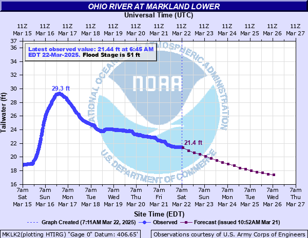
Ohio River at Markland Lower
Critical Stages
49' - Action
51' - Flood
62' - Moderate
74' - Major
Latest Observation
Updated: 1:45 PM EST 12/15/25
Status: No Flooding
Stage: 15.06 ft
Flow: 58.3 kcfs
Forecast
| Time | Stage (ft) | Flow (kcfs) |
|---|---|---|
| 7 PM 12/15 | 15 | 57.7 |
| 1 AM 12/16 | 14.9 | 56.8 |
| 7 AM 12/16 | 14.8 | 55.8 |
| 1 PM 12/16 | 14.8 | 55.8 |
| 7 PM 12/16 | 14.8 | 55.8 |
| 1 AM 12/17 | 14.7 | 54.9 |
| 7 AM 12/17 | 14.6 | 54 |
| 1 PM 12/17 | 14.5 | 52.8 |
| 7 PM 12/17 | 14.5 | 52.8 |
| 1 AM 12/18 | 14.5 | 52.8 |
| 7 AM 12/18 | 14.5 | 52.8 |
| 1 PM 12/18 | 14.6 | 54 |
| 7 PM 12/18 | 14.7 | 54.9 |
| 1 AM 12/19 | 14.9 | 56.8 |
| 7 AM 12/19 | 15 | 57.7 |
| 1 PM 12/19 | 15.2 | 59.5 |
| 7 PM 12/19 | 15.4 | 61.4 |
| 1 AM 12/20 | 15.6 | 63.2 |
| 7 AM 12/20 | 15.7 | 64.1 |
| Time | Stage (ft) | Flow (kcfs) |
|---|---|---|
| 1:45 PM 12/15 | 15.06 | 58.3 |
| 1:30 PM 12/15 | 15.05 | 58.2 |
| 1:15 PM 12/15 | 15.06 | 58.3 |
| 1:00 PM 12/15 | 15.06 | 58.3 |
| 12:45 PM 12/15 | 15.08 | 58.4 |
| 12:30 PM 12/15 | 15.1 | 58.6 |
| 12:15 PM 12/15 | 15.04 | 58.1 |
| 12:00 PM 12/15 | 15.05 | 58.2 |
| 11:45 AM 12/15 | 15.06 | 58.3 |
| 11:30 AM 12/15 | 15.07 | 58.3 |
| 11:15 AM 12/15 | 15.06 | 58.3 |
| 11:00 AM 12/15 | 15.07 | 58.3 |
| 10:45 AM 12/15 | 15.09 | 58.5 |
| 10:30 AM 12/15 | 15.08 | 58.4 |
| 10:15 AM 12/15 | 15.06 | 58.3 |
| 10:00 AM 12/15 | 15.06 | 58.3 |
| 9:45 AM 12/15 | 15.07 | 58.3 |
| 9:30 AM 12/15 | 15.08 | 58.4 |
| 9:15 AM 12/15 | 15.08 | 58.4 |
| 9:00 AM 12/15 | 15.09 | 58.5 |
| 8:45 AM 12/15 | 15.09 | 58.5 |
| 8:30 AM 12/15 | 15.1 | 58.6 |
| 8:15 AM 12/15 | 15.11 | 58.7 |
| 8:00 AM 12/15 | 15.12 | 58.8 |
| 7:45 AM 12/15 | 15.13 | 58.9 |
| 7:30 AM 12/15 | 15.15 | 59.1 |
| 7:15 AM 12/15 | 15.16 | 59.2 |
| 7:00 AM 12/15 | 15.12 | 58.8 |
| 6:45 AM 12/15 | 15.12 | 58.8 |
| 6:30 AM 12/15 | 15.13 | 58.9 |
76.09' -
This is the flood of record of January 1937. The entire flood plain is inundated at this level. Numerous homes, businesses and roads are flooded. Evacuations are required in the low areas of Switzerland County in Indiana, as well as Carroll and Gallatin Counties in Kentucky.
74' -
Much of the flood plain is inundated, including major flooding near the river in Carrollton and Warsaw, Kentucky, and Patriot and Vevay, Indiana. Numerous structures between Indiana Route 156 and the river are inundated, as well as structures between Route 42 and the river on the Kentucky side. Substantial backwater flooding occurs along creeks and streams emptying into the river, including the Kentucky River itself. Backwater rises as far upstream as Gratz result in flooding along the Kentucky River.
65' -
A flood of this level is roughly equivalent to the FEMA 1 percent flood. Much of Main Street in Carrolton is flooded, with stretches of Route 42 in Kentucky and Route 56 in Indiana under several feet of water due to backwater flooding into creeks. Front and Short Streets in Rising Sun are inundated. The entire area of Route 42 and Highway 1039 near Markland is flooded. Portions of Davis Street in Ghent is flooded, as is Locust Street in Warsaw.
64' -
Widespread flooding occurs in southeast Indiana and northern Kentucky near the river. Parts of Warsaw, Kentucky and Route 42 become flooded, with flooding of Rabbit Hash and Rising Sun. Indiana Route 156 is flooded along long stretches.
62' -
Significant backwater flooding can be expected resulting in flooding of parts of Carroll and Gallatin Counties in Kentucky and Switzerland County in Indiana. Parts of Markland, Kentucky and Florence, Indiana become flooded.
59' -
Backwater flooding can be expected along creeks near the Ohio River and will also affect the Kentucky River. Lowland flooding becomes widespread near Carrollton, Ghent and Ethridge in Kentucky.
57' -
Lowland and backwater flooding results in dozens of road closures near the Ohio, Kentucky River and creeks and streams emptying into the Ohio River experiencing backwater flooding. Counties affected include Gallatin and Carroll Counties in Kentucky and Switzerland County Indiana. Several roads along the river become flooded in areas. If the Kentucky River is also above the 32 foot flood stage at Lockport, backwater flooding closes dozens of roads in Carroll County alone.
55' -
Water affects some trailers parked at the mouth of Craigs Creek, one and a half miles upstream of the dam near Ethridge, Kentucky. Water also begins to cover parts of Route 156 in Indiana. Lowland flooding worsens along the river in Switzerland County, Indiana and Gallatin and Carroll Counties in Kentucky. Backwater flooding also occurs along the Kentucky River near Carrollton.
52' -
Lowland roads near the river are flooded including low-lying roads near Carrollton, Vevay, Warsaw and Florence. Portions of Indiana Route 56 are flooded downstream of Vevay.
51' -
Mainly lowland areas near the river are impacted with some roads along both the Indiana and Kentucky side of the river experiencing minor flooding.
50' -
Flooding occurs in the River Drive area upstream of Patriot with water approaching some homes. Flooding of Ogle Park in Vevay occurs, as well as flooding in the low areas of Carrollton along the Kentucky River due to backwater. Elsewhere, flooding of some streets and parks between Route 42 and the river occurs in Kentucky.
49' -
Backwater flooding results in water covering a few roads including Notch Lick Road near Carrollton.
| Date | Stage (ft) |
|---|---|
| Jan 26, 1937 | 76.1 |
| Apr 1, 1913 | 66.7 |
| Mar 8, 1945 | 65.2 |
| Mar 12, 1964 | 64.5 |
| Mar 6, 1997 | 60.72 |
| Apr 18, 1948 | 60.2 |
| Mar 23, 1933 | 58.6 |
| Apr 8, 2025 | 57.76 |
| Feb 26, 2018 | 57.04 |
| Mar 10, 1955 | 56.4 |
| Feb 6, 1950 | 55.7 |
| Mar 15, 2015 | 53.02 |
| Mar 5, 2021 | 52.74 |
| Mar 5, 2021 | 52.1 |
| Apr 27, 2011 | 51.97 |
| Jan 25, 1996 | 51.8 |
| Feb 13, 2019 | 51.56 |
| Jan 12, 2005 | 51.43 |
| Feb 20, 2025 | 51.01 |
| Mar 14, 2011 | 50.5 |
Data provided by the National Weather Service.