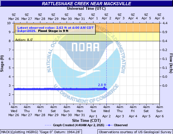
Rattlesnake Creek (KS) near Macksville
Critical Stages
8' - Action
9' - Flood
10' - Moderate
11' - Major
Latest Observation
Updated: 8:00 PM CST 12/15/25
Status: No Flooding
Stage: 3.25 ft
Flow: 0 kcfs
Forecast
Forecast not available for this location.
| Time | Stage (ft) | Flow (kcfs) |
|---|---|---|
| 8:00 PM 12/15 | 3.25 | 0 |
| 7:45 PM 12/15 | 3.24 | 0 |
| 7:30 PM 12/15 | 3.24 | 0 |
| 7:15 PM 12/15 | 3.24 | 0 |
| 7:00 PM 12/15 | 3.24 | 0 |
| 6:45 PM 12/15 | 3.24 | 0 |
| 6:30 PM 12/15 | 3.24 | 0 |
| 6:15 PM 12/15 | 3.23 | 0 |
| 9:00 PM 12/14 | 3.21 | 0 |
| 8:45 PM 12/14 | 3.21 | 0 |
| 8:30 PM 12/14 | 3.21 | 0 |
| 8:15 PM 12/14 | 3.2 | 0 |
| 8:00 PM 12/14 | 3.21 | 0 |
| 7:45 PM 12/14 | 3.21 | 0 |
| 7:30 PM 12/14 | 3.2 | 0 |
| 7:15 PM 12/14 | 3.2 | 0 |
| 7:00 PM 12/14 | 3.2 | 0 |
| 6:45 PM 12/14 | 3.2 | 0 |
| 6:30 PM 12/14 | 3.2 | 0 |
| 6:15 PM 12/14 | 3.2 | 0 |
| 6:00 PM 12/14 | 3.2 | 0 |
| 5:45 PM 12/14 | 3.2 | 0 |
| 5:30 PM 12/14 | 3.2 | 0 |
| 5:15 PM 12/14 | 3.2 | 0 |
| 5:00 PM 12/14 | 3.2 | 0 |
| 4:45 PM 12/14 | 3.2 | 0 |
| 4:30 PM 12/14 | 3.21 | 0 |
| 4:15 PM 12/14 | 3.21 | 0 |
| 4:00 PM 12/14 | 3.21 | 0 |
| 3:45 PM 12/14 | 3.21 | 0 |
14' -
Water begins to flow over the Dillwyn Road Bridge at the Macksville 8SE river gage on Rattlesnake Creek.
12.8' -
Flooding reaches the bottom of the bridge.
12' -
Expect record flooding of 3 feet or more along the Rattlesnake Creek from Gary Creek to the confluence of the Wild Horse Creek as floodwaters move broadly over the floodplain downstream. Most roads near the creek will be impassible... Possibly sections may be washed out.
11' -
Flood depths of 2 feet or more will be common as the Rattlesnake Creek moves farther out onto the floodplain between Gary Creek and the Wild Horse Creek. Low-lying bridges will be threatened with overtopping at a stage of 11 feet.
10' -
Expect moderate flooding of 1 feet or more as the Rattlesnake Creek charges further out onto the floodplain from Gary Creek to the confluence of the Wild Horse Creek. Many unpaved roads near the Rattlesnake Creek will be impassible. Water levels will approach the bottoms of low-lying bridges along the Rattlesnake Creek.
9' -
At a stage of nine feet, expect minor flooding along both banks of Rattlesnake Creek from the confluence of Gary Creek to the Wild Horse Creek as the Rattlesnake Creek spills out of its banks onto the adjacent floodplain. Travel near Rattlesnake Creek is strongly discouraged... Sections of unpaved sand roads may become impassible.
8' -
At a stage of 8 feet, the low banks along the Rattlsnake Creek from Gary Creek to Wild Horse Creek will begin to flood. Unpaved sandy roads immediately adjacent to Rattlesnake Creek may become soft due to underflow, and isolated road sections may become too wet to traverse. Drive with caution.
| Date | Stage (ft) |
|---|---|
| Sep 26, 1973 | 11.02 |
| Jul 16, 1993 | 10.02 |
| May 24, 1977 | 9.710000038147 |
| Jun 25, 1975 | 9.6999998092651 |
| Jun 30, 1951 | 9.6999998092651 |
| Apr 1, 1973 | 9.6400003433228 |
| Sep 3, 1963 | 9.6000003814697 |
| Jun 29, 1975 | 9.5500001907349 |
| Mar 12, 1973 | 9.4499998092651 |
| May 23, 1995 | 9.37 |
| May 27, 1978 | 9.3299999237061 |
| Mar 24, 1987 | 9.2299995422363 |
| Oct 12, 1973 | 9.2299995422363 |
| Sep 19, 1962 | 9.039999961853 |
| Sep 21, 1996 | 9.03 |
| Jun 3, 1963 | 9 |
| Sep 18, 1969 | 8.9300003051758 |
| Mar 20, 1960 | 8.8999996185303 |
| Mar 26, 1973 | 8.8000001907349 |
| Aug 28, 1969 | 8.7299995422363 |
Data provided by the National Weather Service.