« Back to Ile Aux Grues Rivers
St. John River at Nine Mile Bridge
Critical Stages
13' - Action
15' - Flood
20' - Moderate
23' - Major
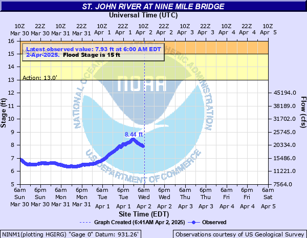
Latest Observation
Updated: 8:00 AM EST 12/16/25
Status: No Flooding
Stage: 1.99 ft
Flow: 0.999 kcfs
Forecast
Forecast not available for this location.
| Time | Stage (ft) | Flow (kcfs) |
|---|---|---|
| 8:00 AM 12/16 | 1.99 | 0.999 |
| 7:45 AM 12/16 | 1.99 | 0.999 |
| 7:30 AM 12/16 | 1.99 | 0.999 |
| 7:15 AM 12/16 | 1.99 | 0.999 |
| 7:00 AM 12/16 | 1.99 | 0.999 |
| 6:45 AM 12/16 | 1.99 | 0.999 |
| 6:30 AM 12/16 | 1.99 | 0.999 |
| 6:15 AM 12/16 | 2 | 1.01 |
| 6:00 AM 12/16 | 2 | 1.01 |
| 5:45 AM 12/16 | 2 | 1.01 |
| 5:30 AM 12/16 | 2 | 1.01 |
| 5:15 AM 12/16 | 2 | 1.01 |
| 5:00 AM 12/16 | 2 | 1.01 |
| 4:45 AM 12/16 | 2 | 1.01 |
| 4:30 AM 12/16 | 2 | 1.01 |
| 4:15 AM 12/16 | 2 | 1.01 |
| 4:00 AM 12/16 | 2 | 1.01 |
| 3:45 AM 12/16 | 2 | 1.01 |
| 3:30 AM 12/16 | 2 | 1.01 |
| 3:15 AM 12/16 | 2 | 1.01 |
| 3:00 AM 12/16 | 2 | 1.01 |
| 2:45 AM 12/16 | 2 | 1.01 |
| 2:30 AM 12/16 | 2 | 1.01 |
| 2:15 AM 12/16 | 2 | 1.01 |
| 2:00 AM 12/16 | 2 | 1.01 |
| 1:45 AM 12/16 | 2 | 1.01 |
| 1:30 AM 12/16 | 2 | 1.01 |
| 1:15 AM 12/16 | 2 | 1.01 |
| 1:00 AM 12/16 | 2 | 1.01 |
| 12:45 AM 12/16 | 2 | 1.01 |
23' -
Widespread flooding of trails and campgrounds along The St. John River from Moody Campground to Seven Islands and the Blanchette/Maibec Road Bridge. Additional widespread flooding of campgrounds from Priestly Rapids to the confluence of the Big Black River. Flooding similar to April 1991.
20' -
Several campgrounds in the North Woods flooded including Moody, Burntland Brook, Nine Mile, East Nine Mile, Connors Farm, Seven Island, Priestly, Simmons Farm, Basford Rips and Big Black.
15' -
Minor flooding occurs in campgrounds between Burntland Brook to Priestly Rapids with backwater issues on small streams and creeks.
13' -
River approaches bankfull. Low water crossings become impossible.
| Date | Stage (ft) |
|---|---|
| Apr 11, 1991 | 23 |
| Apr 2, 1976 | 20 |
| Apr 16, 2019 | 19.1 |
| Apr 16, 1994 | 18.8 |
| Apr 5, 2009 | 18.14 |
| Apr 24, 2007 | 15.88 |
| Mar 31, 1953 | 15.78 |
| Apr 22, 1996 | 15.15 |
| Apr 20, 2008 | 14.76 |
| Dec 21, 1961 | 14.26 |
| May 1, 1974 | 12.63 |
| Apr 14, 2024 | 9.02 |
| Apr 28, 2025 | 7.78 |
Data provided by the National Weather Service.