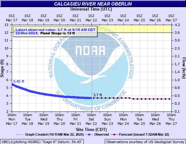
Calcasieu River near Oberlin
Critical Stages
12' - Action
13' - Flood
15' - Moderate
19' - Major
Latest Observation
Updated: 1:15 PM CST 12/15/25
Status: No Flooding
Stage: 2.37 ft
Flow: 0.176 kcfs
Forecast
| Time | Stage (ft) | Flow (kcfs) |
|---|---|---|
| 6 PM 12/15 | 2.4 | 0.18 |
| 12 AM 12/16 | 2.4 | 0.18 |
| 6 AM 12/16 | 2.3 | 0.166 |
| 12 PM 12/16 | 2.3 | 0.166 |
| 6 PM 12/16 | 2.3 | 0.166 |
| 12 AM 12/17 | 2.3 | 0.166 |
| 6 AM 12/17 | 2.2 | 0.153 |
| 12 PM 12/17 | 2.2 | 0.153 |
| 6 PM 12/17 | 2.2 | 0.153 |
| 12 AM 12/18 | 2.2 | 0.153 |
| 6 AM 12/18 | 2.1 | 0.14 |
| 12 PM 12/18 | 2.1 | 0.14 |
| 6 PM 12/18 | 2.1 | 0.14 |
| 12 AM 12/19 | 2.1 | 0.14 |
| 6 AM 12/19 | 2.1 | 0.14 |
| 12 PM 12/19 | 2 | 0.127 |
| 6 PM 12/19 | 2 | 0.127 |
| 12 AM 12/20 | 2 | 0.127 |
| 6 AM 12/20 | 2 | 0.127 |
| Time | Stage (ft) | Flow (kcfs) |
|---|---|---|
| 1:15 PM 12/15 | 2.37 | 0.176 |
| 1:00 PM 12/15 | 2.38 | 0.177 |
| 12:45 PM 12/15 | 2.38 | 0.177 |
| 12:30 PM 12/15 | 2.38 | 0.177 |
| 12:15 PM 12/15 | 2.38 | 0.177 |
| 12:00 PM 12/15 | 2.39 | 0.179 |
| 11:45 AM 12/15 | 2.39 | 0.179 |
| 11:30 AM 12/15 | 2.39 | 0.179 |
| 11:15 AM 12/15 | 2.4 | 0.18 |
| 11:00 AM 12/15 | 2.4 | 0.18 |
| 10:45 AM 12/15 | 2.4 | 0.18 |
| 10:30 AM 12/15 | 2.4 | 0.18 |
| 10:15 AM 12/15 | 2.4 | 0.18 |
| 10:00 AM 12/15 | 2.41 | 0.182 |
| 9:45 AM 12/15 | 2.4 | 0.18 |
| 9:30 AM 12/15 | 2.4 | 0.18 |
| 9:15 AM 12/15 | 2.39 | 0.179 |
| 9:00 AM 12/15 | 2.4 | 0.18 |
| 8:45 AM 12/15 | 2.41 | 0.182 |
| 8:30 AM 12/15 | 2.4 | 0.18 |
| 8:15 AM 12/15 | 2.4 | 0.18 |
| 8:00 AM 12/15 | 2.41 | 0.182 |
| 7:45 AM 12/15 | 2.41 | 0.182 |
| 7:30 AM 12/15 | 2.41 | 0.182 |
| 7:15 AM 12/15 | 2.41 | 0.182 |
| 7:00 AM 12/15 | 2.41 | 0.182 |
| 6:45 AM 12/15 | 2.41 | 0.182 |
| 6:30 AM 12/15 | 2.41 | 0.182 |
| 6:15 AM 12/15 | 2.41 | 0.182 |
| 6:00 AM 12/15 | 2.41 | 0.182 |
32' -
Water is at top of elevated mobile home along the river.
26.5' -
The river is at its flood of record. Widespread major to catastrophic flooding will occur.
26.4' -
FEMA flood insurance maps indicate that at 26.4 feet, if you are located in the 1% (100 year) flood plain your property is at a high risk for flooding. A 1 percent flood is a flood that has a one percent or greater chance of occurring in any given year.
26' -
Flooding begins to impact Highway 26 east of the bridge. Several homes near the river are subject to flooding.
19' -
Major flooding will occur. Secondary roads and homes near the river will be affected. Reeds Bridge Road begins to flood upstream of oberlin.
15' -
Moderate flooding will occur with several access roads to the river flooded.
13' -
Minor lowland flooding near the river will occur.
12' -
Water begins to overflow the banks on both sides of the river.
| Date | Stage (ft) |
|---|---|
| May 19, 1953 | 26.53 |
| Jul 2, 1989 | 24.7 |
| Dec 30, 1982 | 24.33 |
| Feb 14, 1966 | 23.07 |
| Mar 14, 2016 | 22.88 |
| Apr 6, 2017 | 22.16 |
| Oct 11, 2020 | 21.88 |
| Feb 16, 1950 | 21.54 |
| Apr 7, 1923 | 21 |
| May 16, 2004 | 20.87 |
| Apr 27, 1952 | 20.83 |
| Nov 2, 1985 | 20.81 |
| Apr 2, 2018 | 20.74 |
| Sep 21, 1979 | 20.7 |
| Oct 23, 1984 | 20.42 |
| May 7, 1975 | 20.25 |
| Dec 24, 1923 | 20.2 |
| Mar 11, 1995 | 20.18 |
| Nov 6, 2002 | 20.17 |
| Apr 12, 1995 | 20.16 |
Data provided by the National Weather Service.