« Back to Jefferson County Rivers
Neches River at Evadale
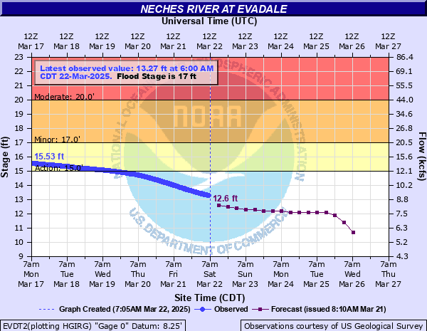
Critical Stages
15' - Action
16' - Flood
20' - Moderate
24' - Major
Latest Observation
Updated: 6:00 AM CST 12/6/25
Status: No Flooding
Stage: 8.66 ft
Flow: 3.58 kcfs
Forecast
| Time | Stage (ft) | Flow (kcfs) |
|---|---|---|
| 12 PM 12/6 | 8.5 | 3.43 |
| 6 PM 12/6 | 8.4 | 3.33 |
| 12 AM 12/7 | 8.4 | 3.33 |
| 6 AM 12/7 | 8.3 | 3.24 |
| 12 PM 12/7 | 8.3 | 3.24 |
| 6 PM 12/7 | 8.3 | 3.24 |
| 12 AM 12/8 | 8.1 | 3.05 |
| 6 AM 12/8 | 8 | 2.96 |
| 12 PM 12/8 | 8 | 2.96 |
| 6 PM 12/8 | 8 | 2.96 |
| 12 AM 12/9 | 7.9 | 2.88 |
| 6 AM 12/9 | 7.9 | 2.88 |
| 12 PM 12/9 | 7.9 | 2.88 |
| 6 PM 12/9 | 7.9 | 2.88 |
| 12 AM 12/10 | 7.9 | 2.88 |
| 6 AM 12/10 | 7.9 | 2.88 |
| Time | Stage (ft) | Flow (kcfs) |
|---|---|---|
| 6:00 AM 12/6 | 8.66 | 3.58 |
| 5:45 AM 12/6 | 8.65 | 3.57 |
| 5:30 AM 12/6 | 8.64 | 3.56 |
| 5:15 AM 12/6 | 8.64 | 3.56 |
| 5:00 AM 12/6 | 8.64 | 3.56 |
| 4:45 AM 12/6 | 8.63 | 3.55 |
| 4:30 AM 12/6 | 8.63 | 3.55 |
| 4:15 AM 12/6 | 8.63 | 3.55 |
| 4:00 AM 12/6 | 8.62 | 3.55 |
| 3:45 AM 12/6 | 8.61 | 3.54 |
| 3:30 AM 12/6 | 8.61 | 3.54 |
| 3:15 AM 12/6 | 8.6 | 3.53 |
| 3:00 AM 12/6 | 8.59 | 3.52 |
| 2:45 AM 12/6 | 8.59 | 3.52 |
| 2:30 AM 12/6 | 8.58 | 3.51 |
| 2:15 AM 12/6 | 8.58 | 3.51 |
| 2:00 AM 12/6 | 8.57 | 3.5 |
| 1:45 AM 12/6 | 8.57 | 3.5 |
| 1:30 AM 12/6 | 8.56 | 3.49 |
| 1:15 AM 12/6 | 8.55 | 3.48 |
| 1:00 AM 12/6 | 8.54 | 3.47 |
| 12:45 AM 12/6 | 8.54 | 3.47 |
| 12:30 AM 12/6 | 8.54 | 3.47 |
| 12:15 AM 12/6 | 8.53 | 3.46 |
| 12:00 AM 12/6 | 8.53 | 3.46 |
| 11:45 PM 12/5 | 8.51 | 3.44 |
| 11:30 PM 12/5 | 8.51 | 3.44 |
| 11:15 PM 12/5 | 8.5 | 3.43 |
| 11:00 PM 12/5 | 8.49 | 3.42 |
| 10:45 PM 12/5 | 8.49 | 3.42 |
32' -
Water reaches the bridge floor.
29.5' -
Water reaches the top of the instrument shelf.
29' -
Water reaches the bottom of the bridge over the river.
26.2' -
The river is at its flood of record. Water reaches the floor of the shelter house.
24' -
Major lowland flooding occurs.
21' -
Moderate lowland flooding occurs. Water across some roads near the river.
19' -
Minor lowland flooding. Water enters buildings adjacent to gauge.
17' -
Minor flooding expected with the boat ramps at Evadale possibly becoming inaccessible. Flooding can be expected in the low-lying areas of the Lakeview community in Orange County.
16' -
Roads in Northwest Orange County are flooded to the point vehicle traffic is impossible along Connolly road as lower spots of Lake View road near the river.
15' -
Conolly road in Northwest Orange County floods.
13' -
The river is at bankfull stage.
| Date | Stage (ft) |
|---|---|
| May 1, 1884 | 26.2 |
| Sep 2, 2017 | 25.11 |
| Aug 8, 1915 | 24.5 |
| May 11, 1944 | 23.58 |
| May 24, 1953 | 22.53 |
| Jun 1, 1929 | 22.2 |
| Mar 1, 1932 | 21.45 |
| May 20, 2021 | 21.02 |
| Jul 6, 1989 | 20.79 |
| May 19, 2024 | 20.12 |
| Jun 6, 2016 | 19.67 |
| Mar 14, 2016 | 19.57 |
| Oct 21, 2006 | 19.46 |
| Oct 25, 1994 | 19.33 |
| Mar 13, 1992 | 19.3 |
| Jan 7, 2019 | 19.01 |
| Apr 2, 2018 | 18.73 |
| Nov 28, 1986 | 18.02 |
| Mar 19, 2001 | 17.95 |
| Nov 22, 1998 | 17.89 |
Data provided by the National Weather Service.