« Back to Jefferson County Rivers
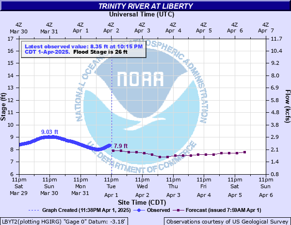
Trinity River at Liberty
Critical Stages
21' - Action
26' - Flood
27' - Moderate
29' - Major
Latest Observation
Updated: 6:15 AM CST 12/6/25
Status: No Flooding
Stage: 9.38 ft
Flow: 3.46 kcfs
Forecast
| Time | Stage (ft) | Flow (kcfs) |
|---|---|---|
| 12 PM 12/6 | 9.6 | 3.67 |
| 6 PM 12/6 | 9.6 | 3.67 |
| 12 AM 12/7 | 9.5 | 3.58 |
| 6 AM 12/7 | 9.5 | 3.58 |
| 12 PM 12/7 | 9.5 | 3.58 |
| 6 PM 12/7 | 9.5 | 3.58 |
| 12 AM 12/8 | 9.5 | 3.58 |
| 6 AM 12/8 | 9.5 | 3.58 |
| 12 PM 12/8 | 9.5 | 3.58 |
| 6 PM 12/8 | 9.5 | 3.58 |
| 12 AM 12/9 | 9.5 | 3.58 |
| 6 AM 12/9 | 9.5 | 3.58 |
| 12 PM 12/9 | 9.5 | 3.58 |
| 6 PM 12/9 | 9.5 | 3.58 |
| 12 AM 12/10 | 9.5 | 3.58 |
| 6 AM 12/10 | 9.5 | 3.58 |
| Time | Stage (ft) | Flow (kcfs) |
|---|---|---|
| 6:15 AM 12/6 | 9.38 | 3.46 |
| 6:00 AM 12/6 | 9.38 | 3.46 |
| 5:45 AM 12/6 | 9.38 | 3.46 |
| 5:30 AM 12/6 | 9.39 | 3.47 |
| 5:15 AM 12/6 | 9.39 | 3.47 |
| 5:00 AM 12/6 | 9.39 | 3.47 |
| 4:45 AM 12/6 | 9.39 | 3.47 |
| 4:30 AM 12/6 | 9.39 | 3.47 |
| 4:15 AM 12/6 | 9.4 | 3.48 |
| 4:00 AM 12/6 | 9.4 | 3.48 |
| 3:45 AM 12/6 | 9.4 | 3.48 |
| 3:30 AM 12/6 | 9.4 | 3.48 |
| 3:15 AM 12/6 | 9.41 | 3.49 |
| 3:00 AM 12/6 | 9.41 | 3.49 |
| 2:45 AM 12/6 | 9.41 | 3.49 |
| 2:30 AM 12/6 | 9.41 | 3.49 |
| 2:15 AM 12/6 | 9.42 | 3.5 |
| 2:00 AM 12/6 | 9.42 | 3.5 |
| 1:45 AM 12/6 | 9.42 | 3.5 |
| 1:30 AM 12/6 | 9.42 | 3.5 |
| 1:15 AM 12/6 | 9.43 | 3.51 |
| 1:00 AM 12/6 | 9.43 | 3.51 |
| 12:45 AM 12/6 | 9.43 | 3.51 |
| 12:30 AM 12/6 | 9.44 | 3.52 |
| 12:15 AM 12/6 | 9.44 | 3.52 |
| 12:00 AM 12/6 | 9.45 | 3.53 |
| 11:45 PM 12/5 | 9.45 | 3.53 |
| 11:30 PM 12/5 | 9.46 | 3.54 |
| 11:15 PM 12/5 | 9.46 | 3.54 |
| 11:00 PM 12/5 | 9.47 | 3.55 |
29' -
Major lowland flooding begins as homes in several subdivisions above Liberty begin flooding. Extensive flooding over much of Liberty County can be expected with each incremental rise in the river.
27' -
Moderate lowland flooding begins as roads into several outlying communities above Liberty are closed with residents in 5 or 6 subdivisions cut off if not evacuated.
26.5' -
Roads into some outlying communities above the gage can have up to one foot of water over them.
26' -
Minor lowland flooding begins and significant lowland flooding in the vicinity of the gage can be expected as roads into some outlying communities above the gage begin to flood.
| Date | Stage (ft) |
|---|---|
| Sep 1, 2017 | 32.7 |
| May 6, 2024 | 32.37 |
| Oct 21, 1994 | 31 |
| May 23, 1990 | 30.03 |
| May 31, 2015 | 29.96 |
| Jun 1, 2016 | 29.95 |
| Oct 22, 2018 | 29.95 |
| May 15, 2019 | 29.92 |
| Jan 6, 1992 | 29.62 |
| Dec 20, 2015 | 29.6 |
| Dec 14, 2018 | 29.58 |
| Jan 14, 2016 | 29.54 |
| Jan 19, 2019 | 29.45 |
| Apr 2, 2018 | 29.4 |
| Jan 6, 2019 | 29.39 |
| May 12, 1942 | 29.38 |
| May 12, 1957 | 29.26 |
| May 14, 1966 | 29.07 |
| Jan 21, 1991 | 29.05 |
| May 31, 2021 | 29.01 |
Data provided by the National Weather Service.